Space Awareness
Let's Map the Earth
Before maps went mobile, people actually had to learn how to read maps. Pupils look at map elements in order to understand how to read them and locate specific locations. Finally, young cartographers discover how to make aerial maps.
California Academy of Science
Kinesthetic Astronomy: Earth's Rotation
After completing the activity, "Kinesthetic Astronomy: The Meaning of a Year," zoom in on Earth's rotation using the same simulation setup and this outline. Each class member dons a map of the Western Hemisphere and plays the part of...
Curated OER
Earth from Space Maps
Students use photo images from space to create a large map of the United States or the world, find where they live and label other places they know. They are exposed to a Web resource that allows them to view photo images of Earth taken...
Curated OER
Regents High School Examination: Physical Setting Earth Science 2008
Throughout this earth science exam, high-school geologists complete a series of multiple choice and short answer questions about the solar system, atmosphere, and earth system. This is an amazing test, as are all of the exams developed...
Curated OER
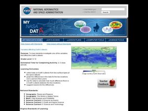
Variables Affecting Earth's Albedo
Students study the variables that affect the Earth's albedo. In this environmental data analysis lesson students interpret and graph information and calculate changes.
Institute for Geophysics
Understanding Maps of Earth
Here is your go-to student resource on primary geography concepts, including facts about the surface of the earth and its hemispheres, latitude and longitude, globes, types of maps, and identifying continents and oceans.
Artisan Global
QuakeFeed Earthquake Map, Alerts and News
Amateur seismologists explore Earth's earthquakes in real time using a variety of map styles and parameter selections.
Curated OER
Mapping Worksheet #1
Get out the compass and a pencil its time to use a coordinate grid to practice mapping skills. Young cartographers use the prompts and provided grid to plot locations, draw parallel lines, and determine distances between points.
Curated OER
Mapping
Introduce middle or high schoolers to topographic maps with this PowerPoint. After a review of longitude and latitude, display and describe contour lines and intervals. Also explain map scale. This is a useful presentation for a social...
NOAA
Mapping the Deep-Ocean Floor
How do you create a map of the ocean floor without getting wet? Middle school oceanographers discover the process of bathymetric mapping in the third installment in a five-part series of lessons designed for seventh and eighth graders....
Curated OER
The Personal Concept Map
There are lots of details that make you who you are! Illustrate what those details are with a personal concept map project. After learners view a step-by-step presentation, the follow a rubric to complete a concept map about themselves.
Curated OER
Topographic Maps
Sometimes it is difficult to grasp topographic maps. Here is a clever presentation designed to help your middle school earth scientists understand. Beginning with a side view of a pair of mountains, a graphic guy walks up one slope. As...
Curated OER
Regents High School Examination: Physical Setting Earth Science 2009
Junior geologists address 50 multiple choice questions and 35 short answer questions about the earth system. Plenty of visuals are included for interpretation: diagrams, graphs, maps, photographs, laboratory setups, weather symbols, and...
Curated OER
Regents High School Examination: Physical Setting Earth Science 2006
Test your class on earth science with this extensive resource. This test, created by The University of the State of New York Regents, is made up of 50 multiple choice questions and 32 short answer questions that cover the branches of...
Curated OER
Regents High School Examination: Physical Setting Earth Science 2010
Every topic under the sun is covered in this New York State Regents High School Examination. With the focus of earth science, participants answer 85 quesitons about the solar system, geologic time, rocks and minerals, landforms, and...
Curated OER
Playground Mapping
Students convert their physical models of a playground from a previous lesson into a map of the playground that includes a scale and key. They examine and discuss examples of maps, view an image to map photo essay, and create a map using...
Curated OER
Regents High School Examination: Physical Setting Earth Science 2009
In this earth science worksheet students complete a series multiple choice questions. There are 85 questions that include diagrams.
Curated OER
What Can a Map Tell You?
Young scholars investigate how maps can provide useful information about health issues. They study a map to draw conclusions about cholera death in London.
Curated OER
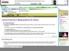
Lesson 2 Activity 2: Mapping Mount St. Helens
Students use topographic map skills to interpret impact of the May 18, 1980 eruption of Mount St. Helens on the volcano's topography, and draw profile views of Mount St. Helens before and after the May 18, 1980, eruption.
Curated OER
Mapping the Aegean Seafloor
Earth science learners create a two-dimensional topographic map of the floor of the Aegean Sea. They use it to then create a three-dimensional model of the ocean floor features. This comprehensive resource delivers strong background...
NASA
Earth's Global Energy Budget
Introduce your earth science enthusiasts to the earth's energy budget. Teach them using an informative set of slides that include illuminating lecturer's notes, relevant vocabulary, embedded animations, colorful satellite maps, and a...
Teach Engineering
Where Are the Plastics Near Me? (Mapping the Data)
The last activity in a nine-part series has teams create a Google Earth map using the data they collected during a field trip. Using the map, groups analyze the results and make adjustments to the map to reflect their analysis. A short...
Teach Engineering
Projections and Coordinates: Turning a 3D Earth into Flatlands
Introduce your class to map projections and coordinates, the basics for the work done in a GIS, with an activity that uses Google Earth to challenge learners to think about the earth's shape.
Mr. E. Science
Introduction to Earth Science
From the layers of Earth's spheres to latitude and longitude to looking at topographic maps, learners discover the elements of Earth's systems.
Other popular searches
- Earth Scene Concept Maps
- Earth Scone Concept Maps
- Earth Science Mapping
- Earth Sciecne Concept Maps
- Mapping Earths Surface
- Mapping Earthquakes


