Curated OER
Exploring an Atlas
Students explore global geography by participating in an atlas activity. In this countries of the world lesson, students collaborate in small groups and analyze an atlas while researching continents, countries and demographics. Students...
Curated OER
Continents and Islands Map Quiz
In this online interactive geography quiz worksheet, students respond to 17 identification questions about the continents and islands of the world.
Curated OER
World Continents Map Quiz
In this online interactive geography quiz learning exercise, students respond to 7 identification questions regarding the continents of the world.
Curated OER
Me on the Map Lesson 2
Students analyze and interpret maps, globes and geographic information systems to define and identify cities, counties, states, countries and continents to create a booklet called me on the map. They also determine and calculate the...
Curated OER
Magical Maps
Second graders discuss the importance of using maps and how they are used. After they listen to a folktale, they develop their own story line maps and write their own folktale to accompany a map. They also identify and locate the seven...
Curated OER
Put the Mountains on the Map
Pupils discuss what they know about the regions where snow leopards live. They observe the worksheets to see if they can identify any of the mountain ranges and then use atlases to check and complete the country identification worksheet.
Curated OER
Me on the Map Lesson 1
Students use maps, globes, geographic information systems and other
sources of information to analyze the nature of places at a variety of scales. They identify on a map and determine the population
of the city, county, state, country...
Curated OER
Easter Island
Fifth graders describe the location and physical environment of Easter Island. This description include: identification of the closet continent to Easter Island, ocean in which Easter Island is located, and some geographical features of...
Curated OER
African Safari Adventure
Students conduct Internet research on the different safaris available. They locate and label safari sites on the continent of Africa. They create a PowerPoint presentation for the class to persuade the class why they should vote for...
Curated OER
Africa: Political Map
Students create a political map for Africa. In this country identification lesson, students locate Africa on a globe and discuss some of its major countries and bodies of water. Students complete a political map of Africa and test...
Curated OER
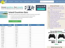
Island Countries Quiz
In this online interactive geography quiz worksheet, students respond to 48 identification questions about island nations in the world. Students have 5 minutes to complete the quiz.
Curated OER
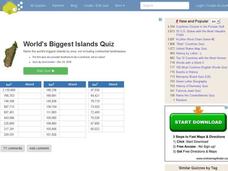
World's Biggest Islands Quiz
In this online interactive geography quiz activity, students respond to 20 identification questions about the largest islands in the world. Students have 4 minutes to complete the quiz.
Curated OER
Lowest Fertility Countries Quiz
In this online interactive geography quiz worksheet, students respond to 20 identification questions about countries with the lowest fertility rates. Students have 3 minutes to complete the quiz.
Curated OER
AIDS
Students in an ESL classroom examine the effect of HIV/AIDS on the continent of Africa. As a class, they identify the concerns of the Treatment Action Campaign to determine if they are justifiable or not. They must identify the main...
Curated OER
Christopher Columbus: The Man, the Myth, the Legend
Learn more about maps by examining Christopher Columbus's voyage to the New World. Kindergartners will learn about basic map skills and how to identify the compass rose, oceans, and land masses. They will also discover the purpose of...
Owl Teacher
Introduction to World of Geography Test
Assess your learners on the five themes of geography and the most important key terms and concepts from an introductory geography unit. Here you'll find an assessment with 15 fill-in-the-blank and 14 multiple-choice questions, sections...
Curated OER
Where in the World Do Those Cookies Come From?
Students discuss exports and imports by discovering where the ingredients come from for making chocolate chip cookies. They take a survey of their favorite cookies and create a bar graph to represent the information.
Core Knowledge Foundation
Columbus Sailed the Ocean Blue
Young adventurers embark on a journey, setting sail along the blue ocean with Christopher Columbus. Teachers will find that this unit makes their lesson planning smooth sailing!
Curated OER
Investigating Our Place in the World
Students study the concept of geography in a year long unit. In this geography unit, students participate in different activities that explain the spatial sense of the world, the physical landmasses and bodies of water, geographic...
Curated OER
Early Explorers
Fifth graders investigate the routes taken by the early explorers. In this explorers lesson, 5th graders use interactive notebooks, discussion and maps to discover the routes taken. Students get into pairs and label maps, and create...
Curated OER
Family Life in a Village in Bangladesh
In this Bangladesh learning exercise, students read about the lives of men and women and the weather in Bangladesh. They then take that information to create a poster. Maps are also provided.
Curated OER
Pollution Solution
Fourth graders examine how trees help to absorb the pollution that is emitted from automobiles. They review the process of photosynthesis and determine how forest management is important on their reservation. They think about the...


