Curated OER
The Country of Chile - Map Work
In this map worksheet, learners label a map of Chile by following 11 directions given at the bottom of the page. They label landforms and water bodies associated with the country.
Curated OER
El Mundo Hispano
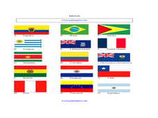
Welcome to the Spanish-speaking world! Show your learners which countries declare Spanish as their primary language. Included are maps and flags for each Hispanophone country.
Curated OER
Countries
For this ESL worksheet, students solve a crossword puzzle about different countries. Countries include Argentina, Belgium, Canada, Finland, and Libya.
Curated OER
National Anthems of Selected Countries
In these national anthems worksheets, learners read the general information and the anthems for the countries of the United States, Canada, Sweden, Switzerland, Zambia, Great Britain, Chile, Ethiopia, Korea, New Zealand, Greece, Taiwan,...
Curated OER
South America Quiz 1
In this South America worksheet, students complete short answer questions on the rivers, countries, sports, and more about South America. Students complete 10 short answer questions.
Curated OER
Folk Dances from Spanish Speaking Countries
Pupils explore dance activities from three different Spanish speaking countries.
Curated OER
ESL: Animals and Countries
In this animal and countries worksheet, students match pictures and names of animals, find countries given on a map, match animals to countries, copy sentences and spell animal names correctly and design a postage stamp for their...
Curated OER
Which Country?
In this geography worksheet, students study the names of 60 countries. Students indicate their home country by coloring its name in the word grid puzzle. Students then answer 8 questions about their country concerning what language is...
Curated OER
South American Countries: Area Activity
For this area worksheet, students use a table with a an area given for Argentina in square kilometers, then use that to complete the table, finding area for other South American countries.
Curated OER
South American Flags
In this identifying flags from the countries in South America worksheet, students write the names of the countries under their flags. Students answer 15 questions.
Curated OER
Mapping Brazil
In this Brazil worksheet, students label cities, oceans, and surrounding countries around Brazil. Students label and color 10 places.
Curated OER
Understanding Fair Trade
Fourth graders work in groups to research fair trade products from various countries in the world. In this fair trade lesson, 4th graders work in 5 groups and make a chart or graph to detail the important information from their handout....
Curated OER
Nationalities
For this nationalities worksheet, learners write the nationalities of the countries, write countries that match nationalities, complete a word search, and more. Students complete 4 activities.
Curated OER
Colors and Fruit
Review colors in Spanish by presenting different photographs and asking your charges to identify the colors in each picture. Consider bringing in pictures from Spain, Mexico, or another Spanish-speaking country to make the activity more...
Curated OER
South America Alphabet Activity
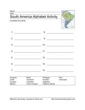
In this alphabet activity activity, students read the names of South American countries and alphabetize the 14 words onto the provided lines.
Curated OER
South America Challenge
In this South America facts activity, students read the statements about South America and select the best choice to complete the 10 statements.
Curated OER
Dia de la Independencia
Students learn about Mexican Independence Day. In this Hispanic Heritage lesson, students learn about holidays in Hispanic countries specifically looking at their days of independence. Students read information about fiestas that occur...
Curated OER
Trading Up?
Students explore the benefits and drawbacks of free trade from the perspective of the United States, Canada, Brazil, Argentina, Venezuela, Chile and Mexico. For homework, they each write a letter to the editor expressing their personal...
Curated OER
South America Map Quiz
In this online interactive geography quiz worksheet, students examine the map that includes all of South America's countries. Students identify the 13 countries in 2 minutes.
Curated OER
Know Your Boundaries: Earthquake Lessons in the Classroom
With all the recent attention on Haiti, and now Chile, it is the perfect time to teach your students about earthquakes!
Curated OER
Welcome to the Americas
Students research and map the North and South American continents. In this geography lesson on the Americas, students can locate North, Central and South American countries and states. Students choose a location to research and prepare a...
Curated OER
Map of Argentina
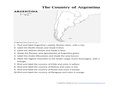
In this map of Argentina instructional activity, students label key areas, cities, bodies of water and surrounding countries, then color the map according to directions.
Curated OER
Refugees' Experiences in Countries of Asylum: "What's in a name"?
Ninth graders examine the term stereotype. In this Current Events lesson, 9th graders analyze posters on racism. Students watch news reports on racism and stereotyping.
Curated OER
Geography Words
This activity uses maps of South America and Canada to combine basic geography vocabulary and using prepositions. Students use the maps to answer questions about the locations of various countries on the two maps. This would be a good...


