Curated OER
Europe Maps
A series of maps depicts pre-WWI to post-WWII Europe for your geographers. They use reference materials to help them correctly fill in the countries and the borders as they changed through time. A great resource for a history lesson, or...
Curated OER
Poland
In this Poland maps learning exercise, 6th graders research, study and label the regions, states and landmarks on a map of Poland. Students hang their maps up on the wall.
Curated OER
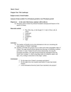
The Landscape of Poland
Students recognize and re-create the political boundaries and physical features of the nation of Poland. They create three dimensional topographic maps of Poland. In addition, they compose two journal entries written in two different...
Curated OER
Poland's Next Step
Students investigate the history of Poland. They explore various Polish historical websites, explore an interactive online map of Polish cities, answer discussion questions, and locate newspaper articles about Poland.
Curated OER
Mapping World War II: During and After
In this World War II activity, students follow the provided instructions to mark 2 maps according to events and outcomes of the war.
Curated OER
Where Am I? Map Activity
In this map activity worksheet, students determine which countries are shown on a set of 16 maps, then read facts about each country designed to help with a report on that country.
Curated OER
Mapping Germany
In this Germany worksheet, students label the map of Germany with different landmarks. Students label the map with 10 different cities, rivers, and borders.
Curated OER
Getting To Know Germany
In this getting to know Germany learning exercise, students use map skills (map not included) to answer 14 questions, then draw a map of Germany labeling the capital and major cities.
Curated OER
Sixth Grade Social Studies Quiz
In this social studies instructional activity, 6th graders complete multiple choice questions about economics, climate, maps, and more. Students complete 15 questions.
Curated OER
Geography - Mapping the Holocaust
Eighth graders map the important locations of the Holocaust. In this Holocaust lesson, 8th graders research the location of countries involved in the Holocaust as well as the location of concentration camps. Students mark the locations...
Curated OER
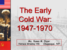
The Early Cold War: 1947-1970
With a combination of images, maps, and valuable information, this presentation is a strong resource for a history class that is coming out of a WWII unit and into a Cold War unit. Some points are outlined for students, while others are...
Curated OER
"The Pianist" As A Tool For Classroom Instruction About the Holocaust
Students watch "The Pianist" to gain insight on the Holocaust and World War II. They write an essay based on ideas from the film and read a variety of poems and writings from the time period. In groups, they discuss the diffuculties of...
Echoes & Reflections
The "Final Solution"
Nazi policies shifted from deportation and imprisonment to extermination of the Jewish people in death camps in the "Final Solution." Learners examine photos of artifacts, read poetry written by survivors, analyze testimony from...
Curated OER
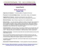
Radio Program #2: Ethnic Mix
Students examine patterns of migration into the area. They complete various map activities and interviews. Students partake in family histories as well. On a map of Europe, identify the countries of immigrant origin mentioned in the...
Curated OER
The Congress of Vienna
Established to "undo what Napoleon had done," the Congress of Vienna instituted many changes throughout Europe in the early 19th century - the details of which are included in this presentation. Maps and key decisions are outlined in...
Owl Teacher
Latitude & Longitude
Here is a activity activity where learners mark the latitude and longitude coordinates of cities all over the world. There are 15 cities to identify, from Baghdad, Iraq to Warsaw, Poland and Anchorage, Alaska.
Curated OER
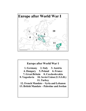
Europe after World War I
In this Europe after World War I map worksheet, students note the 11 regions of the Europe labeled on the map.
Curated OER
"Czech It Out" - A Look at Eastern Europe
High schoolers research several countries in Eastern Europe. Students compare and contrast several Eastern European countries and then choose a specific country to research and prepare a class presentation with their findings.
Curated OER
South Carolina Voices: Lessons from the Holocaust
Students examine the location of the Holocaust. In this mapping lesson, students analyze two maps identifying the area in which the Holocaust took place. Students familiarize themselves with the symbols used during this time period and...
Curated OER
Open Cities: Europe
In this European cities worksheet, 10th graders find the countries of Europe on a map, match countries with capital cities, categorize different types of cities and identify cities from pictures and on a map.
Curated OER
Weather and Climate
Students identify the words plain and climate and discuss what would happen if it never rained. Students identify and interpret the weather in Poland and create a web illustrating various weather patterns. Students write a 4-line poem...
Curated OER
Drifting Continents
For this plate tectonics worksheet, students study the continents map and complete 8 short answer questions related to them. They predict what the Earth will look like millions from now.
Curated OER
Where in the World Is ...?
Students move themselves around a "world" map on the classroom floor, using lines of latitude and longitude to locate specific spots. They determine the locations of 11 countries where Peace Corps Volunteers are serving and identify in...
Curated OER
Korea Cultural Lesson Plan
Students engage in a study of geography and maps of Korea. They examine charts and graphs. Students are expected to interpret the information accurately and completely. The geography skills can be used on other countries as well.


