Association of American Geographers
Project GeoSTART
Investigate the fascinating, yet terrifying phenomenon of hurricanes from the safety of your classroom using this earth science unit. Focusing on developing young scientists' spacial thinking skills, these lessons engage learners in...
Curated OER
Annotating Change in Satellite Images
Students construct a movie using Landsat images to observe changes over time on Earth. In this satellite images instructional activity, students observe changes in land use over time and document one type of change they observe. They...
Curated OER
Imagers: The Adventure of Echo the Bat Number to Pictures: How Satellite Images are Created
Learners examine the three primary colors of light and design a numerical code to represent those colors. They tell how satellites use numbers to create satellite images after completing a number of experimental activities.
Curated OER
Amelia the Pigeon: As a Pigeon Flies
Learners follow Amelia's adventure on a satellite image. They use measuring and math skills to determine the distance she traveled.
Curated OER
Reading Satellite Images
Students analyze satellite images. In this astronomy lesson, students examine 3 satellite images in order to understand how satellite images are taken and what they can teach scientists.
Discovery Education
Satellite Telemetry
Satellites require rockets to launch, but it doesn't take a rocket scientist to understand them. Future engineers learn about how satellites send data to Earth and how to interpret satellite images. They see how radio waves play a role...
NASA
NASA Visualization Explorer
Read some of the most up-to-date information available from NASA's current Earth and space research! Along with showcased stories, you will find computer animations and satellite images that help you to view what humans cannot see with...
American Museum of Natural History
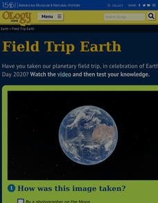
Field Trip Earth
Take a field trip around Earth by way of satellite images. Learners watch a video lesson that describes different images taken from orbiting satellites. They then test their visual skills in a 14-question online quiz.
Curated OER
Remote Sensing and Landsat Satellite Imagery
Learners comprehend how satellites use remote sensing to produce images. They use supervised classification with Landsat images. Students recognize that the earth's surface has different basic land surfaces that reflect/emit different...
CK-12 Foundation
Satellites, Shuttles, and Space Stations: Satellites in Orbit
Blast off! How do satellites, space shuttles, and space stations escape Earth's gravity and achieve orbit? Young astronauts study rocket science (literally) with an interactive lesson. They discover the four main uses for satellites, how...
Curated OER
What Color is the Ocean?
Students view satellite pictures of the ocean, and discuss the presence of phytoplankton and the colors of the ocean. Students compare/contrast ocean satellite images with maps and globes, then color world maps to replicate the satellite...
Curated OER
Hurricane Shapes: Spatial Patterns on Satellite Images
In this earth science worksheet, students match 21 hurricane satellite images to their appropriate shape. They also answer 4 short answer questions about hurricane shape classification.
Space Awareness
Valleys Deep and Mountains High
Sometimes the best view is from the farthest distance. Satellite imaging makes it possible to create altitude maps from far above the earth. A three-part activity has your young scientists play the role of the satellite and then use...
International Technology Education Association
Pixel This!
Did the image I drew match the image you saw? By simulating a satellite and a ground station, teams of two transmit data in the form of pixels in order to recreate an image. They use four different levels of brightness, creating slightly...
NASA
The Saturn System Through the Eyes of Cassini
Get a close-up view of Saturn. Pupils read a NASA eBook filled with images of the Saturn system, including the rings and moons of Saturn along with images of the planet itself. Learners become familiar with the planet's system as they...
Curated OER
Satellite Images- Night Time
Fourth graders study the geography and population distribution of various places on earth. They utilize actual satellite images of the night sky (lights showing heavily around area of dense population) to study and make observations...
Curated OER
Image Classification
Students explore what are "multi-spectral" or "multi-band" images? They investigate how landscapes change over time- at least over the time-span of satellite imagery, particulary due to human influences. Students explore how to train...
NOAA
Ground-truthing Satellite Imagery with Drifting Buoy Data
Ground-truthing ... is it even a word? The last installment of a five-part series analyzes how scientists collect sea surface temperature data. Scholars use government websites to compare temperature data collected directly from buoys...
Curated OER
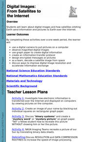
Digital Images: From Satellites To The Internet
Students examine digital images and how satellites orbiting Earth send information and pictures to Earth over the Internet. They use a digital camera to put pictures on a computer and decode a satellite image from space.
Curated OER
Exploring Biomes Lesson 1: Mapping Biomes
Environmental science learners examine satellite imagery of temperature, vegetation, precipitation, and productivity. They use these maps to understand how scientists divide the planet into major biomes. As part of a larger unit on...
Lawrence Hall of Science
DIY Sun Science
Get an up-close-and personal look at the sun from the safety of your classroom with this fun science application. Offering numerous activities, images, and videos, the resource supports children of all ages as they learn about the sun.
Curated OER
Can You See What I See?
Students gain an understanding of the methods used to explore the earth's surface. Students create a time line leading to the first satellite image of the Earth that includes the various methods utilized to observe the earth's surface.
Space Awareness
A View From Above
Analyzing and interpreting satellite data takes knowledge and patience. Through a detailed lab investigation, young scholars learn the process of analyzing this data. They use technology to create color images and maps from real...
Curated OER
Satellite Sense
Students look at data to understand how it is interpreted by scientists. In this satellite sense instructional activity, students complete worksheets based on radar and satellite images. Students work in groups of two to diagram a...
Other popular searches
- Satellite Imagery
- Hurricane Satellite Images
- Infrared Satellite Imagery
- Image Satellite
- Aerial and Satellite Imagery
- Satellite Images of Erosion
- Science Satellite Imagery
- Satellite Imagery Weather Maps
- Octagonal Image Satellite


