NOAA
Ground-truthing Satellite Imagery with Drifting Buoy Data
Ground-truthing ... is it even a word? The last installment of a five-part series analyzes how scientists collect sea surface temperature data. Scholars use government websites to compare temperature data collected directly from buoys...
Association of American Geographers
Project GeoSTART
Investigate the fascinating, yet terrifying phenomenon of hurricanes from the safety of your classroom using this earth science unit. Focusing on developing young scientists' spacial thinking skills, these lessons engage learners in...
Curated OER
Unit VIII Worksheet 5: Circular Motion
Seven problems send physics stars out of this world! Challenge learners to calculate centripetal force, time to complete revolutions, circular speed, and acceleration. They also are asked to explain scenarios and draw a force diagram for...
Curated OER
The Global Precipitation Measurement Mission (GPM) Lesson
Introduce your class to one of the ways that technology is benefiting humanity. The Global Precipitation Measurement Mission involves the data collected by nine satellites from different countries with a united focus on studying world...
NASA
Hurricanes and Hot Towers with TRMM
Take cover because a wild presentation on hurricanes is about to make landfall in your classroom! An outstanding PowerPoint presentation is the centerpiece of this lesson. Not only does it provide information and photographs, but several...
Curated OER
Get the Picture!
Astronomers practice downloading data from a high-energy satellite and translate the data into colored or shaded pixels. As a hands-on activity, they use pennies to simulate high-energy satellite data and they convert their penny...
Curated OER
Unit VIII: Worksheet 3 - Central Force
Beginning physicists imagine being aerospace engineers by solving seven centripetal force problems. They calculate the work, speed, time, and acceleration of objects in orbit: a satellite around Earth, and Earth around the sun. This is a...
NASA
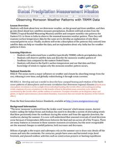
Observing Monsoon Weather Patterns with TRMM Data
Follow a fabulous slide show on how monsoons form and how satellite technology is being used to observe the phenomena, explaining why they occur. Afterward, visit the TRMM (Tropical Rainfall Measuring Mission) website to access actual...
Curated OER
Ecosystems and Remote Sensing
Learners obtain remote sensing data to compare and contrast global biomass data with global temperature data.
NASA
Erosion and Landslides
A professional-quality PowerPoint, which includes links to footage of actual landslides in action, opens this moving lesson. Viewers learn what conditions lead to erosion and land giving way. They simulate landslides with a variety of...
Curated OER
Satellite Drag and the Hubble Space Telescope
In this satellite drag and Hubble space telescope worksheet, high schoolers solve two problems using a graph showing the altitude of the satellite vs. the year with two lines showing two different types of re-boost and one line without...
Curated OER
Reflections on Earth: Exploring Planet Earth from Space
Students examine satellite images of Earth and contrast images at different scales. In this exploring Earth from space lesson plan, students use satellite images to contrast images at different scales, calculate distances from the scale...
Curated OER
What Color is the Ocean?
Students view satellite pictures of the ocean, and discuss the presence of phytoplankton and the colors of the ocean. Students compare/contrast ocean satellite images with maps and globes, then color world maps to replicate the satellite...
Curated OER
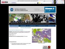
Aruba Cloud Cover Measured by Satellite
Students analyze cloud cover and compose written conclusions to a given related scenario. Students submit a letter of response and a report detailing their calculations and conclusions.
Curated OER
Aruba Cloud Cover Measured by Satellite
Students analyze cloud cover and to compose written conclusions to a given related scenario. They submit a letter of response and a report detailing their calculations and conclusions.
Curated OER
Satellites
Eighth graders explore the history of space travel and satellites. Through a teacher demonstration, 8th graders observe how a satellite revolves another object. They identify natural and artificial satellites, explore how satellites...
Curated OER
Lesson 6: Crowded Skies
This is a treasure-trove of multimedia resources to help your scholars analyze transportation methods. They discuss different forms of movement, utilizing several infographics to spur conversation deeper and get visual learners engaged....
Howard Hughes Medical Institute
Lesson 5: Tracking Lion Communities
Researchers in Gorongosa National Park placed cameras there many years ago to understand what was happening with the lion communities that lived there. Little did they know, they opened a door to so much more! Inquisitive...
Curated OER
Can You See What I See?
Students gain an understanding of the methods used to explore the earth's surface. Students create a time line leading to the first satellite image of the Earth that includes the various methods utilized to observe the earth's surface.
Curated OER
Satellite Tracking
Students apply satellite tagging data to investigate questions related to open-ocean animals, their habitats, and their migratory behaviors. They determine how physical or biological factors determine organism behavior using a data...
Curated OER
Storm Clouds-- Fly over a Late Winter Storm onboard a NASA Earth Observing Satellite
Students study cloud data and weather maps to explore cloud activity. In this cloud data lesson students locate latitude and longitude coordinates and determine cloud cover percentages.
CK-12 Foundation
Location on the Earth: Longitude and Latitude
To what degree do learners understand coordinates? Get them some practice in Yosemite National Park in a simple, fun interactive. Pupils explore a map and locate coordinates of popular sights within the park, then answer questions to...
Curated OER
Geography from Space
Students explore geography as seen from space. In this web-based lesson, students brush up on geography skills by identifying geographic locations based on satellite or aerial images and a brief clue.
Curated OER
Trends of Snow Cover and Temperature in Alaska
Students compare NASA satellite data observations with student surface measurements of snow cover and temperature. They practice data collection, data correlations, and making scientific predictions.


