Curated OER
Washington D.C.
Learners research monuments in Washington, D.C. In this geography lesson plan, students research one monument and use the Internet to gather information. Learners create a three-dimensional model of their monument.
Curated OER
States and Capitals Activity
Students explore states and capitals. In this U.S. geography lesson, students practice locomotor skills playing Freeze Tag. Students generate the matching capital when given a specific state name in order to continue the game.
Curated OER
Under Pressure: How Deep Can They Dive?
Students explore geography by conducting an in-class experiment. In this deep sea exploration lesson plan, students identify the different zones of the ocean and utilize water bottles, masking tape and scissors to conduct a water...
Curated OER
Aboriginal Dreamtime Symbols
Students create their own dreamtime symbols in the style of modern Aboriginal culture. They are told that aboriginal art is very important in native Australian culture. Students locate Australia on a world map. They find pictures of...
Curated OER
Living By Water
Young scholars research a coastal community, locate it on a map and profile its physical, geography, climate, architecture and cultural characteristics. They envision this coastal community and make a detailed drawing of it by blending...
Curated OER
Rainforest Layers Illustration
In this science and geography worksheet, students learn about the emergent layer, canopy, understory and undergrowth layers of the rain forest by studying this labeled color picture.
Curated OER
Third Grade Social Studies-Multiple Choice Activity
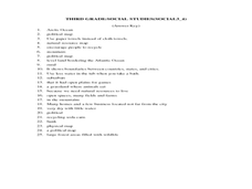
For this grade 3 social studies worksheet, 3rd graders complete a set of 25 questions about a variety of topics including geography, types of communities, map and questions about the environment.
Curated OER
Can You Name the Region?
While just a picture of the Rocky Mountains, this presentation could be used as an introductory activity to a geography lesson. The series of slides begins with a piece of a complete picture which is revealed little by little, until the...
Curated OER
Geography Review
Third graders name the continent, country, state, and community in which they live. They locate Maryland and Baltimore on a map of the United States.
Curated OER
Geography of the English Settlements
Third graders locate several important American colonial cities on a map and research how their proximity to water and nearby arable land affected the rate and success of settlement.
Curated OER
Geography: Islands and Alcatraz
Learners, in groups, create maps of islands including map keys and compass roses. They compare and contrast their island communities with that of the island prison, Alcatraz. Students select from a series of projects, including writing...
Curated OER
Geography General Space
Pupils work together to explore states and/or countries while designing their movement area for the day.
Curated OER
Utah: Geography
Students research the different geographical regions and landforms in Utah.
Curated OER
Geography: World Dynamics
Students discuss and examine how the world is changing. After reading an article, they discover the immediate changes that have taken place and how they have effected living things. They complete a worksheet identifying the changes as...
Curated OER
Advertise With Geography...it's Free And It's Easy!!
Students establish awareness of how landforms/landmarks produce a visual image of a region and demonstrate how advertisers use the "positive geographical image" to sell their product by creating their own advertisements.
Curated OER
Geography
Third graders study the Mediterranean Region by locating and identifying Italy, Greece, France, Spain, North Africa, the Mediterranean and Adriatic Seas.
Curated OER
Global Geography of Economics: The Indiana Steel Industry
Pupils are introduced to how steel is made and investigate the importance of the steel industry. They participate in a role-play that explores the concepts of taxes, tariffs and imports vs. domestic production.
Curated OER
Geography Action! Rivers 2001- Human River
Students create a 'human river' by arranging themselves into a river pattern. Each student selects an article to represent a pollutant such as paper, book, or pencil. Students at the source of the river pass their pollutant on to the...
Curated OER
State Geography
Students reinforce their knowledge of the locations of the states. They need to know where the states of the United States are located in relation to each other. Students review the states symbols, capitals and landmarks as well within...
Curated OER
Geography: Lesson One
Students pretend they have been chosen to receive an elephant for a pet. Individually, they use the internet to research where elephants come from, their diet and sleeping behaviors. They identify their habitat and their characteristics...
Curated OER
United States City and States
For this United States capital cities worksheet, students write the name of the state under each city and its famous image. The capital cities are Chicago, St. Louis, New York, Los Angeles, Seattle, San Francisco, Atlanta, Boston, and...
Curated OER
Edible Resource Maps
Third graders work in groups to create an edible resource map showing locations of at least five resources in the United States. Students research on the internet different regions and the resources that are found in those areas. They...
Curated OER
Map a World of Facts
Pupils mark ten places on a world map while they follow fun facts on the included printable sheet. They research using a variety of resources to determine the location of the ten places.
Curated OER
Say "Thank You" in 100 Languages!
Young scholars put the "Thanks" back in Thanksgiving with this geography and language activity that teaches students to say "thank you" in many languages.
Other popular searches
- Five Themes of Geography
- U.s. Geography
- China Geography
- Africa Geography
- Mexico Geography
- Canada Geography
- Asia Geography
- France Geography
- Japan Geography
- World Map
- Ireland Geography
- Geography Studies

