Curated OER
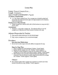
Using a Compass Rose
Second graders practice navigating around their neighborhood by utilizing a compass. In this geography lesson, 2nd graders view a compass rose, discover the purpose of it, and utilize it to navigate through a printed map of their...
Curated OER
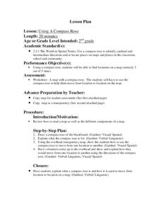
Using a Compass Rose
Second graders explore geography by completing a mapping activity in class. In this directional lesson plan, 2nd graders examine a map in class and utilize a compass rose to identify their location and destination. Students write...
PBS
Arthur's World Neighborhood: Building Global and Cultural Awareness
Kids become global anthropologists as they explore commonalities and differences both in their classroom and expanding across the globe. Throughout several activities, learners conduct partner interviews that culminate in Venn diagrams,...
Curated OER
Create a Compass Instructions for Teachers
Students, who are teachers, discover how to make box and water compass in their classrooms. They describe the scientific principles that are involved in making and using a compass.
Curated OER
Age of Exploration
Students work individually or in a group researching a box compass using historical information on the uses of the compass as well as the scientific theories of the compass. They create a box compass and a water compass which are...
Curated OER
To Walk the Sky Path
Fifth graders use maps of Florida. They locate places from a list on their map. Students use the places mentioned in the book, "To Walk the Sky Path," and locate them on the map. Students should have labeled a minimum of 10 places, and...
Curated OER
Switzerland
In this map of Switzerland worksheet, students view and label on a map of Switzerland its regions, major cities, important landmarks, compass rose and a legend.
Curated OER
Wales
In this map of Wales activity, students view and label on a map of Wales its regions, major cities, landmarks, compass rose and a legend.
Curated OER
British Isles
In this map of British Isles worksheet, students view and label on a map of the British Isles its regions, major cities, important landmarks, compass rose and legend.
Curated OER
Geography: Islands and Alcatraz
Students, in groups, create maps of islands including map keys and compass roses. They compare and contrast their island communities with that of the island prison, Alcatraz. Students select from a series of projects, including writing...
Curated OER
Cartography
Students research about cartography and how to be a cartographer. In this math lesson plan, students draw a map of their classroom. They use a robot to explore navigation using a compass rose.
Curated OER
Route To School Mapping Assignment
Students create a map showing the route from home to school. Students include a legend, compass, label buildings, and color the map route on the map. They write out specific directions.
Curated OER
Migrating to Texas
Fourth graders explore the migration to Texas from other parts of the United States. Through journal entries they write about the trip as if they were the settlers coming to a new and foreign country. Working in small groups, 4th graders...
Curated OER
Sam Houston for President...Again
Fourth graders discover the political career of Sam Houston. For this Texas history lesson, 4th graders research primary resources and create a modern-day version of Sam Houston's political campaign of the 1840s.
Curated OER
A Walk Around the School: Mapping Places Near and Far
After reading Pat Hutchins’ Rosie’s Walk, have your young cartographers create a map of Rosie’s walk. Then lead them on a walk around the school. When you return class members sequence the walk by making a list of how the class got from...
Curated OER
Places in My World
Second graders explore where they are located on the globe. In this maps and globes lesson, 2nd graders use a map to show where they live and show the cardinal directions. Students identify characteristics of mountains, flat land,...
Curated OER
Map It!
Fourth graders demonstrate map making skills by using the computer to create maps of the geographic features, regions, and economy for their state.
Curated OER
A Class Census
Students recognize that data represents specific pieces of information about real-world activities, such as the census. In this census lesson, students take a class and school-wide census and construct tally charts and bar graphs to...
Curated OER
Maps
Maps, globes, and computer software aid young explorers as they locate state capitols, major cities, geographic features, and attractions for states they are researching. They then use desktop publishing software to create a map to share...
Curated OER
Drake's West Indian Voyage 1588-1589
Learners investigate several maps detailing Sir Francis Drake's voyages. In this geography lesson, students practice reading maps and locating the precise locations of where Sir Francis Drake visited. Learners create an outline of the...
Curated OER
Strawberry Girl: Lesson 3 - Trains, Sails, and Trails
Students read two chapters of Strawberry Girl by Lois Lenski and complete activities about Florida's transportation history. In this literacy and economics lesson, students read two chapters of the book, talk about their journal entries,...
Curated OER
U.S. Geography: The Northeast
Young scholars investigate U.S. Geography by creating a map in class. In this natural resource lesson, students create a map of the United States and research the Northeast based on their resources and recyclable materials. Young...
Curated OER
America Will Be
High schoolers work together to research and create different types of maps of the United States to be used as part of a geography trivia game.Groups research North American annual rainfall, climate, mountain ranges major rivers and...
Curated OER
Let's Travel!
Learners review the rules and expectations, they earn points each day by making the correct behavioral choices. They read maps and do Internet reserach, students become aware of United States and or world geography. Learners check...
Other popular searches
- Compass Rose Worksheet
- Compass Rose Art Lessons
- Compass Rose Lesson Plans
- Using a Compass Rose
- Creating a Compass Rose
- Making a Compass Rose
- History of Compass Rose
- Using the Compass Rose
- Compass Rose Lesson
- Using Compass Rose
- Compass Rose for Directions
- Making Compass Rose


