Curated OER
Mapping Districts
Students become literate in their use of maps. In this 2010 Census lesson plan, students visualize census data on maps, use map keys to read population maps, and explore the concept of population density.
Curated OER
Mapping Districts
Students use maps to learn about the U.S. Census. In this 2010 Census lesson plan, students visualize census data on maps, use map keys to read population maps, and explore the concept of population density.
Curated OER
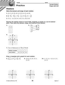
Relations
In this relations instructional activity, 10th graders solve and complete 10 different problems that include defining various forms of relations. First, they state the domain and range of each relation. Then, students express the...
Curated OER
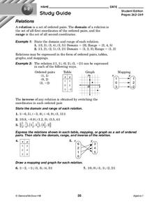
Relations
In this relations worksheet, 10th graders solve and complete 7 different problems that include defining various relations of number sets. First, they state the domain and range of each relation. Then, students express the relations shown...
Curated OER
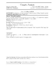
Complex Analysis: Linear Fractional Transformations
In this transformation worksheet, students explore linear transformations and mappings. They map equations on a coordinate plane. This two-page worksheet contains approximately three problems.
Curated OER
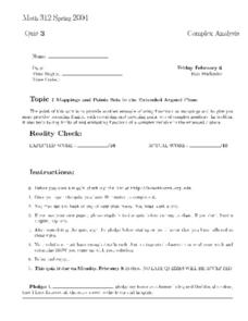
Math 312 Spring 2004: Argand Plane
In this Argand plane worksheet, students map problems dealing with theoretical aerodynamics to represent cross-sections of airfoils. They use Joukowsky mapping to sketch the image of a circle and compute the limits of a function. This...
Curated OER
Math 312 Spring 2004: Argand Plane
In this Argand Plane instructional activity, students use inversion mapping to sketch images of a circle in the Argand plane. This two-page instructional activity contains five problems.
Curated OER
Math 312 Spring 98 - Mappings and Points
For this mapping and points worksheet, students describe and sketch point sets of complex numbers. They evaluates functions of a complex variable in an extended plane. This one-page worksheet contains five problems.
Curated OER
Complex Analysis: The Complex Derivative
For this complex derivative worksheet, students determine the circle of a radius under the mapping principle. They identify analytic functions, and explore the relationship between real and imaginary parts of complex functions. This...
Curated OER
Antarctica Map
In this Antarctica worksheet, students study a very detailed map of this continent. Important features on this map are labeled.
Curated OER
Year 3 Geography
In this social studies worksheet, students find the words that are related to the concepts found in Geography and the answers are found at the bottom of the page.
Curated OER
Where in the World is Tacky the Penguin?
First graders complete activities related to they story they are reading in class. Through art and measurement activities, 1st graders relate a story from the "Tacky the Penguin Series" to everyday objects and ideas they encounter.
Curated OER
What Are Maps For?
Middle schoolers create a story about a problem someone could have which could be solved by the use of a map. They complete a worksheet that guides them through the features of a map of Chicago. Then they calculate story problems using...
Curated OER
Asking For Directions
Students draw a map of their surrounding area using appropriate landmarks and identifying characteristics. Students ask for and give directions to locations found on their maps to their partner. This lesson is intended for students...
Curated OER
Coordinate Grid: Mapping an Archaeological Site
Students examine how archaeologists preserve context of sites through use of rectangular grid or Cartesian coordinate system, and develop sense of distance by pacing off and estimating distances.
Curated OER
What Do You Know About Oceans?
Students brainstorm and discuss what they know about oceans and seas, read poem My Ocean Speaks by Olga Cossi, discuss narrator's feelings about ocean, write reflective journal entries about their experience or inexperience with the...
Curated OER
Monument Museum
Students design monuments, taking into account what is known about geometric shapes and measuring. Students create a museum complete with monuments and descritions of the monuments. Students provide guides at each monument in order to...
Curated OER
Alberta And Saskatchwan: the View in 1905
Students analyze the differences between maps 1905 and current maps of Alberta and Saskatchewan. They use maps from the Canadian Council for Geographic Education to complete a guided inquiry. This lesson also has many extension activities.
Curated OER
Map your Schoolyard
Students practice their mapping skills by creating an accurate map of their schoolyard using an aerial photo from the National Map web site. Students include legends, a scale, and a north arrow on their maps.
Curated OER
Mapping Your Community
Students define the boundaries of their community by comparing the community's official boundaries with other historical, political, physical, and perceived boundaries of the area and create a community map.
Curated OER
Gridding a Site
Students establish a grid system over an archaelogical site. They label each grid unit. They determine the location of artifacts within each grid unit. They construct a scientific inquiry concerning the location of artifacts on the site.
Curated OER
Getting to Know My World
Students participate in hands-on activities using maps and globes to identify geographical features. Students use map legends to identify direction. Students locate oceans, continents, countries, states and cities. Handouts and...
Curated OER
Mapping the Human Movement
Students practice their skills in reading content to locate the data on African-American emigration. After placing the data in a chart, they create a human movement map. They create another map using research on current immigration...
Curated OER
Roll With The Punches: Crossroads to Where?
Third graders visualize and create a map to outline scenes from the novel Roll of Thunder, Hear My Cry. They understands the importance of organizing information when making maps and giving directions.


