Curated OER
Calculating Distance On Maps
Fourth graders determine the mileage from the local community to various scenic attractions in the Four-Corners-Region. They receive direct instruction and carry out activities in cooperative group settings.
Curated OER
Mapping a Garden
Second graders recognize the components of a map, particularly the legend, the key, the symbols and the area. They develop their own map of a garden they be planting in their upcoming science lesson plan.
Curated OER
Maps In Our Everyday Lives
Students break into groups and complete a chart about information on maps of their hometown.
Curated OER
America Will Be
High schoolers work together to research and create different types of maps of the United States to be used as part of a geography trivia game.Groups research North American annual rainfall, climate, mountain ranges major rivers and...
Curated OER
Investigating Haiti
Learners engage in a instructional activity that is about the island of Haiti. They conduct research using a variety of resources. The information is used in order to help students locate the island on a map. They answer questions while...
Curated OER
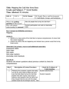
Mapping the Cold War Arms Race
Seventh graders create a visual representation of the Cold War Arms Race. Using a map of the world, they identify where the events where the Cold War to place.
Students analyze the events and create a journal entry explaining how a...
Curated OER
Lets Put Delaware On The Map
Young scholars compare and contrast historical and modern maps of Delaware. Through class discussion and group activities, students analyze maps and make comparisons. Each group participates in a game to aid in discerning the...
Curated OER
Head of the Class
Fourth graders complete a map according to a theme. Using Internet and word processing tools, student fill in the missing information according to the theme of the map. All maps are answers are computer based.
Curated OER
Map It Out!
Students open their Alabama history book to the chapter on the Civil Rights Movement noticing how the chapter is broken into headings. They read a passage and as a class, create a story map focusing on the main ideas and details.
Curated OER
Spatial Understanding of the Cities and Towns
Students engage in a fun stand up, move around activity that teaches some basics of geography. They develop concepts of distance between community locations and practice giving and taking directions in an organized manner.
Curated OER
Where Do You Live?
Students identify their state and city on a map. After completing a reading of Zoom, students identify various landmarks on a globe and on a map. They begin by identifying the United States and refine their identification until they have...
Curated OER
Becoming A Local Historian
Students practice the art of being a historian. They compare primary and secondary resources to conduct a critical thinking assignment. Students compare the map of the Baton Rouge area to a modern one in order to make inferences about...
Curated OER
Mapping in Words
Learners create maps to describe the Wabanaki's relationship with their environment. They discuss the names the Wabanaki people gave to areas of land and water. They review a map of their community to discuss the names of towns and their...
Curated OER
What Is In A Name?
Fourth graders investigate the meaning of names and how they are used to name geographic places. They conduct research using a variety of resources. Special attention is paid to names given within the Native American culture. Students...
Curated OER
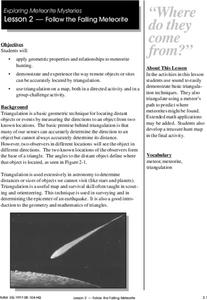
Follow The Falling Meteorite
Middle schoolers investigate the supposed traveling path of a meteorite. They use sound in order to triangulate the path. The results of the experiment are written on a map to display the path of the meteorite. The culminating activity...
Curated OER
Making a Map of the Classroom
Students create a map of the classroom using the computer programs AppleWorks and iChat in this math-based technology lesson. Lesson extension ideas include a scavenger hunt and maps of other school buildings.
Curated OER
Dreaming of a Healthy City
Ninth graders design a healthy city. They identify the essential elements of a city and describe how climate and geography can determine the layout of a city. They create a blueprint of their design and share in small groups.
Curated OER
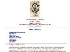
Deborah Sampson
Fifth graders describe the major accomplishments of Deborah Sampson and her importance in American history. They list in chronological order the evets that took place in Deborah Sampson's life. They demonstrae their ability to...
Curated OER
Around the World in 17 Days
Students examine geography while studying the 2006 Winter Olympics. Students keep track of the winners of each Olympic event by finding the results using the Internet or by reviewing the newspaper and discuss the country the medalist...
Curated OER
Did You Feel That? Earthquake Data Chart
Students plot earthquakes on the world map using coordinates of longitude and latitude. They designate the earthquakes magnitude with a symbol which they include in the map key.
Curated OER
North America Knowledge
Second graders move around a large map of the North America drawn on the playground. They follow the directions called out by the teacher. They may also develop their own tasks for other students to follow.
Curated OER
Population Counts
Young scholars use 2001 population figures to color provinces and territories on a map. They use the information on their map to answer questions.
Curated OER
Lagoon Lake
Students develop skill in using co-ordinates. Up to eight cardinal points of the compass are used making this a useful activity in simple map and grid work. They utilize educational software to gain practice.
Curated OER
Down on the Farm
Students are introduced to a map of an Illinois farm. They determine whether the map is of the past, present, or future by looking at features on the map. They also use the map to make a three-dimensional model.


