Curated OER
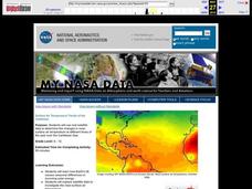
Surface Air Temperature Trends of the Caribbean
Students use real satellite data to determine the changes in near-surface air temperature at different times of the year over the Caribbean Sea. They discover how Earth's tilt causes seasonal differences in incoming solar energy. They...
Curated OER
Sea Horse Habitats
Students research sea horses around the world. In this sea horse habitats lesson, students use the Internet to take a virtual tour of a sea horse in its natural habitat. Students work in groups to study a geographical region such as...
Curated OER
Telecollaboration Lesson
Sixth graders explore the Caribbean sea and the Arctic ocean. They become familiar with the living conditions of others. Students investigate the geographic location of each area. They become familiar with important events that helped...
Curated OER
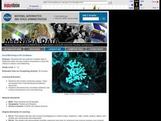
Coral Bleaching in the Caribbean
Students practice analyzing images, maps and graphs from Internet-based educational resources. They explore the correlation between sea surface temperature and coral bleaching. Students comprehend that coral reefs are collections of tiny...
Curated OER
Classification and Adaptations- Streams, Rivers, and Lakes - Where the Land Meets the Sea And Caribbean Reef
In this science worksheet set, students answer 14 short answer questions about the classification and adaptation of life in streams, rivers, and lakes. They also answer 15 questions about life "Where the Land Meets the Sea" and in a...
Curated OER
See Turtles Nest! See Turtles Hatch!
Students graph data of sea turtles hatching rates from Watamu/Malindi Marine National Park and Reserve in Kenya. For this math lesson, students use real life science data to calculate mean and median values. Students use the data to...
Curated OER
Surface Air Temperature Trends of the Caribbean
Students investigate the seasonal changes to sea surface and near-surface air temperatures near the equator. They use actual satellite data to track and graph the differences in air and sea temperatures during different seasons in the...
Curated OER
Anguilla: An Island Economy
Learners role play a potential investor and prepare a position paper concerning possible investment opportunities in the Caribbean--specifically, the island of Anguilla. They read a variety of articles as they complete research needed to...
Curated OER
Exploring Marine Ecosystems in the Caribbean and Maine
Students compare the marine habitats of Maine and the Caribbean using temperature, tides, ocean currents, latitude and longitude. In this marine ecosystems lesson, students analyze maps to complete graphic organizers that evaluate the...
Curated OER
Seas, Gulfs and Bays
Students define gulf, bay, and sea. In this bodies of water mapping lesson, students locate seas, gulfs and bays and explain how they knew which body of water it was.
Curated OER
Coral Bleaching in the Caribbean
Students use authentic satellite data on the NASA website to determine when the sea surface temperature meets the criteria to induce coral bleaching.
Curated OER
Corals and Coral Reefs
Students label the continents, oceans, and seas on a provided world map and use it to determine where they would expect most of the world's coral reefs to be found based on provided information the teacher has read to them.
Curated OER
Follow That Ship!
Learners in this exercise are introduced to the distinct ways of measuring distance (nautical miles) and speed (knots) at sea, as well as the concepts of latitude and longitude for establishing location.
Curated OER
Monitor Marine Migrants
Students, in groups, track the seasonal journey of a species, such as a shorebird, sea turtle, or marine mammal, using various sources of migration data
Curated OER
Hurricanes: An Environment of Concern
Students study hurricanes and research the damage done by hurricane Katrina. In this environment investigative lesson plan students divide into groups and complete a given assignment.
Curated OER
Hurricane Research
Students examine the factors that influence hurricanes to develop. In this hurricane instructional activity students research atmospheric trends that affect hurricanes and create a summary.
Curated OER
Coral Snapshots
Using photographs and a coral reef identification key, junior marine biologists compare changes in coral cover for a No-Take Area and the surrounding unprotected area. The data that is collected is then analyzed for richness,...
Alabama Department of Archives and History
Yellow Journalism
What role did yellow journalism play in bringing the United States into war with Spain? As part of their study of the Spanish-American War, class groups examine newspapers of the times and other texts and then produce their own...
Curated OER
What is Good Use of Time?
Students analyze the best uses of time in other cultures. In this time use lesson, students read the poem 'Soccer Into Dusk' and 'The Meaning of Time' as analysis of time usage in other culttures. Students complete a discussion, journal...
Curated OER
Geography of South America
Student's identify geographic features of a South American map. They use the scale of the map to calculate distances between points. They identify examples of the five geographic themes on the map of South America.
Curated OER
Slavery, Society, and Apartheid
Students examine the St. John slave revolt of 1733. In this slavery and apartheid lesson, students view the DVD "Slavery, Society, and Apartheid." Students respond to discussion questions regarding the content of the DVD which features...
Virginia Department of Education
Hurricanes: An Environmental Concern
Hurricanes, typhoons, and tropical cyclones are the same type of storm, but their names change based on where they happen. Scholars use a computer simulation to learn about hurricanes. Then they hypothesize ideas to prevent hurricanes...
Curated OER
What Do You Know About Oceans?
Students brainstorm and discuss what they know about oceans and seas, read poem My Ocean Speaks by Olga Cossi, discuss narrator's feelings about ocean, write reflective journal entries about their experience or inexperience with the...
Curated OER
Ocean Floor Properties and Near Shore Environments
High schoolers explore and model the characteristics of the ocean floor and near shore environments through in-class demonstrations, laboratory activities, and internet research. They use classroom materials to research the...
Other popular searches
- Caribbean Sea Map
- Caribbean Sea Food Chain
- Maps Caribbean Sea
- The Caribbean Sea
- Caribbean Monk Seal
- Caribbean Dry Season


