California Academy of Science
Kinesthetic Astronomy: Earth's Rotation
After completing the activity, "Kinesthetic Astronomy: The Meaning of a Year," zoom in on Earth's rotation using the same simulation setup and this outline. Each class member dons a map of the Western Hemisphere and plays the part of...
Institute for Geophysics
Understanding Maps of Earth
Here is your go-to student resource on primary geography concepts, including facts about the surface of the earth and its hemispheres, latitude and longitude, globes, types of maps, and identifying continents and oceans.
Teach Engineering
Where Are the Plastics Near Me? (Mapping the Data)
The last activity in a nine-part series has teams create a Google Earth map using the data they collected during a field trip. Using the map, groups analyze the results and make adjustments to the map to reflect their analysis. A short...
California Academy of Science
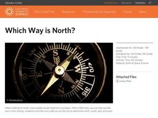
Which Way is North?
Who needs a compass to find cardinal directions? Just place a stick in the ground and record the movement of its shadow over the course of a day. Then, measure the shadow lengths in order to determine a north-south line. A simple...
NASA
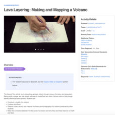
Lava Layering: Making and Mapping a Volcano
Looking for an out-of-this-world volcanic activity? Geologists study Earth's volcanic history and the neighboring planet Mars by modeling volcanic eruptions, lava flows, and building a shield volcano. Participants use graph paper and...
Seussville
The Lorax's Earth Day
Add a touch of Dr. Seuss whimsy to your Earth Day celebration with six pages consisting of Earth-friendly, inspiring, and engaging activities designed to enhance the beauty of your school campus and showcase the famous story, The Lorax.
Curated OER
Mt. Whitney to Death Valley
This is an intriguing problem that brings together real-world data, technology, and mathematical problem solving. If visibility wasn't an issue, could you see from the highest point in the lower 48 states, Mt. Whitney, to the lowest...
Oregon State
World Map of Plate Boundaries
Young geologists piece together the puzzle of plate tectonics in an earth science lesson. Given a physical map of the world, they search for land formations that indicate the location of different types of plate boundaries.
Teach Engineering
Searching for Bigfoot and Others Like Him
Individuals create a GIS data layer in Google Earth that displays information about where one might find seven different cryptids. The class members research to find data on cryptid sightings they can include in their data layer.
It's About Time
Taking a Ride on a Lithospheric Plate
Assist your pupils and broaden their horizons with several activities that determine the exact positioning of various communities over the globe. Pupils use data from the Global Positioning System to determine the position and rate of...
Curated OER
3D Textured Globe
The earth, our home planet, and the star of Earth Day celebrations everywhere! Celebrate Earth Day or examine Earth's place in the solar system, with a fun and easy craft, perfect for children nine and up. Paper mache ornaments, paint,...
K-State Research and Extensions
Water
How are maps like fish? They both have scales. The chapter includes six different activities at three different levels. Scholars complete activities using natural resources, learn how to read a map, see how to make a compass rosette,...
Teach Engineering
What's Wrong with the Coordinates at the North Pole?
Here is an activity that merges technology with life skills as individuals use Google Earth to explore the differences between coordinate systems and map projections. The self-guided worksheet is the fourth segment in a nine-part unit....
Curated OER
Those Who Have Come Before Me
Class members are transformed into explorers as they work in groups to locate hidden items and map their journey along the way. They then leave clues for other groups of students to follow, and ultimately discover how past explorations...
Teach Engineering
Drawing Magnetic Fields
Class members use a compass and several points to map out the magnetic field of a magnet. Pairs trace the magnetic field lines produced by a permanent magnet by positioning the compass in numerous spots around the magnet to view the...
Teach Engineering
Incoming Asteroid! What's the Problem?
Oh, no! An asteroid is on a collision course with Earth!. Class members must rise to the challenge of designing a shelter that will protect people from the impact and permit them to live in this shelter for one year. In this first lesson...
It's About Time
Where are the Volcanoes?
Middle school geologists map the volcanoes closest to themselves, learn about map distortion, and infer possible future volcano locations. A focus on latitude, longitude, and volcanoes beneath the ocean helps connect the lesson.
It's About Time
The Changing Geography of Your Community
Lead your class in exploring their local communities as well as the general environment. As they determine continental distributions by investigating minerals, rocks, and fossils located in their local region, pupils construct a...
US Environmental Protection Agency
Mapping Greenhouse Gas Emissions Where You Live
After investigating the US Environmental Protection Agency's climate change website, your environmental studies students discuss greenhouse gas emissions. They use an online interactive tool to look at data from power production...
US Environmental Protection Agency
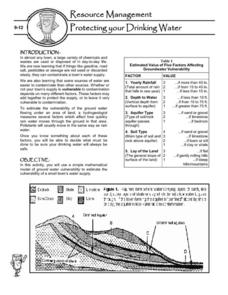
Protecting Your Drinking Water
Having a clean, reliable source of drinking water is essential for any community, but in many cases this is easier said than done. Engage young environmentalists in exploring the five factors affecting vulnerability of a groundwater...
Howard Hughes Medical Institute
Finding the Crater
A mass extinction event caused by an impact usually leaves a crater. Scholars use data from 10 different sites around the world trying to determine where to look for the crater. They use data, listing the amount of various minerals to...
NASA
How Far Away Is Space?
Space is about 60 miles from the surface of Earth. Pupils make calculations to model that distance by stacking coins the appropriate height using scale. They then explore the distance to objects in space such as satellites and the space...
Novelinks
The Hobbit: Concept/Vocabulary Analysis
Considering using Tolkien's The Hobbit for book circles or whole-class reading? Check out this packet that provides an overview of the novel, some interesting background materials, and links to additional resources.
It's About Time
Effects of Plate Tectonics
Explore our world from within as you lead young scientists on a thrilling adventure. Pupils examine the location of plate boundaries to determine earthquake and volcano distribution around the globe and explore the cause of hot spots in...
Other popular searches
- Earth Scene Concept Maps
- Earth Scone Concept Maps
- Earth Science Mapping
- Earth Sciecne Concept Maps
- Mapping Earths Surface
- Mapping Earthquakes


