Curated OER
Oh, the Regions
Focus on the geography of Oklahoma. In this activity, learners compare different geographic regions in Oklahoma, create a collage to share their results, and identify important landforms throughout the United States, such as the Rocky...
Curated OER
The Happy Game: Physical Features
Students love to test their knowledge, use this game to see what your students know about landforms and other basic geographic terminology.
Science Matters
Seismic Activity and California Landforms
By the 19th lesson in the 20-part series, scholars realize volcanoes and earthquakes are related to plate boundaries. The lesson extends and applies the knowledge by having individuals create a bumper sticker for one specific area of...
Curated OER
The Earth's Crust
Students use clay to form models of the different landforms and then complete a data table using a map, atlas, or the Internet to locate famous landforms in the United States. Students complete various activities, writing down their...
Curated OER
Common Themes
Tenth graders test usefulness of a model Earth by comparing its predictions to observations in the real world. In this landforms lesson students construct an island from a contour map using model clay then analyze the landscape features...
Curated OER
Neither Wind Nor Rain
Here is another in the interesting series of lessons that use the special State Quarters as a learning tool. This one uses the North Dakota State Quarter. During this lesson plan, your class learns about the different patterns of...
Curated OER
Rocks and Minerals
Learners are able to describe earth processes (e.g., rusting, weathering, erosion) that have affected selected physical features in students, neighborhoods. They are able to identify various earth structures (e.g., mountains, faults,...
Curated OER
Watershed Works: Unit 1
By constructing a watershed model and identifying watershed features in it, they discover how water erosion changes the landscape. As with most watershed modeling activities, this one is costly in terms of time and materials. It is,...
NASA
Geographical Influences
"If global warming is real, why is it so cold?" Distinguishing the difference between weather and climate is important when it comes to understanding our planet. In these activities, young scientists look at the climate patterns in a...
Curated OER
Geography Terms
Students identify different landforms and fill out a worksheet where they explain what each landform is. In this geography lesson plan, students fill in a landform map and then use landform words as they describe the landforms.
K-State Research and Extensions
The Crusty Earth
Geology rocks — literally! A geology chapter offers eleven activities at four different levels. Scholars enjoy completing hands-on experiments before applying critical thinking skills following a share, process, generalize, apply, and...
Curated OER
Plate Tectonics & Land Forms
Fourth graders discuss the different interactions of plates and the ways mountains are created. In this plate tectonics lesson plan students complete an activity in groups.
Curated OER
SUBMARINE MOUNTAINS
Students create a two-dimensional contour map of a submerged area from a simulated survey using sounding techniques.
Columbus City Schools
Constructive and Destructive Geologic Processes
Show the class the world as they've never seen it before—from way above! Learners try to unravel the mysteries presented by rich satellite imagery, learn to interpret topographic maps, and study erosion by constructing their very own...
Curated OER
Sculptured Landscapes
Students research glaciers, how they are formed and what kind of landforms they carve out of the rock they pass over. They organize their findings into a mock newscast in a presentation for the class.
Curated OER
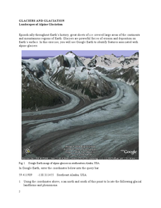
Landscapes of Alpine Glaciation
In this glaciers worksheet, students use Google Earth to look for examples of different glacial landforms and phenomena. Students complete 2 short answer questions.
Curated OER
Earth Structure and Processes
Students classify different rocks according to their types. In this earth science lesson, students explain how plate tectonics created Earth's landforms. They explain the continental drift theory and sea floor spreading in their own words.
Curated OER
Windbreakers; Earth Science, Topography, Weather
Young scholars consider how topography affects weather and human activity. Students simulate a mountain range and observe surrounding wind patterns.
PBS
Regional Patterns of Climate: Pacific Northwest
Climate systems involve sunlight, ocean, atmosphere, ice, land forms, and many other factors. Scholars explore each of these variables related to the Pacific Northwest rain forest. They use an online interactive to investigate the polar...
Curated OER
Rock Cycle
Third graders identify various types of landforms of the United States. They discuss earth movements that produce geologic structures and landforms and define cycle as it relates to rocks and soil. They demonstrate the processes forming...
Curated OER
Pass the Plate
Pupils define constructive forces. They describe how landforms are created as a result of constructive forces. Students recognize active volcano areas in the United States. They demonstrate an understanding of Panagea.
Curated OER
Plate Tectonics
Students identify that most of mountain ranges found on all major land masses and in the oceans are external reflections of tectonic movements within the earth. They identify that earthquakes and related phenomena are caused by the...
Curated OER
Plate Tectonics
Learners examine plate tectonics and landforms. In this plate tectonics lesson students complete an activity. Learners practice drawing maps that show different fault lines and the land formations that were caused.
Curated OER
The Great Continental Drift Mystery
Students stud the concept of Pangaea by using Wegener's clues to construct a map of the continents joined together. They determine how fossil distribution can be used to enhance the study of continental drift. They locate the...


