Curated OER
Geographic Landforms
Each slide is a simple notebook page with one landform in blue and its definition in red. There are 26 vocabulary terms in all, some you may want to use, and others easily hidden. It is recommended that you add photos or other graphic...
Curated OER
Landforms of Illinois
Fifth and sixth graders are introduced to the primary landforms of Illinois and discover how they were created. Landform cards are made for each pupil. They use the twenty-questions format until they have identified each one. Then,...
NorthEast Ohio Geoscience Education Outreach
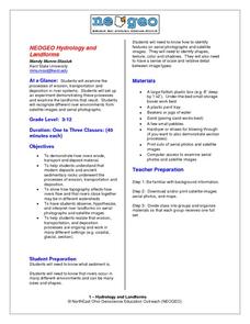
Hydrology and Landforms
Three days of erosion exploration await your elementary geologists. Learners begin by examining rivers via Google Earth, then they model water flow in sand, and finally, they identify resulting landforms. This lesson is written...
Curated OER
How Does My River Flow?
Students create a river. In this water flow lesson, students predict how they think their river will flow and then construct a river box. Students create a landscape for the river to flow through, let the river flow and record...
Curated OER
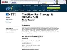
The River Ran Through It
Students identify the processes that shape our rivers and form our lakes. They participate in hands-on and multimedia activities as they discover and apply the river-cutting processes of water.
Science 4 Inquiry
Let's Get Moving
Rivers top the list of causes of erosion over time. Scholars experiment with wind, water, and ice reshaping sand. They connect the simulations facts about erosion and deposition to understand unique landforms such as the Grand Canyon and...
Curated OER
Water Works Wonders
Students examine where water is found in the world, how we use it, and the various forms it takes. They observe the refraction of light through a prism, record the day and night sky over a week's time, and create a topographic model of...
National Park Service
Weather Patterns of the Pacific Ocean
How do oceans affect weather patterns? Learners define vocabulary associated with dew point, topographical lifting, condensation, and formation of clouds and precipitation as they explore the weather in the Pacific Northwest. They also...
Curated OER
Tall as a Mountain, Flat as a Plain
Students examine a variety of landforms that are found on the Earth and compare and contrast the distinguishing qualities of these forms. A topographical model of the landforms is made.
Curated OER
Coasts and Reefs: Shallow Marine Processes
A more thorough presentation on coastal systems would be difficult to find! Detailed diagrams illuminate the offshore, shoreface, foreshore, and backshore zones of beach. The sources and movement of sediments along the coastline are...
Montana State University
Meet Mount Everest
Learning about one landform might seem boring to some, but using the resource provided practically guarantees scholar interest. The second in a sequential series of eight covering the topic of Mount Everest includes activities such as a...
Curated OER
Landforms Slideshow
Students identify twelve different types of landforms, and create a slideshow about each landform that includes a title, pictures, definitions, conclusions and a reference page.
Lakeland Central School District
Erosion and Deposition
If you are looking for a straightforward presentation about erosion and deposition with an emphasis on rivers, look no further. While not super flashy or entertaining, vocabulary is presented simply and accompanied by pictures to...
CK-12 Foundation
Topographic and Geologic Maps: Topographic Maps
Maps are great for helping you get where you're going, but what does that place actually look like? Geology scholars compare and contrast the features of topographical and geologic maps using an interactive lesson. The resource describes...
Curated OER
Erosion
In this earth science worksheet, students describe the course of the river from its source to the mouth, including shapes of the valleys and erosion processes in each course. Then they identify possible types of erosion that would have...
Curated OER
Mud in the Water
Young scholars build a soil erosion model to study the importance of soil conservation. They investigate how land forms from both constructive and destructive forces.
Curated OER
Carve That Mountain
Students investigate major landforms (e.g., mountains, rivers, plains, hills, oceans and plateaus). They build a three-dimensional model of a landscape depicting several of these landforms. Once they have built their model, they act as...
Curated OER
Rivers... for Kids
Students investigate U.S. geography by exploring it's bodies of water. In this river formation lesson, students identify the reasons rivers are needed in our country by reading assigned text. Students examine a diagram which explains how...
Curated OER
A River Ran Wild
Students describe and illustrate pollution and how to clean up pollution. They display their solutions by creating posters, signs, bumper stickers, slogans, T-shirt designs, commercials and poetry. This lesson ties in with 'A River Ran...
Curated OER
Sand Art Creation
Students create a model of a geological land-form. For this art lesson, students will create a model of a land-form using sand.
Space Awareness
Let's Map the Earth
Before maps went mobile, people actually had to learn how to read maps. Pupils look at map elements in order to understand how to read them and locate specific locations. Finally, young cartographers discover how to make aerial maps.
Curated OER
Shaping the Land
In this shaping the land activity, learners will match 7 vocabulary words relating to the movement of sediments to its definition. Students will read 10 statements about how water and glaciers impact sediment movement and answer true or...
Curated OER
Landforms
In this landform review worksheet, learners use 17 provided terms to complete a paragraph about different landforms. After filling in the blanks, they name 4 kinds of mountains and provide examples of each.
Curated OER
Science: Draining the Land - the Mississippi River
Students use topographic maps to identify parts of rivers. In addition, they discover gradient and predict changes in the channels caused by variations in water flow. Other activities include sketching a river model with a new channel...


