Art Institute of Chicago
The Art Institute of Chicago
In addition to information about the museum, its exhibits and programs, the site offers much to those arts and humanities teachers exploring online. Teacher and student resources are described and can be purchased and downloaded at the...
American Rhetoric
American Rhetoric: Adlai Stevenson: Accepting Democratic Presidential Nomination
This is the CSPAN video of Adlai Stevenson's acceptance of the 1952 Democratic Presidential nomination speech which was delivered on July 26, 1952, in Chicago, Illinois.
Other
University of Illinois: Population Genetics [Pdf]
This site from the University of Illinois at Chicago provides an in-depth article on Human Genetics, with a focus on primarily population genetics. The article is factual and informative full of charts, formulas, and extensive text. A...
Ducksters
Ducksters: Illinois State History for Kids
Kids learn about the history and timeline of the state of Illinois including early explorers, Native Americans, settlers, Black Hawk War, Civil War, and the Chicago Fire.
Other
Chicago Tribune: Timeline of the Blagojevich Investigation
Follow the events leading to the impeachment of Illinois Democratic Governor Rod Blagojevich. Photos and links to additional information are included. (01/30/09)
Other
University of Illinois Chicago: Human Genetics: Mendelian Inheritance
Great genetics site with a very good section on Punnett squares.
Library of Congress
Loc: Biographical Directory of the u.s. Congress: Harold Washington
This brief biography describes the career of the Illinois-born African American politician Harold Washington.
Curated OER
Educational Technology Clearinghouse: Maps Etc: Chicago and Vicinity, 1901
A city plan from 1901 of Chicago and vicinity showing the city limits, major streets, neighboring cities and towns, the Illinois and Michigan canal, parks, stock yards, and the shoreline of Lake Michigan.
Curated OER
Educational Technology Clearinghouse: Maps Etc: Chicago, 1911
A city plan from 1911 of Chicago showing major streets, railroads and stations, the Chicago Union transfer railway yards, canals, Plaines River, parks, harbor, and major landmarks of the city.
Curated OER
Educational Technology Clearinghouse: Maps Etc: Chicago and Vicinity, 1916
A map from 1916 of Chicago and vicinity, showing the railroad network of the area, major cities and towns, rivers, and the southern portion of Lake Michigan from Waukegan to Chicago. The map coverage includes the cities of Elgin, Aurora,...
Curated OER
Educational Technology Clearinghouse: Maps Etc: Illinois, 1902
A map from 1902 of Illinois showing the State capital of Springfield, major cities and towns, railroads, canals, the shoreline of Lake Michigan, and the Mississippi and Ohio rivers. An inset map shows the vicinity of Chicago.
Curated OER
Educational Technology Clearinghouse: Maps Etc: Illinois, 1912
A map from 1912 of Illinois showing the State capital of Springfield, counties and county seats, major cities and towns, railroads, canals, lakes and rivers. An inset map shows the vicinity of Chicago. A grid reference in the margins of...
Curated OER
Etc: Maps Etc: Generalized Glacial Map of Northern Illinois, Ice Age
A map from 1911 of the glacial remnants in northern Illinois, showing areas of moraine deposits, driftless areas to the east, Illinoian drift, lowland drift, till sheets, and the proglacial Lake Chicago outlet.
Curated OER
Wikipedia: Featured Image: Illinois Institute of Technology Machinery Hall
The Machinery Hall at Illinois Institute of Technology in Chicago, USA was designed by C.
Curated OER
Educational Technology Clearinghouse: Maps Etc: Chicago, 1922
A map from 1922 of Chicago and neighboring counties. The map shows county boundaries and county seats, cities, towns, railroads, canals, lakes, rivers, and the shoreline of Lake Michigan.
Curated OER
Educational Technology Clearinghouse: Maps Etc: Chicago, 1903
A city plan from 1903 of Chicago and vicinity showing the city limits, major streets, neighboring cities and towns, the western drainage canal, parks, Union stock yards, major landmarks, and the shoreline of Lake Michigan.
Curated OER
Educational Technology Clearinghouse: Maps Etc: Chicago and Vicinity, 1901
A map from 1901 of Chicago and vicinity showing the city limits, major streets, neighboring cities and towns, major landmarks, the drainage canal, stock yards, parks, Lake Calumet, rivers, and the shoreline of Lake Michigan.
Curated OER
Etc: Maps Etc: Chicago and Surrounding Area, 1909
A map from 1909 of Chicago and vicinity, including the State capitol of Springfield. The map shows the railroad network of the area, major cities and towns, rivers, and the southern portion of Lake Michigan.
Science and Mathematics Initiative for Learning Enhancement (SMILE)
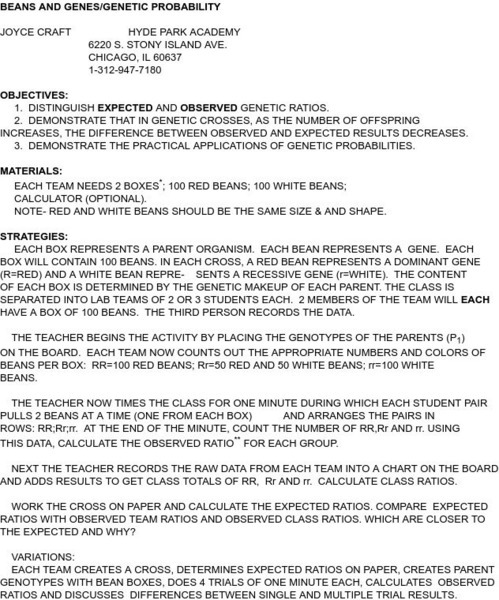
Smile: Beans and Genes/genetic Probability
This lesson was put on by Joyce Craft from Hyde Park Academy in Chicago. This is used to help demonstrate applications in genetic probability.
Read Works
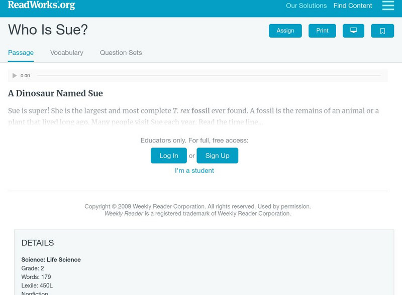
Read Works: Who Is Sue?
[Free Registration/Login Required] An informational text about Sue, the most complete tyrannosaurus rex fossil ever found. A question sheet is available to help students build skills in reading comprehension.
Science and Mathematics Initiative for Learning Enhancement (SMILE)
Smile: Sample Science Fair Judging Forms
Two nice examples of documents you can use for judging science fair projects, one for judge registration, etc. and the other for actual project judging. This particular form comes from the Chicago public schools. Adapt it to your own...
Curated OER
Wikipedia: Natl Historic Landmarks in Illinois: Chicago Board of Trade Building
Skyscraper designed by Holabird & Root, housed the world's largest trading floor when built in 1930.
Information Fluency
Imsa 21 Cif Portal: Online Citation Wizards
Citing Internet resources can be painless with this user-friendly wizard. Choose the type of Citation Standard (APA, Chicago, CSE, Harvard, or MLA) and fill in your information to create a citation. The 21st Century Information Fluency...


