Curated OER
Geography: US States and Capitals Pictures/Words #1
In this printing practice instructional activity, students practice their handwriting skills by tracing the sentences that state the capital cities for Alabama, Alaska, Arkansas, and California.
Curated OER
Geography: US States and Capitals Picture/Word #3
In this printing practice worksheet, students practice their printing skills by tracing the sentences that state the capital cities for the following states: Hawaii, Idaho, Illinois, Iowa, and Indiana.
Curated OER
Geography: US States and Capitals Picture/Word #5
In this printing practice instructional activity, learners practice their printing skills by tracing the sentences that state the capital cities for the following states: Massachusetts, Michigan, Minnesota, Mississippi, and Missouri.
Curated OER
Geography: US States and Capitals Picture/Word #8
In this US States and capital cities worksheet, students trace the sentences that list the capital cities of the following states: Oklahoma, Oregon, Pennsylvania, Rhode Island, and South Carolina.
Curated OER
Geography: US States and Capitals Picture/Word #7
For this US states and capitals worksheet, students trace the sentences that list the capital cities of the following states: New Mexico, New York, North Carolina, North Dakota, and Ohio.
Curated OER
Geography: US States and Capitals Picture/Word #6
In this US states and capitals worksheet, students trace the sentences that list the capital cities of the following states: Montana, Nebraska, Nevada, New Hampshire, and New Jersey.
Curated OER
Geography: US States and Capitals Picture/Word #10
In this US states and capitals cities worksheet, students trace the sentences that list the capital cities of the following states: Virginia, Washington, West Virginia, Wisconsin, and Wyoming.
Curated OER
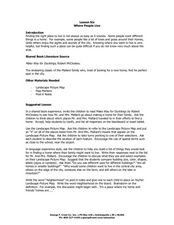
Lesson Six Where People Live
Students investigate where people live. In this early geography lesson, students read Make Way for Ducklings! by Robert McCloskey and then discuss what neighborhoods are as they identify them on landscape picture maps.
Curated OER
Ocean Currents
Students discover the geography of Earth by analyzing water currents. In this oceanography lesson, students create visual references on a map of the globe where and why major ocean currents are moving water. Students conduct a water...
Curated OER
Identifying Island Countries
Students discover the definition of an island and identify island countries around the world. For this geography lesson, students determine the characteristics of an island. Finally the students will identify specific island countries,...
Cassandra Reigel Whetstone
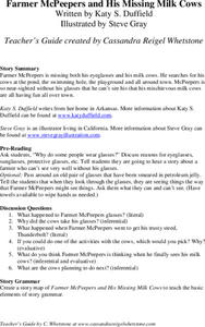
Farmer McPeepers and His Missing Milk Cows
Pair your reading of Farmer McPeepers and His Missing Milk Cows with the questions and activities provided here. Learners answer questions about the text, create story maps, put together brochures, relate math to the story, practice some...
PBS
Dear Pen Pal
Explore cultures from around the world with an engaging pen pal resource. Through a series of classroom activities and written correspondence, children learn about the favoritec pastimes, schooling, geography, and weather that is...
PBS
Arthur's World Neighborhood: Building Global and Cultural Awareness
Kids become global anthropologists as they explore commonalities and differences both in their classroom and expanding across the globe. Throughout several activities, learners conduct partner interviews that culminate in Venn diagrams,...
Curated OER
Symbols of Our State: Arkansas
Here are a series of lessons designed to assist early elementary learners to discover the symbols of Arkansas. They learn about the state flag, insect, state seal, state bird, flower, tree, and gem. A booklet (emedded in the plan), is...
Curated OER
Mapmaker, Make Me a Map!
Here is a well-designed, very thorough lesson plan on mapping for very young children. Within the six-page plan, you will find everything you need to implement the activity. They will identify various landforms found in Colorado on a...
Curated OER
An Audio Travel Album
Learners interview a person who recently visited a country they are interested in knowing more about. Using the Internet, they research the country noting the geography and economic situations of the country. In groups, they import the...
Curated OER
Flat Stanley
Students read Flat Stanley, and make a poster board Flat Stanley which they sent out to family members in different states. They create an adventure for their Flat Stanley based on his "travels" and map out his trip.
Curated OER
Everybody Cooks Rice
Pupils read the book, "Everybody Cooks Rice," and they participate in activities pertaining to the book. They identify countries mentioned in the text and locate them on a world map. They use an atlas to identify the climatic conditions...
Curated OER
Port Portrait
Students research and identify exciting places to visit and plan an imaginary cruise, using maps, to study other languages, climates and geography and draw scenes from your trip. They make a portrait of your group waiting to leave one...
Weston Wood
Joseph Had a Little Overcoat
Create a cross-curricular learning experience based on the children's book Joseph Had a Little Overcoat with this collection of learning activities. Starting with a class reading of the story, children go on to learn about the sequence...
K12 Reader
Write About a State
Kids select a state, describe its climate and geography, and include interesting facts about it. The template includes space for drawings and pictures.
University of Kansas
Newspaper in the Classroom
Newspapers aren't only for reading—they're for learning skills, too! A journalism unit provides three lessons each for primary, intermediate, and secondary grades. Lessons include objectives, materials, vocabulary, and procedure, and...
Curated OER
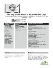
The Silly States: Where Is Your State and City?
First graders read The Scrambled States of America and discuss whether it is real or fantasy as compared to the United States. In this geography lesson, 1st graders identify their city or state on a map and work in groups to color the...
Curated OER
Making an Illustrated Dictionary with Geographic Terms
Learners construct a geography dictionary. In this geography lesson, students work in small groups to construct a dictionary of geographic terms. Learners use illustrations and descriptions to develop their geographic dictionaries.
Other popular searches
- Five Themes of Geography
- U.s. Geography
- China Geography
- Africa Geography
- Mexico Geography
- Canada Geography
- Asia Geography
- France Geography
- Japan Geography
- World Map
- Ireland Geography
- Geography Studies


