Curated OER
I Know Where You Are!
Students study what a GPS is and use it to challenge themselves and find positions on a map. In this investigative lesson students find various points on a map using a GPS system and answer questions on a worksheet.
Curated OER
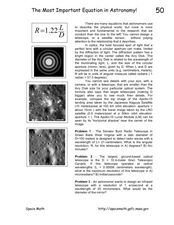
The Most Important Equation in Astronomy!
In this astronomy optics worksheet, students calculate the angular resolution and maximum resolution for given telescope specifics. This worksheet has 3 problems to solve.
Curated OER
Moon Walk
Students actively listen to a lecture lesson plan about the moon. In this moon lesson plan, students explore the moon's surface and human exploration of the moon. They also learn about the inventions created by engineers to help us learn...
Curated OER
Space Puzzle
In this space puzzle, students identify names of spacecraft, planets, and items placed in space. A list of 18 words are provided for students to identify.
Curated OER
Solar System 2
In this space worksheet, students identify and locate vocabulary terms and names related to the Solar System. There are 31 words located in the puzzle.
Curated OER
How Wet Did It Get?
Students measure the rainfall/snowfall on the playground on a rainy/snowy day with a rain/snow gauge. They draw a bar graph representing the amount of water that fell and observe a satellite image of the clouds and local weather system...
Curated OER
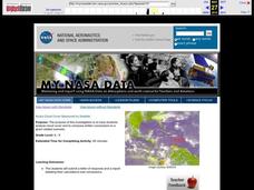
Aruba Cloud Cover Measured by Satellite
Students analyze cloud cover and to compose written conclusions to a given related scenario. They submit a letter of response and a report detailing their calculations and conclusions.
Curated OER
Trends of Snow Cover and Temperature in Alaska
Students compare NASA satellite data observations with student surface measurements of snow cover and temperature. They practice data collection, data correlations, and making scientific predictions.
Curated OER
A Look At Sunspots
Students research how the development of new technology has increased our knowledge of how the sun works. This lesson is part of a three-part series aimed at showing students how our knowledge of the universe must be inferred through the...
Curated OER
TE Lesson: Navigating at the Speed of Satellites
Students study the basic concepts of the Global Positioning System and how it increases the accuracy of navigation. They examine trilateration and how the speed of light is used to calculate distances.
Curated OER
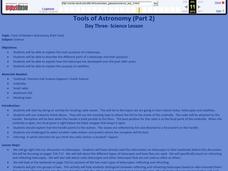
Tools of Modern Astronomy
Students differentiate refracting and reflecting telescopes. In this earth science lesson, students explain how they are closely connected to satellites. They complete the concept map at the end of the activity.
Curated OER
The Nature of Science and Technology
Students study the environmental concerns of orbital debris. In this orbital debris lesson students complete several activities.
Curated OER
Tracking the Weather
Students use satellite imagery and forecasting maps as a storm moves through the United States. In this weather lesson students track storm systems and chart the systems on a map.
Curated OER
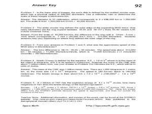
STEREO Watches the Sun Kick up a Storm!
For this solar storm worksheet, students use images of a solar tsunami to determine the size and speed of the wave. This worksheet has 5 problems to solve.
Curated OER
Exploration of the Moon
In this moon learning exercise, high schoolers review the Clementine exploration of the Earth's moon. This learning exercise has 8 matching and 14 true or false questions.
Curated OER
The Solar System
In this space worksheet, students identify and locate vocabulary terms related to the Solar System. There are 30 words located in the puzzle.
Curated OER
Satellite Mobiles
Students discuss satellites and their functions. They design and construct their own satellite out of readily available materials. Students are taught the definition of a satellite. They discuss the two main purposes of satellites:...
Curated OER
Satellite Eyes
Students explore the ways in which satellite images provide details of the Earth's surface and how they are capable of taking digital images of the Earth from space they vary in resolution and breadth. They view how cameras and lenses...
Curated OER
Satellite Maps
Students examine contemporary satellite and digital maps. They explore new mapping technologies have transformed the field of cartography. At the same time and analyze how mapmakers' 'interests' are still present in digital maps.
Curated OER
Growing Plants Using Space Technology
Students explain why delivering planet nutrients to crops at the correct time and amount is important. Students list possible negative effects of improper nutrient delivery. Students descrive two problems that farmers are now able to...
Curated OER
Annotating Change in Satellite Images
Students compare a series of satellite images taken 3-4 years apart to investigate the effects of human land use. They annotate the images using ImageJ software and use the annotated images to explain their findings.
Curated OER
Orbit an Artificial Satellite
Students construct an artificial satellite from random materials. They demonstrate the principle of an orbit. Students are divided into small groups. Each group creates a model of an artificial satellite in orbit.
Curated OER
Aruba Cloud Cover Measured by Satellite
Students analyze cloud cover over Aruba. They compose and submit written conclusions which include data, analysis, errors in data collection, and references.
Curated OER
Satellite Simulation
Students explore communication ovr long distances using satellites. The lesson uses a light beam to represent a radio signal being relayed from one place to another via a "mirror satellite."


