Curated OER
The Tone Map
Poems are meant to be heard. Hearing a poem being read enriches one’s understanding of the tone and mood of the piece. Introduce your class to the sounds of poetry with a packet that not only details how to use poetry recordings in the...
Curated OER
Cultural Maps
Fifth graders examine map elements. In small groups they create a map of an imaginary country that includes a title, legend, directional indicator, scale, boundaries, capital cities, country name, and icons of five natural resources. ...
It's About Time
Present-Day Climate in Your Community
So what exactly is climate? This first installment of a six-part series introduces the concept of climate using real-world data tables and topographic maps. The timely lesson includes a comprehensive overview of climate, as well as...
Curated OER
Plate Tectonics: Second Grade Lesson Plans and Activities
Second graders explore convection currents and how they relate to the movement of tectonic plates. Then, young geologists reconstruct Pangaea with a worksheet and pinpoint plate boundaries on a map...
National Geographic
Australia, Antarctica, and Oceana
Go on a traveling adventure throughout Australia, Oceana, and Antarctica! This textbook excerpt offers a full unit of study that can easily be supplemented by extra projects or research materials. Learners study maps, read about...
University of Colorado
Phases of Charon
Pluto, although no longer considered a planet, has five moons. Pluto's moon, Charon, is the focus of a resource that describes how the moon is viewed from the surface of Pluto. Photos help individuals see how Charon would look at...
Stanford University
Edward Curtis Photographs
A picture is worth a thousand words. The photos of Edward Curtis capture the life and culture of Native American Tribes during the early part of the twentieth century. A presentation first gives background information on Edward Curtis...
Mojang
Minecraft – Pocket Edition
You don't have to be a Minecraft wiz to know that this app has great playability for your learners! As afterschool programs and classroom projects around the world demonstrate, this game goes well beyond placing blocks and traditional...
Texas Heart Institute
Anatomy: How Does the Cardiovascular System Work?
How can the circulatory system compare to a city map? Pupils distinguish the "roadways" and "vehicles" of the cardiovascular system, compare the anatomy and function of veins and arteries, and review different types of blood cells with...
Macmillan Education
Understanding Your Skills and Talents
Skills, talents, and personal qualities are the focus of the fourth session in a 23-lesson series of life skills exercises. Participants build a mind map of all the skills and talents in the class, and then groups work together to...
Curated OER
Say Hello! Around the World
Hello! Bonjour! Paivaa! Ni hao! Teach learners of all ages how to say hello in several different languages. There are project ideas for younger learners and older learners. Kids love learning a different language, even if it's just this...
Curated OER
Malta: The Landscape
Students work in small groups to create a topographic map of Malta. They must include labeled line drawings of bordering countries and bodies of water. Students use salt and flour clay to make Malta three dimensional, showing the nearest...
Curated OER
Welina's World
Students living in Hawaii draw a picture of themselves in their neighborhood. They draw their neighborhood in relation to their district and then in relation to the island they are from. They compare their pictures to their classmates'...
Mathematics Assessment Project
Hopewell Geometry
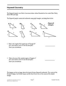
Right triangles from 2,000 years ago? Learners investigate different right triangles found in the earthworks of the Hopewell people, a Native American culture that populated the United States from 200BC to AD 500. Learners apply concepts...
Curated OER
Flat Earth Society
Students explore map distortion. In this geography instructional activity, students compare Mercator projection maps to globes in order to understand the strengths and weaknesses of projection maps.
Curated OER
Angles, Bearings and Maps
In this angles worksheet, 6th graders solve and complete 14 different problems. First, they determine the angle in which they turn through clockwise. Then, students look at the diagram on the information sheet and find the angle given...
Curated OER
Cities and Countries Around the World
Briefly introduce your young Spanish speakers to different cities around the world. Identify the country they are located in, what the people are called from those countries, and the country's location on a class map. Make sure to use...
Bowland
Outbreak: Infection Detection
Explore the mathematics of infection outbreaks with activities that ask learners to use coordinate grids to locate infected patients. They calculate amounts of ingredients for antidotes and determine which groups of people should be...
Environmental Education in Wisconsin
Biome Travel Guide
In a perfect marriage of social studies and science, groups work together to research and create a travel guide presentation to share with the class. Not only do kids learn about the climate and geography of a biome, but also the...
Curated OER
The Earth is an Orange
Students examine and identify the various types of maps. Using two types of maps, they compare the data that can be gathered from each one. They also identify and locate the continents and the oceans. They review the purposes of each...
Curated OER
Europe Before and after WWI
Eighth graders compare and contrast maps of Europe before and after World War I. In this World War I activity, 8th graders color and label maps of Europe prior to the war and after it. The historical maps can be accessed online.
Curated OER
Establishment of Plainfield
Eighth graders analyze documents and maps of Plainfield, CT from different time periods, then, working in a small group, create a map for a giventime. In this Plainfield lesson, 8th graders read primary and secondary sources...
Curated OER
Eastern Europe: Passport to Understanding
Seventh graders explore Eastern Europe. They analyze data on select countries. Students prepare a short oral presentation on the country they researched. They locate their country using an interactive map.
Curated OER
Race and Genetics: An Integrated Approach
Students analyze racial issues related to the Human Genome Project. They participate in a mock symposium and write a reflection/position paper based on specific ethical principals.


