Curated OER
3-D Model of Lake Benthos
Students create 3-D models of Lake Benthos. In this scale drawing lesson, students create a 3-D model of Lake Benthos. Students work in groups to create the models. Students use the models to to encourage people to conserve natural...
Curated OER
Working With Electronic Topography Maps
Junior geologists examine topographic maps online and learn how to read them. they answer seven associated follow-up questions. This lesson plan is only a general outline and does not provide the details or the websites that you would...
Curated OER
Electric Field Mapping in 3D
Students create a 3D vector field map of an electric field. For this physics lesson, students measure the voltage inside an aquarium with water. They present their findings and map to class..
Curated OER
Production of the Lunar Relief Map Project
Students replicate the lunar surface. In this mapping skills lesson, students study the topography of the moon. Students then use craft materials to create topographic maps of the lunar surface where the Eagle landed.
Curated OER
Exploring Maps: Lesson 2 Guide: Navigation
Students explore and examine how maps have been used in navigation. They research how travelers collected observations to keep track of their positions and plotted information on maps. Each student then makes a Mercator projection...
Curated OER
Book: Germany
Students, after reading Chapter One in the book, "Germany," analyze and recreate the political boundaries as well as the physical features of the nation of Germany with the assistance of play-doh or salt dough. In groups, they create...
Curated OER
Applications of the Pythagorean Theorem - Magnetism
Middle and high schoolers use the Pythagorean Theorem to complete a table showing with the magnetic field strengths in given cities. They find the average value of the Earth's magnetic field and plot one of the three-dimensional values...
Curated OER
Salad Tray 3D Topographic Model
High schoolers explore the characteristics of topographical maps. They examine the relationship of contour lines and vertical elevation. Students create a three-dimensional model of a landscape represented by a topographic contour map.
Curated OER
3-D Topographic Maps
Students create a 3-D topographic map. In this map building lesson, students use cardboard to create a topographic map of the Catskills mountain region.
NC Cooperative Extension, Guilford County Center
Life Cycle Of Painted Lady Butterflies
The Very Hungry Caterpillar is the inspiration for this project-based learning activity. Kindergartners create a lifecycle chart for a butterfly with four sections: egg, caterpillar, pupa, and butterfly. It is a three-dimensional...
Curated OER
Sky 3: Modeling Shadows
Learners will construct models to demonstrate their understanding of shadows. Many questions and suggestions for variants on the activities are presented to allow you to tailor this lesson to your particular needs. It is best to make the...
Curated OER
Combining Geography and Literature by Mapping a Story
Students listen to or read a story on their own. Using the text, they describe the relative locations of the main events. In groups, they develop two and three dimensional maps of the story. They create a key and a title for their map.
Curated OER
California Geography
Fourth graders explore geography of four distinct regions of California: mountains, coast, central valley, and desert. They locate California on map, identify state's boundaries and borders, and explore agriculture, a major economic...
Curated OER
"Potato Mountain": Reading/Understanding Topographic Maps
Students investigate how to read topographic maps. For this map reading lesson students complete a topographic map activity.
Curated OER
Creating a 3d Model and Corresponding Topographic Map
Students create a landform model and topographic map. In this topography lesson, students use a real landform to create a model and topographic map to scale.
Curated OER
Topographic Map Unit Plan
Students examine topographic maps and discover how to decipher contour intervals, use contour lines and apply information to complete a topographic map lab. Working in groups, they identify the scale of the map, latitude and longitude,...
Curated OER
Relief Maps
Learners study geographical maps and their functions. In this geography lesson students work in groups to build a map to scale.
NOAA
Watching in 3D
Bring the ocean floor to life! Earth science scholars discover the process of deep sea mapping in the third installment in a series of five lessons about ocean exploration. The teacher's guide includes helpful resources, worksheets, and...
PBS
Accessible Shapes
All the 2-D and 3-D measurement work you need is in one location. Divided into three sections, the geometry lesson plans consist of visualization of three dimensions, classifying geometric figures, and finding surface area and volume....
Annenberg Foundation
Geometry 3D Shapes: Surface Area and Volume
Whether you wrap it or fill it, you're using geometric concepts. Classmates use an interactive approach to learn how to find volume and surface area of cylinders and prisms in the second lesson in a five-part series. The online lesson...
Annenberg Foundation
Geometry 3D Shapes: Test Your Skills
Time to find out what they've learned! The final lesson of a five-part series has learners complete a 39-question multiple choice review. They use what they've learned in the previous lessons to complete questions that include concepts...
Ocean Explorer
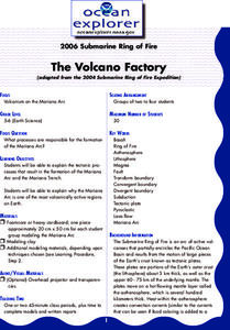
The Volcano Factory
The tectonic processes that have resulted in the formation of the Marianas Arc, and the Marianas Trench are explored. Groups of pupils access websites that give them a wealth of information about these formations. Each group must prepare...
Curated OER
Hungary: The Landscape
Learners work in small groups to create a topographic map of Hungary. The map will include labeled line drawing of the bordering countries. Hungary should be three dimensional, made of salt and flour clay. The mountains, plains and...
Curated OER
Italy: The Landscape
Students work in small groups to create a topographic map of Italy. They must include labeled line drawings of bordering countries and bodies of water. Students use salt and flour clay to make Italy three dimensional, showing the many...
Other popular searches
- Three Dimensional Story Maps
- Three Dimensional Map
- Three Dimensional Physical Map
- Three Dimensional Map


