Curated OER
Georgia State Map
In this geography of Georgia worksheet, students color the map and label major cities and physical features. Students also study a second map showing the location of the state of Georgia in the United States.
Curated OER
Florida State Map
For this geography of Florida worksheet, students color the map and label major cities and physical features. Students also study a second map showing the location of the state of Florida in the United States.
Curated OER
U.S. State Capitals Word Scramble Worksheet
In this states worksheet, students unscramble the names of states in the United States. Students unscramble the names for 15 states.
Curated OER
Discovering American Symbols
Help youngsters get to know their states and capitals, explore their own country, and study American symbolism. They take a "trip" across America collecting symbols, images, and information about each state as they go (through text and...
Curated OER
Library Guide to the States
Students use a library research activity to research the fifty United States. In this library research lesson, students complete a unit of lessons where they research and study the fifty states in the United States. Students research the...
Curated OER
States and Capitals, Mountains and Rivers
Students identify geographical locations in the midwestern United States. In this geography instructional activity, students identify 12 states and capitals and geographical features in the region by using U.S. maps. Students use blank...
Curated OER
United States of America: 1860
In this United States historical map worksheet, students examine the boundaries of the labeled states and territories of the nation in 1860.
Curated OER
United States of America: 1860
In this United States historical map worksheet, students examine the boundaries of the states and territories of the nation in 1860. This map is unlabeled.
Curated OER
USA Capitals
In this USA capitals worksheet, students are given the capitals to each of the United States, and they are to list the state and the abbreviations they belong to. Students match 50 capitals to all 50 states.
Curated OER
States and Capitals - Lesson 4 - U.S. Political Map
In this U.S. state capitals worksheet, students identify the capital cities of the 50 states using the latitude and longitude coordinates provided.
Curated OER
The States and Capitals- Part Two
Students complete a activity. In this states lesson, students write the name of each capital beside its respective state.
Curated OER
Basic U.S. Geography
Provide your 11th graders with a basic understanding of U.S. Geography. They label the state, regions, and boundaries found in the contiguous U.S. as well as Hawaii and Alaska. Then, they complete two Internet related activities.
Curated OER
Washington Challenge
In this state facts activity, learners read the statements about the state of Washington. Students find the correct answer for the 10 problems.
Curated OER
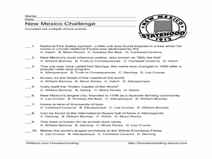
New Mexico Challenge
In this state facts activity, students read the clues associated with New Mexico. Students select the correct answer for the 10 statements.
Freecloud Design
Stack the States™
Kids have fun learning US geography and state facts, including capitals, nicknames, major cities, and landmarks. They can choose between the game, or informational flashcards for each state.
Curated OER
Our Fifty States
Seventh graders identify and locate all fifty states in the United States and their capitals. Individually, they research one state identifying when it became a state, its motto, song, flower and nicknames. To end the lesson, they are...
Curated OER
The 50 States
Fifth graders use maps and music to learn the 50 states. In this US Geography lesson plan, 5th graders map out a region of the United States and practice singing the song, The 50 States that Rhyme.
Curated OER
The Protestant Ethic and the Spirit of Capitalism
In this online interactive philosophy quiz worksheet, students respond to 20 multiple choice questions about Weber's The Protestant Ethic and the Spirit of Capitalism. Students may submit their answers to be scored.
Curated OER
51st State
Students, in small groups, design a new state and create a brochure to present to an agency representative outlining the given information in the lesson. Students use templates in the compute lab to write sentences they have created...
Curated OER
Regions of the US: Gulf Stream, States and Their Capitals
Fifth graders identify one way of dividing the US into geographical regions and then consider alternate ways of doing the same. They locate each of the fifty states and their capitals on a map. They research the Gulf Stream region.
Curated OER
US Policy In Somalia
Students investigate the US policy for the country of Somalia. They conduct research using a variety of resources. They locate the country and then discuss major geographical features of the areas. Students discuss the present US...
Curated OER
Egg Hunt: Review of States and Capitals
Fourth graders participate in an Easter egg hunt that gives them clues to states and their capitals. In this states and capitals lesson plan, 4th graders use clues to figure out the states described.
Curated OER
Naming the States of the U.S
Fifth graders study the 50 states on a map. In this social studies lesson, 5th graders identify the names of the states and location. Additionally, students work in small groups to name and locate as many states as they can on a blank map.
Curated OER
Learning the 50 States
Students become familiar with all 50 states over the course of ten days.


