Curated OER
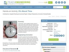
It's About Time
Students investigate how Global Positioning Systems work and how and why GPS receivers make errors. They graph data points and apply estimation and prediction to real-life GPS situations, discuss time delay, and complete a worksheet.
Curated OER
GPS Scavenger Hunt
Middle schoolers go on a GPS scavenger hunt. They use GPS receivers to find designated waypoints and report back on what they found. They compute distances between waypoints based on the latitude and longitude, and compare with the...
Curated OER
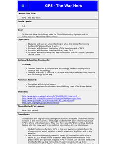
GPS - The War Hero
Students understand what the Global Positioning System (GPS) is and how it works. They discover the history of the development of GPS and how the military uses GPS. They realize why GPS was essential to the success of Operation Desert...
Curated OER
Names in the Field: A Simple GPS Field Exercise
Students explore basic methods of GPS data collection, uploading the data to a computer, and making simple maps of their data using GIS software. They create a map of the data using GIS software (or Excel)
Curated OER
Cultural Anthropology Study Using the Fundamentals of Geography and GPS
Students, in groups, operate the GPS unit, plotting each head stone with accompanying description. Two other students to log in data that corresponds to the given points. One student to note general observations
Curated OER
From Home to School, GPS Style
Students are introduced and increase proficiency in the use of the hand held GPS system. They explore the meaning of longitude and latitude lines, then identify the parts of the map.
Curated OER
GPS Receiver Basics
Students practice using a GPS receiver. They walk in different directions and monitor their progress on maps. They enter specific locations and use information given to them to get them back to their original locations.
Curated OER
GPS Treasure Hunt
Students practice using a GPS receiver and reading directions in an on-campus field trip. Students can identify a building stone, tree, or plant at each stop depending on which area of science is being studied.
It's About Time
Taking a Ride on a Lithospheric Plate
Assist your pupils and broaden their horizons with several activities that determine the exact positioning of various communities over the globe. Pupils use data from the Global Positioning System to determine the position and rate of...
Space Awareness
Let's Map the Earth
Before maps went mobile, people actually had to learn how to read maps. Pupils look at map elements in order to understand how to read them and locate specific locations. Finally, young cartographers discover how to make aerial maps.
Curated OER
Hide and Seek with Geocaching
Students locate objects using a Global Positioning System. In this global geography lesson plan, students explore latitude and longitude using a GPS in order to locate objects.
Curated OER
The Grand Excursion GPS Map
Eighth graders investigate the uses of a global positioning system. They create waypoints and have to find them using the system. Students must review the geographical concepts of latitude and longitude. The media requirements of the...
Curated OER
Where Am I?
Extensive background on marine navigation is provided for you as the teacher. Assign groups to research marine navigation techniques and construct astrolabes. Resource links are listed for extension ideas. If you are teaching an...
Curated OER
Where Am I - Navigation and Satellites
Students explore geography by completing a navigation activity in class. In this satellite positioning lesson, students define terms such as orbit, satellite, GPS and triangulation. Students view diagrams of the Earth's orbit and...
Science 4 Inquiry
Edible Plate Tectonics
Many people think they can't observe plate tectonics, but thanks to GPS, we know that Australia moves at a rate of 2.7 inches per year, North America at 1 inches per year, and the Pacific plate at more than 3 inches per year! Scholars...
Curated OER
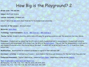
How Big Is The Playground?
Students calculate the standard and metric measurements of a playground. In this measurement instructional activity, students use GPS coordinates and graphing calculators to determine the dimensions of an area outside of the school in...
Curated OER
Space Age Technology Comes to Earth
Both GPS and GIS are now used regularly in agricultural careers. Explore the new technologies that require higher education for those interested in agri-science careers. Upper graders examine how agriculturalists use new technologies by...
Curated OER
Mapping My Community
Ninth graders are introduced to GPS technology. They complete fieldwork as they visit a specific area of their community to identify and map types of land use in the surveyed area. They use the collected data to create a digital map.
Curated OER
Can You Find Me Now?
Students locate points using longitude and latitude coordinates. They locate their home using longitude and latitude, explore the uses of GPS, and accurately use a GPS.
Curated OER
Your Expedition of Discovery
Students study GPS and see how it is used to determine points on the Earths surface. For this expedition lesson students use GPS to find given coordinates.
Curated OER
"Where in the World is my School?"
Learners learn new vocabulary and discuss what GPS is and does. They locate their school using the equipment.
Curated OER
Drift Study
Students observe, work with charts, and work with GPS in order to determine the path lobster larvae travel based on local currents. In this currents lesson plan, students work with local fishermen to observe the natural currents.
Curated OER
Science Inquiry Lesson: Mapping Project
Young scholars explore the methods of creating maps. They create a map of Animas River Park using a compass and measuring tape, develop a single map from the team map sections, and devise another map of the Animas River Park using a GPS...
Curated OER
I Know Where You Are!
Students study what a GPS is and use it to challenge themselves and find positions on a map. For this investigative lesson students find various points on a map using a GPS system and answer questions on a worksheet.
Other popular searches
- Gps Navigation
- Gps Technology
- Using Gps
- Latitude and Gps
- Gps Device
- Gps Lesson Plans
- Gps Rubrics
- Gps Record
- Gis and Gps Technology
- Gis Gps
- Gps Maths
- Gps + Maths


