Curated OER
A VIEW FROM THE TOP
Students explore the idea of aerial photography through the story of Amelia the Pigeon. They view an actual aerial photograph of their school or home, and then write a story describing what Amelia would see if she flew over their school...
K20 LEARN
Water We Going To Do? Floodplains And Watershed Management
How has human activity affected Earth's watersheds? An action-packed lesson plan, part of the K20 Center, examines water's ability to go with the flow regardless of what is in its path. Scholars build model watersheds, examine time-lapse...
Curated OER
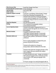
Land Use Change Over Time
Middle schoolers use historical aerial photographs and current aerial photographs to compare the change over time to the land. For this land changing lesson plan, students analyze, compare, contrast, and list the land change in their own...
Curated OER
Plate Tectonics Day 3 Sea Floor Spreading: Evidence for Continental Drift
Students are introduced to Sea Floor Spreading and how it provides evidence for Hess's and Deitz's theory of Continental Drift. They use paleomagnetic data to calculate the rate of Sea Floor Spreading.
Curated OER
What Can a Map Tell You?
Students investigate how maps can provide useful information about health issues. They study a map to draw conclusions about cholera death in London.
Curated OER
A world of oil
Students practice in analyzing spatial data in maps and graphic presentations while studying the distribution of fossil fuel resources. They study, analyze, and map the distribution of fossil fuels on blank maps. Students discuss gas...
Curated OER
Remote Sensing
Students research the Earth's ocean systems. They examine the impact of global warming on the oceans and the world as a whole.
Curated OER
Environmental Impact
Students analyze a 20th century photograph of a Los Angeles landscape and examine the population expansion of L.A. They discuss the principles of design, complete a worksheet, and write a research paper on overpopulation in Los Angeles.
Curated OER
Principles of Flight: Where are We?
Students explore the concept of topographical maps. In this topographical map lesson, students discuss how airplanes know where to fly. Students use topographical maps to simulate a field trip on the computer.
Other popular searches
- Barbados Aerial Photography
- Aerial Photography Video
- Aerial Photography Worksheet
- Lessons, Aerial Photography
- Lessons Aerial Photography


