Curated OER
Avalanche And Landslide Hazards in Canada
Learners explore where the natural disasters, avalanche and landslides, are most frequent in Canada and investigate their associated causes and effects. They navigate the Atlas of Canada Web site for natural hazards.
Curated OER
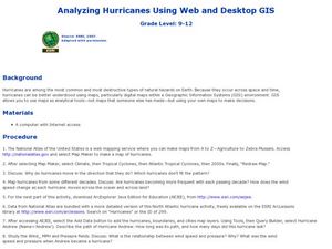
Analyzing Hurricanes Using Web and Desktop GIS
Students analyze hurricanes. In hurricanes activity, students use the Internet and GIS to analyze hurricanes. Students view the National Atlas of Maps to discuss the direction hurricanes move. Students study the wind and pressure fields...
Curated OER
Geography Worksheet
For this geography skills worksheet, students respond to 14 short answer questions by using maps and atlases. The maps and atlases are not included.
Curated OER
Putting It on the Map
Students consider the purpose of various types of maps and their different uses throughout history. They create their own maps and reflect on the map-making process.
Curated OER
Project Map: Latitude And Longitude Worksheet
In this latitude and longitude learning exercise, students find the coordinates of 14 cities around the world and use this information to complete 14 short answer questions. This learning exercise includes online atlas web links.
Curated OER
Map Keys
In this geography worksheet, students identify who a cartographer is and what they do specifically. They study an outline map of a fictitious island and then, respond to the three questions that follow. Finally, students add three more...
Curated OER
Relief Maps
Learners study geographical maps and their functions. In this geography lesson students work in groups to build a map to scale.
Curated OER
Will There Be a White Christmas This Year?
Learners examine historical weather data, and create map and color key that illustrates the likelihood of a white Christmas in different locations across the United States.
Curated OER
Solving the Puzzle
Young scholars create a map showing the United States borders at a specific period in history and produce three questions to be answered by examining the map. They also write a productive paragraph explaining who, what, when, where,...
Curated OER
Storm Clouds-- Fly over a Late Winter Storm onboard a NASA Earth Observing Satellite
Students study cloud data and weather maps to explore cloud activity. In this cloud data lesson students locate latitude and longitude coordinates and determine cloud cover percentages.
Curated OER
Draw an Inch, Walk a Mile
Learners work in small groups to solve the problems presented. The main project, mapping the classroom, use these discussions to collaborate in creating a tangible demonstration of their understanding.
Curated OER
Breeding Bird Atlas Activity
In this breeding birds worksheet, students read a passage about birds and the Breeding Birds Atlas, then answer a set of comprehension questions based on graphs, maps and pictures given. Questions have multiple components.
Curated OER
Mapping the Most Common U.S. City Names
Students discuss the most common U.S. place names. They map the locations of U.S. cities with the most common names and use an atlas, or an online map tool such as MapQuest or Yahoo Maps.
Curated OER
Map of the Ottawa Valley
Students locate Ottawa Valley on a map. They then answer questions in reference to the map such as: What was the first use of timber in the Ottawa Valley?, What occurred first in Gatineau?, and On the Ontario side of Ottawa River, how...
Curated OER
Welcome to My World!
Young scholars use maps to locate information. They read the story, "It Looked Like Spilt Milk", view images of the continents and discuss the various continents. Afterward, they make their own Atlas to record information that they can...
Curated OER
Mesopotamia
Middle schoolers map Mesopotamia. For this Geography lesson, students are introduced to Ancient Mesopotamia. Middle schoolers use an atlas to label the defining features and areas of Mesopotamia on a map.
Curated OER
Where in the World is Mr. Fultz?
Students use maps and other geographic resources to learn about their world while problem solving. They read clues each day and use classroom resources to narrow down where the prize is located.
Curated OER
Identifying Biomes
For this biomes worksheet, students will use an atlas to find the location of 12 cities listed on a graph onto their world map. Then students will use the cities' annual precipitation to figure out what biomes that city is found.
Curated OER
Crossing Time Zones
Young scholars explore the concept of differing time zones. Students refer to maps to identify the time zones in particular regions. They role play phone calls from different time zones. This lesson is intended for young scholars...
Curated OER
Surveying the Land
Students explore the different kinds of maps and the purpose of each. In this Geography lesson, students work in small groups to create a map which includes the use of a map key.
Curated OER
The Oregon Trail
Students use maps and diagrams to examine the Oregon Trail. In groups, they create their own poster of the trail showing the different types of artifacts found along the way. To end the lesson, they identify the sources of water and...
Curated OER
Getting to Know France
For this map skills worksheet, students answer 14 questions about the geography of France. Students then draw a rough map of France. It is assumed that access to an atlas is available.
Curated OER
Johnny Appleseed Walkabout
Second graders calculate mileage for a journey. For this place value and measurement lesson, 2nd graders read Johnny Appleseed, work in groups to locate his birthplace on a map, locate the other states he stopped in, and measure the...
Curated OER
Global Conflict: Kashmir
Students analyze different maps of the region. They create a timeline of the area in dispute, focusing on the creation of Pakistan, Indi and Kashmir and previous conflicts between Pakistan and India over Kashmir. Students construct a...
Other popular searches
- Maps, Globes and Atlases
- Atlases Maps Globes
- Maps Globes and Atlases
- Geography Maps and Atlases
- Maps\, Globes and Atlases


