Teach Engineering
What is GIS?
Is GIS the real manifestation of Harry Potter's Marauders Map? Introduce your class to the history of geographic information systems (GIS), the technology that allows for easy use of spatial information, with a resource that teaches...
Hastings Prince Edward Public Health
What is Health?
Many indicators of health are beyond a teenager's control, but there are many changes they can make in their daily life that can improve their health. Middle schoolers think about their physical, social, and mental health status before...
Teaching Adapted PE
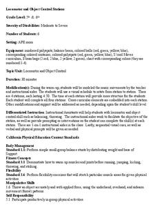
Locomotor and Object Control Stations
Develop children's basic locomotor and object control skills with an invigorating Adaptive PE lesson. A series of four, timed stations engaged the class in playing a game of Twister, walking on a balance beam, throwing bean bags, and...
Curated OER
Map Your House
Students are introduced to the concepts of maps as scale models of the whole. After a brief lecture on creating and using an accurate scale when drawing and reading a map. They create a scale drawing of the floorplan of their homes.
Curated OER
A Map Mystery
First graders solve a mystery by following map clues. In this map clues lesson plan, 1st graders follow a computer program called Neighborhood Map Machine. In this program, it gives students directional and spatial clues in order to...
Curated OER
Ticky Goes to Jr. Map School
First graders sing "We All Live Together," by Greg and Steve. They look at a map and sing the "Soggy Waffle Song" to study about the compass rose. Students write N, E, S, W on the borders of paper that goes under a 100's chart. The...
Curated OER
The Interconnectedness of Ancient Peoples Map Study
Seventh graders begin this lesson by viewing various maps of the Ancient World. As a class, they take notes on the changes of different areas in Europe and Asia as their teacher lectures to them. They answer questions about the...
Curated OER
Mapping Comprehension
Students explore story structure. They discuss questions they can ask themselves while silently reading. Students implement their story knowledge by making story maps. They read The Little Pink Rose and the Cloud and create a story map...
Curated OER
Me on the Map: Homes, Neighborhoods, and Communities
Students read a book about maps and identify the differences between a picture and a map. In this maps lesson plan, students also label maps of their home, neighborhood, and community.
Curated OER
Exploring an Atlas
Students explore global geography by participating in an atlas activity. In this countries of the world lesson plan, students collaborate in small groups and analyze an atlas while researching continents, countries and demographics....
Curated OER
An Introduction to the Night Sky and Movement Astronomy
Basically, this is an interactive exploration of educational astronomy software and an app. Young astronomers discover how the apparent motion of the sky relates to Earth's movements and the position of the observer. It is out of this...
Curated OER
Me On the Map
Second graders listen to Joan Sweeney's book, Me On the Map. They design a map of their bedroom and their house emphasizing the important characteristics.
Curated OER
Cardinal Directions
Students draw items on a map in specific places to show their knowledge of cardinal directions. In this simple map skills lesson plan, students draw a cloud, a tree, a house, and a lake to show North, South, East, and West.
Curated OER
Geography: Continents
First graders identify basic geographical facts about the world they live in and distinguish between land and water on a globe. They research the continents and information associated with each one focusing on building their map skills.
Curated OER
Ticky Goes to Jr. Map School
Second graders explore the compass rose and North - East - South - West.
Curated OER
Story Mapping A Favorite Book
First graders create a diagram of a story by using the computer program Kidspiration. In this diagramming lesson plan, 1st graders will pick a book to write about. They then will plug in story elements of the book into the computer...
Curated OER
Locomotor Treasure Hunt
Students practice in refining their locomotor skills and developing their understanding of pathways and basic map reading skills.
Curated OER
Mapping Your Way Around
First graders identify a map, symbols on a map, and locate places on a map. Finally, they construct a map
Curated OER
Mapping the Human Genome
Students study DNA and how it was discovered. In this biology lesson students see the effects of mapping the human genome would have.
National Endowment for the Humanities
How "Grand" and "Allied" Was the Grand Alliance?
Learn more about the Grand Alliance with a scaffolded lesson plan that includes four activities. Class members use primary sources to complete a map exercise, understand the goals and objectives of each individual nation, and participate...
Curated OER
Adventures With Maps And Globes
First graders examine the differences between a map and a globe. They discuss and identify the symbols on maps and globes, then in small groups complete a worksheet. Students then complete a Venn Diagram comparing maps and globes.
Curated OER
Mapping an Empire
How did the expansion of the Roman Empire during the first century contribute to its downfall? Using a map of the Roman Empire in 44 BC and one of the Roman Empire in 116 AD as references, class member use critical reading skills to...
Curated OER
Finding Their New World
First graders place stickers on maps indicating their understanding of the cardinal directions. They locate Jamestown, England, the Atlantic, and Virginia.
Curated OER
Where in The World Am I?
Young scholars explore the concept of absolution location. In this geography skills lesson, students discuss how to identify and locate latitude and longitude. Young scholars play a game to reinforce the skills.
Other popular searches
- Basic Map Skills Worksheets
- Basic Map Skills Boston
- Basic Map Skills Vosstown
- Hiking Basic Map Skills


