Curated OER
River Run Through It
With vocabulary lists, worksheets, and more, this lesson sets learners on an exploration of the Hudson River area. They read an essay about the area, analyze a relief map of New York State, and complete a worksheet.
Curated OER
Rivers Run Through It
Using a relief map of New York State, learners answer questions about the distance between different cities, identify bodies of water, and more. First, they discuss vocabulary related to the Hudson River area. Then, they complete a...
Curated OER
Mapping Perceptions of China
Students discuss what types of things are included on a map. They compare and contrast maps of China with a map they create and practice using different types of maps. They write analysis of their classmates maps.
Curated OER
Mapping Mistakes
Students examine early European maps and explore geographic errors. They also view maps of the geography of North America. Students discuss the obstacles faced by early explorers in mapping unexplored territory. They consider what the...
Curated OER
Pirate Map
Students write directions explaining how to get from one location to another by using a map of their town and use simple maps to identify and locate places.
Curated OER
A Map Mystery
Second graders solve a map mystery. In this technology lesson plan, 2nd graders develop an awareness of maps and the symbols associated with maps as they the "Neighborhood Map Machine."
Curated OER
Fairy Tale Maps
Students study direction as they listen to the stories of Little Red Riding Hood and The Jolly Postman. For this cardinal direction lesson, learners create a map to show the path Little Red Riding Hood took in the story and label the...
Curated OER
Map Scale
Third and fourth graders are introduced to the concept of map scale. Using an illustration, they discuss if it shows the actual size of the object and why scale is used to represent areas. They use some items in the illustration to...
Curated OER
E-mailing the Chamber of Commerce
Encourage effective internet research and e-mail correspondence as scholars investigate a US capital city they've never visited to find pertinent and relevant information. They begin by picking a city, then visit that city's chamber of...
Curated OER
Grid Frame Mapping
Students map and describe small area of the schoolyard and discuss habitats.
Curated OER
What Do Maps Show?: Lesson 4 How to Read a Topographic Map
Students examine the use of topographic maps as two dimensional representations that show elevations and slopes with contour lines. They read maps of the Salt Lake City, Utah area and complete the associated worksheets that show map...
Curated OER
Lesson Design Archaeology- USGS Maps
Students research USGS maps and identify the major features. In this map skills lesson, students identify low and high elevations on a USGS map and practice finding latitude and longitude.
Curated OER
What Do Maps Show?
Students discover the uses for various types of maps. In this geography skills activity, students discuss the type of maps that exist and what their individual features are. Students then practice using different types of maps.
Curated OER
Traveling/Mapping
Students examine routes to gold. In this California gold rush lesson, students map land and water routes to California. Students use maps to copy the routes that they want to market to gold diggers.
Curated OER
A View from the Ground
Students look at a park from ground perspective. In this map skills lesson plan, students are introduced to a story about a girl at a park and make observations about the park based on a picture. This prepares students for the next...
Rainforest Alliance
Knowing the Essential Elements of a Habitat
To gain insight into the many different types of habitats, individuals must first get to know their own. Here, scholars explore their school environment, draw a map, compare and contrast their surroundings to larger ones. They then write...
National Endowment for the Humanities
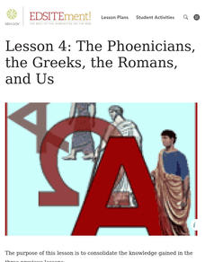
Lesson 4: The Phoenicians, the Greeks, the Romans, and Us
Learners review knowledge gained in the three-part unit on the history of the alphabet. Using maps and images, learners consolidate their understanding of ancient Greece, the Romans and the Phoenicians, and their respective impacts on...
Curated OER
Plotting a Hurricane Using Latitude and Longitude
Learners define and use "absolute location," latitude, and longitude. They locate on a map or globe the Earth's poles, circles, tropics, and beginning points of measurements for latitude and longitude.
Curated OER
Country Capitals
Students locate country capitals on a world map. For this map skills lesson, students review the definition of the word country and discuss what a capital is. Students locate and label capital cities on a world map using a map marker.
Curated OER
Map It!
Fourth graders demonstrate map making skills by using the computer to create maps of the geographic features, regions, and economy for their state.
Curated OER
Map Exploration
Are you looking for a terrific lesson on map activities for your second graders? Then, this resource is for you! The activities range from decoding, to fill-in-the-blank, to read-and-search. There is a website activity related to maps...
Curated OER
Second Graders on the Map
Second graders explore the various types of maps. They examine the differences between street maps and aerial photographs. Students identify various features on each map. They use cardinal directions and the compass rose. They write...
Curated OER
United States Map - Lesson 9
Students explore the concept of cardinal directions. For this geography lesson, students identify the compass rose on a large U. S. map and then discuss the cardinal directions.
Curated OER
Orienteering - Lesson 8 - Map and Compass
Put your students' orienteering skills together. Reading a compass and reading a map. In this assignment the class will use their compass and the map scale to determine the distance of a given route. If they finish their assignment,...
Other popular searches
- Beginning Map Skills Canada
- Beginning Map Skills Uk
- Geography Beginning Map Skills
- Beginning Map Skills Unit


