Curated OER
The History of the Pencil
Students research and write about the pencil. They organize the research using concept maps and write an essay using the writing process.
Curated OER
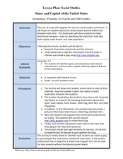
States and Capitals of the United States
Students label states and capitals on a United States map and complete research on one of the states. In this states lesson plan, students fill in the states on blank maps.
Curated OER
Hemispheres & Continents
Students learn in cooperative learning groups to determine how the equator and the Prime Meridian divide the earth into hemispheres and use Venn diagrams. Students will locate and label the hemispheres, continents, and oceans.
Curated OER
Move Around the Map
Fourth graders, while working with a partner, label and identify on a tarp map six major cities and five major rivers in Indiana. They traverse along the rivers utilizing a different locomotor skill (hop, skip, walk, run, leap, gallop,...
Curated OER
Media Center Map Skills
Student demonstrates the ability to locate, retrieve, and handle media and equipment by utilizing the library media center floor plan, symbols, and guides. They then use systems of classification to identify, locate, and retrieve materials.
Curated OER
Roman Empire: Physical Framework - Location, Borders, Dimensions
Students relate the classical world to the modern world. In this map skills lesson, students turn a blank map into a colorful complete map by following step-by-step directions. This lesson allows students to connect our current geography...
Curated OER
China - the Geography of European Imperialism - Spheres of Influence in China
Ninth graders create a map of China. They identify the various spheres of influence carved out by the Imperialist powers of Europe as well as locating geographical features of china and major cities. They explain the global impact of...
Curated OER
Using Venn Diagrams to Compare Two Ecosystems
Students explore the distribution of two ecosystems on a global scale; and map the distribution of tropical and temperate rain forests throughout the world. They use a Venn Diagram to describe these ecosystems and the differences between...
Curated OER
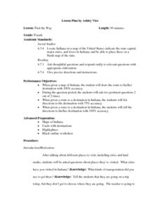
Find the Way
Fourth graders, after discussing different places to visit and being given a map of Indiana, draw the route to his/her destination within Indiana. They tell the directions in their own words and formulate pertinent questions to ask along...
Curated OER
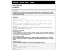
Filling Up Florida
Students study factors controlling Florida's population growth and related environmental impacts. They research natural community types and construct maps (including a large-sized map of Florida) to be used for a simulation activity.
Curated OER
Dead Sea Investigation: Middle East and African Connections
Students demonstrate comprehension of the physical characteristics of the Dead Sea region and its connection to the Red Sea and the African Great Rift Valley. They are given students the opportunity to understand the role of plate...
Curated OER
The Countries of Slave Trade
Young scholars create graphs, routes, and write an essay based on their research of the slave trade. In this slave trade lesson plan, students research the Middle Passage and how slave trade happened in the United States.
Curated OER
This Land is Your Land? This Land is My Land!
Students research the various territory acquisitions in United States history and create an annotated map that tells the history of U.S. expansion. Working in small groups, students outline the land acquisitions and purchases made by...
Curated OER
Canada...a Visual Journey
Students, in groups, research Canada's six natural regions (ecozones). They create a visual representation of each region on a large wall map of Canada and present it to the rest of the class.
Curated OER
Canada...A Visual Journey
Students work together to analyze the six natural regions of Canada. Using this information, they create a visual representation of each region on a large wall map and present it to the class. They must identify five key points of each...
Curated OER
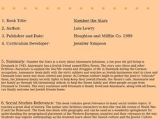
Number the Stars
Students read Number the Stars. In this social studies lesson, students read the story and use a map of western Europe and identify the countries involved in the war. Students locate the cities of Denmark that are discussed in the story.
Curated OER
Buddhism
In this Buddhism worksheet, students respond to 5 fill in the blank, 7 outlining, 10 short answer, 2 mapping, 5 multiple choice, 10 true or false, and 13 matching questions regarding the history of Buddhism and Buddhist beliefs.
Curated OER
World Religions
Seventh graders identify major tenets and the distributions of world religions. In this world religions lesson, 7th graders work with a group to research a religion using the given website. Students complete a graphic organizer for the...
Curated OER
Defining Ethnic Minorities in China
Ninth graders, in groups, research some of China's 56 identified ethnic groups. They prepare maps and posters to display their research.
Curated OER
Global Intelligence
Students discuss the war in Afghanistan and the conditions surrounding the hunt for Osama bin Laden after reading the article "Bin Laden and Omar: Far Harder to Find" from The New York Times. After the class discussion, students...
Curated OER
One Country's Slave Trade
Students examine the slave trade. In this research skills lesson, students research the slave trade in a selected country. Students use databases to locate pertinent information in order to prepare an oral presentation.
Curated OER
Floods
Students explore Earth science by answering study questions on-line. In this natural disasters lesson, students research Australia flood statistics over the past 40 years and identify patterns. Students utilize the web to view...
Curated OER
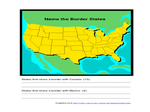
Identifying Border States of the U.S.
In this identifying border states of the U.S. instructional activity, 3rd graders visually identify then write the names of the states that border Canada and Mexico; page 1 is a lesson, page 2 is the instructional activity.
Curated OER
What's Goin' Down?
Students explore the concept of environmental stewardship. In this service learning lesson, students investigate the locations of the world's rain forests and concerns regarding the world's rain forests.
Other popular searches
- Blank Outline Maps Americas
- Blank Outline Maps China
- Blank Outline Maps Europe
- Ohio Blank Outline Maps


