Curated OER
What They Left Behind: Early Multi-National Influences in the United States
Students research the impact of European voyages of discovery and colonial influence on different aspects of American culture. They access a number of online sources and reference maps to trace the influences of England, France, Holland,...
Curated OER
How Big is Big?
Geography learners compare and contrast population densities throughout the world. Using maps, they estimate the relative size of the world's regions and populations. They develop analogies to discover the world they live in and...
Curated OER
Making A New Nation
Eighth graders read standard road maps and topographical maps, and examine the lives of pathfinders who opened the trails to the West. They develop Living History presentations, role-playing a character from the past.
Curated OER
The New Californians
Students identify the groups of immigrants who came to California. They trace the route they possibly took to American on a world map. They discuss the reasons why they left their homeland and what challenges they faced once they arrived.
Curated OER
"Go West, Young Man!"
Students examine reasons why people migrated west. They describe how the geography of the U.S. changed in the 19 th century and design a PowerPoint presentation to convey factors for westward expansion.
Curated OER
ESRI Live Earthquake Site
Students examine a World map and find earthquakes near plate boundaries. They locate and describe earthquakes in the United States and California.
Curated OER
On the Road Again
Young scholars trace the migration route of a gray whale. They color and label a map of North America, and using photocopy pictures of a gray whale, they move the whale along the migration route over a ten week period.
Curated OER
States in the USA Quiz
In this online interactive geography quiz learning exercise, students respond to 50 identification questions about the states in the United States of America. Students have 4 minutes to complete the quiz.
Curated OER
Off to the Future
Students read a handout and predict the position of the San Andreas Fault far in the future. In this future world activity, students use a map worksheet to demonstrate the path of the Pacific Plate millions of years from now.
Channel Islands Film
Arlington Springs Man: Lesson Plan 4
West of the West's documentary Arlington Springs Man introduces viewers to the remarkable finds on Santa Rosa Island. Archaeologist have discovered on this small island that is part of the Channel island chain, human and pygmy mammoth...
Curated OER
Where are the Watersheds in San Francisco?
Students create a mental map of San Francisco. They compare it with actual topographical maps of the city. Then they label various locations on the San Francisco Hillshade map and locate watershed boundaries.
Curated OER
San Francisco Bay Watershed
Young scholars locate important landmarks on a map and explore the watersheds in California. In this watershed lesson students complete a worksheet and discuss what they learned.
Curated OER
Watersheds: The San Francisco Bay Watershed
Sixth graders make a model of a watershed. In this geography lesson, 6th graders view a shaded relief map of California and locate landmarks. Students examine the San Francisco Bay Watershed by following the journey of water through the...
Curated OER
Earthquakes And Fault Lines
Students discuss major causes of earthquakes and identify famous fault lines, access and map information about ten largest earthquakes in world from 1989 to 1998, and theorize about location of these earthquakes as they relate to Earth's...
Curated OER
Tectonic Plates, Earthquakes, and Volcanoes
Challenge geography classes to locate the major volcanoes and earthquake faults on a world map. In groups, they identify the pattern made and examine the relationship between the locations of the faults and volcanoes and tectonic plates....
Curated OER
Where Does It Come from?
Students read articles about various agricultural products and create a map using the statistics in the article. In this agricultural statistics lesson, students look at the geography of the country and which products come from the...
Curated OER
Mapwork: A Place In the News
Students determine how to find geographic information about places they read about in the news. For this geography lesson, students look at political and physical maps to determine the difference. They access maps online to find the...
Curated OER
Medieval African Kingdoms
Seventh graders examine the geography and political history of West Africa. They role-play as applicants to a company that transports customers to any historic time period. Working in teams, they create promotional products encouraging...
Curated OER
More Than One Grain of Rice
Students explore mathematics, geography and agriculture by studying world rice production. In this production of rice lesson, students read One Grain of Rice and use a worksheet grid to calculate how much rice was received. Students...
Curated OER
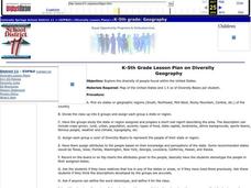
Diversity
Students work in groups to research and prepare an oral report about a region. In this regions lesson, students find out about the geography, population, state capitals, and landmarks. Students assign attributes to the people based on...
Curated OER
Rice Farming in Texas
Third graders explore how rice farming came to Texas. In this rice farming lesson, 3rd graders discover the history of how farmers began to grow rice in the United States. Students color code maps and create a timeline for rice farming...
Curated OER
Gray Whales on the Move
Young scholars study whale migration and their natural history. In this migration lesson students plot whale migration on a map and describe their ecosystems.
Curated OER
Zoo Welcomes Baby Animals
Students engage in activities to gain a better understanding of endangered animals. In these animal lessons, students use vocabulary and comprehension skills to gain a better understanding of endangered animals. They also watch video...
Curated OER
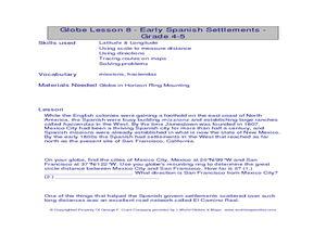
Globe Lesson- Early Spanish Settlements
Students use a globe. In this geography and early settlements lesson, students learn about the settlement of missions and haciendas in New Mexico. Students locate Mexico City and San Francisco on the globe and determine the distance...


