Curated OER
United States Map - Lesson 7: Four Main Directions
Students locate the North and South Poles, and learn the definitions of the four directions by using a United States Map and a globe. In this directions lesson plan, students define north, south, east, and west on a map and a globe.
Curated OER
Compass Rose: Dance and Quilt
Fourth graders identify the cardinal directions by listening to a song entitled, "Stand," and by reviewing the lyrics to that song. They notice the cardinal directions that are posted around the classroom. They perform the motions as...
Curated OER
I Can Compass, Can You?
Learners discover how to use geographic tools. In this compass lesson, students identify cardinal directions by appropriately using compasses along with a number of various maps.
Curated OER
OPEC and the Energy Crisis
Students color the Middle East Nations of OPEC on outline maps. They discuss and watch a video about the United States reliance on oil producing nations of the Middle East. They participate in a discussion of the problems of the gas...
Curated OER
The Sands of Arabia
Sixth graders apply geographic information to the study of World History. For this Geography lesson, 6th graders create a political/physical map of the Middle East, develop questions and answers about the culture of the Middle East, and...
Curated OER
Finding Their New World
First graders place stickers on maps indicating their understanding of the cardinal directions. They locate Jamestown, England, the Atlantic, and Virginia.
Curated OER
Second Graders on the Map
Second graders explore the various types of maps. They examine the differences between street maps and aerial photographs. Students identify various features on each map. They use cardinal directions and the compass rose. They write...
Curated OER
Silk Roads Big Map
Students create an oversized map from Europe to East Asia. They include information such as Silk Roads, geographical features, major cities and cultural information on their map.
Curated OER
World Map and Globe - Four Main Directions
Young scholars study the four main directions on a map. In this map lesson, students locate the North and South pole, and learn the four cardinal directions. They use the compass rose on a map to help with the directions. (Map is not...
Curated OER
Four Main Directions
Students describe directions using a globe for north, east, south and west. In this mapping lesson students identify the north and south pole. Students understand the importance of the equator and the Prime Meridian. Students explain how...
Curated OER
Building A Model of the East Pacific Rise
Young scholars describe the physical attributes of the East Pacific Rise. After locating the region on a map, students work in groups do define each layer of the structure in order to begin their build. Young scholars build their model...
West Virginia Department of Education
A State of Convenience: The Creation of West Virginia
Ever wondered why there is a West Virginia but not an East Virginia? The resource answers questions like this one and more as it takes an in-depth and detailed look at the history of West Virginia and how it became a state. Several...
Calvin Crest Outdoor School
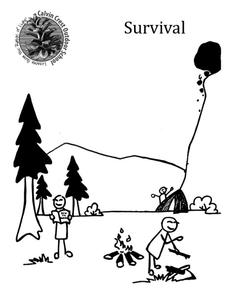
Survival
Equip young campers with important survival knowledge with a set of engaging lessons. Teammates work together to complete three outdoor activities, which include building a shelter, starting a campfire, and finding directions in the...
Teach Engineering
Solar Angles and Tracking Systems
The sun will continue to rise in the east and set in the west, no matter what. The first lesson in a series of eight introduces the class to solar angles. It makes connections between a person's latitude and the angle of position of the...
Curated OER
Using 4 main directions in a classroom
Pupils use the four directions of a compass rose to locate classroom features. In this directions lesson plan, students locate the features by identifying directions.
Curated OER
Using the Four Main Directions in the Classroom
Students use the four main directions to locate features in the classroom. In this direction lesson, students review the 4 main directions using a world map. Students use a magnetic compass to locate the north wall in their classroom and...
Curated OER
East Asia--The Asian Holocaust
Ninth graders study the effects of the Asian Holocaust by comparing it to the Nazi Holocaust. They view a Power Point and discuss the comparisons between both Holocausts. As they compare and contrast both, they discuss their reactions...
Curated OER
Directionality
Second graders discuss the cardinal directions and intermediate directions and then look at the spooky map to locate different points on the map. They answer questions about where things are located in reference to another object and...
Curated OER
Locating Places
In this locating places worksheet, students locate locations by referring to the absolute locations and finding out the coordinates for each location. Students complete 16 problems.
Curated OER
Globe Lesson 8 - Locating Places - Grade 6+
In this absolute location worksheet, students read a 2-paragraph review of locating places and respond to 16 short answer questions.
Pulitzer Center
International Aid and Fragile States
"States suffering from internal conflict, weak infrastructures, lack of economic development, and general instability are emerging as a large threat to the international security." What factors contribute to the creation of a fragile...
National Gallery of Art
Islamic Art and Culture
Provided by the National Gallery of Art in Washington, this resource for teachers examines Islamic art, including calligraphy, arabesques, and geometric designs. A recounting of the spread of the faith and the tumultuous political...
Curated OER
The Expansion of Islam to 750
Track the expansion of Islam throughout the Mediterranean and Near East. Locate and label 17 different areas that adopted the tenets of Islam.
Curated OER
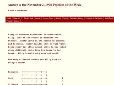
A Walk in Winchester
In this Winchester worksheet, students determine the number of different routes to a determined location. This one-page worksheet contains 1 problem. The answer is provided at the bottom of the page.


