Curated OER
Designing an Ecologically Sound City
Fifth graders design an "ecologically sound" city. They write laws for the city to help make all citizens aware of their ecological responsibilities and propose alternative power sources for light and heat.
Curated OER
United States Map- Map Legend/City Symbols
Students investigate the United States map. In this map skills geography lesson, students explore city symbols on the map legend and identify them. Students use post-it notes to mark various symbols.
Curated OER
City Animals
High schoolers identify some of the most important native and introduced species of animals in the United States. They describe how animals populations of cities have changed over time, outline the benefits and problems associated with...
Curated OER
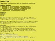
Our community and New York City
Fourth graders research websites to gather information about New York City and the Ridgewood community. In this New York City and Community lesson, 4th graders make a semantic map. Students write short postcards to send to students...
Curated OER
Our 50 States
Students identify the location of the 50 states using an interactive map. They practice geography skills by playing a fun game. Pupils become familiar with the state abbreviations for the US states. Students become familiar with the...
Curated OER
Social Studies - State Riddle Lesson Plan
Students make distinctions between the states, their cities, and capitals, and create riddles for classmates to solve.
Curated OER
Create the Ideal City
Students examine the significance of city planning. They analyze maps, develop a crossword puzzle using vocabulary terms, and create a diagram of an ideal city and describe the features that make it healthy for the economy, the...
Curated OER
United States Identifier
Fifth graders examine and research a major region of the Unites States in groups of four. In addition, they locate the states, capitals, mammals and two bodies of water or mountain ranges found within their region. After the research,...
Curated OER
States and Capitals
This map skills PowerPoint features an interactive states and capitals game. The object of the game is to identify the capital cities of each of the 50 states. The excellent presentation includes United States maps, game directions, and...
Curated OER
Play Doh Map of Your State
Students create a state map using Playdoh. In this hands-on state geography lesson, students work in groups to form a three-dimensional map of their state using Playdoh made at home following a (given) recipe. Students use four colors...
Curated OER
City, County, Community
Students explore issues and situations that make for a city and its local environments. In this local government lesson, students design maps, define issues and create brochures that illustrate their understandings of these concepts and...
Curated OER
Fun With Pacific Northwest Cities and Towns
Intended for fun only, learners play with the names of cities common to their region or state. This activity includes a list of cities in Oregon and not much else. What you and your class choose to do with your list of cities is up to you.
Curated OER
The 50 States and its Holidays
Though the format of this ELL lesson is confusing (the standards listed are for plate tectonics, yet the objectives are for American geography and holidays), a teacher could glean some ideas from the main idea. Here, pupils complete a...
Curated OER
The Glory That Was Greece: A Test
Did your class just finish a unit on Greek life, culture, and conquest? If you think they know everything there is to know about Ancient Greece, then put them to the test with this exam, which contains thirty multiple choice questions.
Curated OER
A Classical Maya News Report
High schoolers research the culture of the Mayans. In this early civilizations lesson, students research selected Maya city-states including Tikal, Clakmul, Piedras Niegras, and Uaxactun. High schoolers use their research findings to...
Freecloud Design
Stack the States™
Kids have fun learning US geography and state facts, including capitals, nicknames, major cities, and landmarks. They can choose between the game, or informational flashcards for each state.
Curated OER
Indiana State Map
In this state maps worksheet, students identify the state of Indiana and fill in the state capital, major cities, and other attractions in the state.
Curated OER
Ancient Greece: Athens as a City State
Sixth graders find Greece on the map and recognize how the geography of Greece was important in its development. In this ancient Greece lesson, 6th graders research Greece and compare to the civilization of ancient Egypt. Students answer...
Curated OER
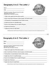
Geography A to Z: The Letter J
How many states, capitals, countries, and locations do your kids know that begin with the letter J? Hopefully they know seven of them, because that's the number of questions on the fun and fast worksheet.
Curated OER
4-H Citizenship Activity Page - Beginning Level
This is a 4-H citizenship activity that asks learners to examine county government, city councils, the three branches of the United States government, and complete a community service project. It also includes a word search, directions...
Curated OER
Biggest Cities in Each State Quiz
In this online interactive geography quiz worksheet, students examine the chart that includes the names of 50 U.S. states. Students identify the names of the two largest cities in each state in 8 minutes.
Curated OER
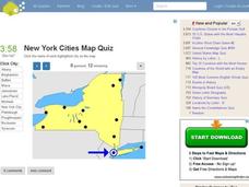
New York Cities Map Quiz
In this online interactive geography worksheet, learners examine a map of New York and identify the 11 noted cities on the map using a pull down menu within 3 minutes.
Curated OER
Washington Cities Map Quiz
In this online interactive geography instructional activity, students examine a map of the state of Washington and identify the 13 noted cities on the map using a pull down menu within 3 minutes.
Curated OER
What Constitutes a State?
Students examine the differences between various state constitutions in the United States. Then, using their own
Other popular searches
- City States in Mesopotamia
- Mesopotamia City State
- Greek City States
- Greek City States
- Ancient Greek City States
- Comma Rules City State
- Sumerian City States
- Sumerian City States
- Ancient Greece City States
- Ancient Greek City States
- Italian City States
- Ancient Greece City States


