Curated OER
Survey of the Louisiana Purchase in 1815
Students explore the survey of the Louisiana Purchase by creating their own surveying and mapping techniques such as natural maps, pace maps, and orienting. Other students then try to follow the maps.
Curated OER
Angle Benchmarks
Sixth graders discuss the characteristics of specific angles and then use the information to to identify and estimate given angles. The class goes outside, identifies north, and turns a specified amount of degrees. Using a given compass,...
Curated OER
Compass Rose Directions
Second graders use cardinal and intermediate directions to locate places on maps and places in the classroom, school, and community. They draw a setting map of "Little Red Riding Hood." Students give five steps of cardinal or...
Calvin Crest Outdoor School
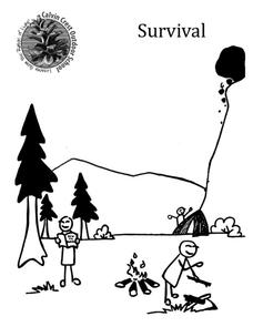
Survival
Equip young campers with important survival knowledge with a set of engaging lessons. Teammates work together to complete three outdoor activities, which include building a shelter, starting a campfire, and finding directions in the...
Province of Manitoba
The Outdoors Camping and Survival Skills
Equip young campers with the tips and strategies for a safe trip to the outdoors with a series of lessons. They learn how to start fires with and without firewood, keep warm in snowy weather, and purify water to make it safe for drinking.
Curated OER
Mystery Photo!
Students examine a photo of the compass plant, and research how the pioneers used the plant as a way of orienting themselves while travelling through the prairies. They analyze the photograph, and complete a Photo Analysis Guide Worksheet.
Curated OER
Which Way Is North?
Students investigate the concept of finding locations with the use of a compass and a map. They practice the skill of bearing and set up courses of travel to different destinations around the school grounds. Students also practice taking...
Curated OER
Second Class Rank: merit badge
In this second class rank learning exercise, students fill out short answer questions using their workbook about compasses, safety, protection, swimming, and more in order to get a merit badge. Students complete 13 questions total.
Curated OER
Using Magnetotactic Bacteria to Study Natural Selection
Young scholars observe bacteria that are able to orient themselves using the Earth's magnetic field.They comprehend the difference between anaerobic and aerobic organisms. Students can tell the difference of the shape of magnetic force...
Curated OER
Orientation of the Earth in Space
Students hypothesize the location of the sun in the sky at diferent times of day and at different latitudes. They perform several experiments to provide evidence for their hypothesis. Experiments including observing the sun's position at...
Curated OER
Map Making/Floor Plans/Map Reading
Learners apply their knowledge of scale when mapping the classroom. They determine the use of a map legend and orient a map using a compass. They create the classroom maps using transfer graph paper.
Curated OER
Going My Way?
Students, in groups, study how a magnet works and how people use the Earth's magnetic field to orient themselves.
Curated OER
Boy Scout: First Class Rank
In this boy scout: first class rank activity, 8th graders research the requirements for this level using the websites listed, and answer 14 detailed questions about using a compass, camping, meal planning, safety, first aid, plantings,...
Curated OER
Radial Design Mandala
Students design original radial art designs.In this radial design lesson, students use compasses and a nature inspired idea to create radial art. Students understand the use of symmetry, balance and design shapes in continual patterns....
Curated OER
Draw A Coastline
Middle schoolers identify, locate and draw at least ten different geographical features on a map. Using the map, they must make it to scale and include their own legend and compass rose. They share their map with the class and answer...
Curated OER
The Sundial
High schoolers explain the design, principle and orientation of a sundial, the type with a gnomon pointing towards the pole of the heavens. They construct a model sundial from paper.
Curated OER
Using Magnetotactic Bacteria to Study Natural Selection
High schoolers demonstrate that living organisms may possess incredible adaptations which enable them to survive. They observe bacteria that are able to orient themselves using the Earth's magnetic field and formulate a hypothesis as to...
Curated OER
Outdoor Education
Students participate in various outdoor activities to teach them about the environment. In this outdoor education lesson plan, students participate in activities such as compass direction, conservation, forestry, wildlife, and...
It's About Time
Detect and Induce Currents
Young scientists recreate an 1820 experiment and build off of it to investigate how to detect and induce electrical currents. As a final activity, scholars answer questions in multiple formats.
It's About Time
Electromagnets
Young scientists build their own electromagnet and test it by picking up paperclips. Analysis questions evaluate knowledge at the end of the activity.
Curated OER
Mid-Ocean Magnetism
Students investigate magnetic evidence that supports the theory of sea floor spreading.
Curated OER
Introducing Maps Through Dance
Students are introduced to the key concepts of maps; direction, pathway/line, shape and symbol. They create the pathways and shapes they have "mapped" out on paper on the floor. They dance along the paths.
Curated OER
Topographic Maps Worksheet
In this geography skills worksheet, students respond to 37 multi-part questions that require them to read and interpret topographic maps.
Curated OER
Learning Directions on a Map
Students use north, south, east, and west to identify relative locations and provide directions.


