Curated OER
What do Maps Show?
Seventh graders practice reading maps. In this geography lesson, 7th graders compare a topographical map to a picture of the actual place.
Curated OER
Mapping and Topgraphy- 8th Grade
Eighth graders practice interpreting a contour map as well as reading latitude and longitude in a team activity. Following a discussion on mapping terms, teams are given maps and estimate the distance between two points. Students...
Curated OER
Common Themes
Tenth graders test usefulness of a model Earth by comparing its predictions to observations in the real world. In this landforms lesson students construct an island from a contour map using model clay then analyze the landscape features...
Curated OER
Cross Section and Slope
Students draw cross sections of given contour maps. In this math lesson, students interpret the different symbols used in the map. They determine slope and steepness through direct measurement.
Curated OER
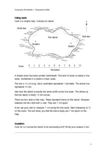
Geographical Skills-- Map Scale
In this maps learning exercise, students study a simple map and the scale in kilometres. Students read the directions and answer one question. Students then look at a sketch map of a town and answer 2 questions. Students also read how to...
Curated OER
Using GIS to Construct Water Table Maps and Flow Nets
Pupils examine how to use GIS software to analyze patterns of groundwater flow. Seepage lake elevation data from the Sand Hills of Nebraska is used to construct a water table map and flow net using Esri's Arc Map software.
Curated OER
Isoseismal Maps
Students examine the difference between magnitude and intensity in earthquakes. They complete map work and write a first hand account of a person living in each level of intensity on the Modified Mercalli Scale.
Curated OER
Melody II
In this music worksheet, students identify melody as a string of notes that has a rhythm. They identify which notes given are melody and/or harmony. Students also map the contour of "Sweet Georgia Brown."
Curated OER
Picture This: Telling Our Tales with Self-Portraits
Students view a number of self portraits to determine the importance of pose, setting, clothing, and props in a piece of artwork. They design a self-portrait emphasizing the use of contour lines.
Curated OER
Reading A Weather Map
Ninth graders construct a weather map. In this meteorology lesson, 9th graders construct a weather map using contour lines and temperature.
Curated OER
Geography: examining the Glacial Features of Cape Cod
Students examine satellite images of the glacial features of Cape Cod. They analyze where human activity is located in terms of those features. Students make models of the features, including kettle holes. They also use contour maps...
Curated OER
Mapping Potato Island
Students create their own topographical map using a potato. In this hands on lesson students construct a topographical map and explain what contour lines are using a potato.
Curated OER
Planning A Railroad
Students use topographical maps students explain the challenges involved in building the railroad in the Sierra Nevada mountains.
Curated OER
Generate an Accurate Landscape Profile from a Topographic Map
Learners enerate an accurate landscape profile from a topographic map. They determine the correct interval needed to accurately graph the change in elevation on a single piece of graph paper.
Curated OER
Creating a 3d Model and Corresponding Topographic Map
Students create a landform model and topographic map. In this topography lesson, students use a real landform to create a model and topographic map to scale.
Curated OER
Comparing Topographical Maps to 3-Dimensional Models
Students apply knowledge of topographical maps and how computer programs are used to make 3-D models of areas that humans have never visited. They view a Mars Canyon movie, then map the canyon.
Curated OER
Understanding a Geological Map
Middle schoolers identify different types of maps and observe a geological map. In this geology lesson plan students create a replica map of a geological area that includes a key.
Curated OER
Informed Drawing Through Observation
Students practice observation techniques to improve their drawing skills. In this drawing technique lesson, students assess drawing as an art media and discuss realism. Students view examples of animal drawings and practice drawing using...
Curated OER
Theobroma - Food of the Gods
Learners discuss the history of cacao and its use in the production of chocolate. They analyze actual cacao pods and record their observations. Finally they create a five minute contour drawing of the cacao pod and seeds.
Curated OER
Planning a Railroad Online Lesson
Students design a train route using a topographical map. In this historical and spatial thinking lesson plan, students must plan a route through the Sierra Nevada mountains that a train could physically travel. Links to printable student...
Curated OER
The Great Topo Race
Students create a three dimensional island out of cardboard to examine how to read and use a topographical map. They make sure that their island can sustain life and that it has one volcanic mountain peak. They trace the parts of their...
Curated OER
Mapping The Ocean Floor
Young scholars explore and analyze the bottom structure of underwater habitats. They describe and explain what can't see through the collection and correlation of accurate data. Learners assess that technology is utilized as a tool for...
Curated OER
Mapping the Sea Floor
Students review their prior knowledge on topographical maps. Using a map, they examine the sea floor off the coast of San Diego, California. With a partner, they chart the sea floor of an area and use cutouts to create a visual...
Other popular searches
- Contour Maps and Elevation
- Contour Maps Topography
- Reading Contour Maps
- Worksheets Contour Maps
- Geography Contour Maps
- Isolines and Contour Maps
- Music Contour Maps
- Salines and Contour Maps
- Everyday Math Contour Maps
- Contour Maps for Music
- Topographic Contour Maps


