Curated OER
Settlement Exploration: Then and Now
NASA has crafted an imaginative and memorable series of lessons, "NASA and Jamestown Education Module." This lesson is one of the five components. In it, middle schoolers connect history and science by comparing the settlement of...
Curated OER
Solar Surface Details
In this solar surface worksheet, students use a photograph taken by the Swedish Vacuum Telescope to answer 6 questions about the solar features in the photograph. Students determine the scale of the image, they determine the smallest...
NOAA
Plate Tectonics II
Mid-ocean ridges, rift valleys, island arcs, mountain ranges, earthquakes, volcanoes ... there are so many features associated with plate tectonics. The 14th installment of a 23-part NOAA Enrichment in Marine sciences and Oceanography...
Midnight Martian
Mars Globe HD
Explore the surface of Mars without leaving the comforts of your home or classroom! Learn about volcanoes, missions to the red planet, view the topography, and more.
Curated OER
Compare Topography of Earth and Mars with a Worldwide Telescope
Students compare geography to topography. In this topography lesson, students examine the topography of the surfaces of the Earth. Students compare one feature of Earth to one feature of Mars and present in a PowerPoint.
Curated OER
The Geology of a Snicker’s Bar: Tectonic Plates
Students explore the layers of the Earth using a Snicker's bar. In this science lesson, students identify the parts of the Snicker's bar and identify which layer of the Earth the parts of the candy bar would represent. Students discuss...
Curated OER
The Ocean Floor
Practice reading comprehension by approaching oceanography through 2 pages of informational text. The text compares the ocean floor to the Grand Canyon to gives students perspective, and gives a brief coverage of the earth's crust and...
Curated OER
Planetary Surface Evolution and Resurfacing
Students are provided with drawings of planet surfaces in order to investigate different types of planetary terrain. They make observations for each planet and discuss the characteristics observed. The instructional activity includes...
Curated OER
Water Features - Lesson 2 - U.S. Political Map Grade 4-5
Students locate water features on maps. In this geography lesson plan, students complete worksheets that require them to identify water features on a U. S. political map.
Curated OER
Identifying Watersheds with Topographic Maps
Students model a watershed and delineate one using topographic maps. In this hydrology lesson, students use aluminum foil to model a landscape and observe how water moves on it. They also observe the features of a topographic map and use...
Curated OER
Landscape Picture Map- The Earth's Surface
Students discuss different landscapes. In this map lesson plan, students describe what they see when they travel between home and school. Students use a landscape picture map to locate the places or objects they see.
Curated OER
Plate Tectonics
Students complete a data sheet. In this Earth composition lesson, students learn what happens when the Earth's plates push against each other. They watch a teacher demonstration and complete a data sheet.
Port Jefferson School District
Climate Patterns
Young climatologists explore the factors that contribute to a region's climate in this two-part earth science activity. To begin, learners are provided with a map of an imaginary planet and are asked to label global wind and ocean...
Curated OER
GEOGRAPHY: SPACE CENTERS
Students examine the descriptive science dealing with the surface of Earth, its division into continents and countries, climate, natural resources, inhabitants and industries of the various divisions and analyze the political geography...
Curated OER
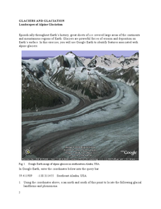
Landscapes of Alpine Glaciation
In this glaciers worksheet, students use Google Earth to look for examples of different glacial landforms and phenomena. Students complete 2 short answer questions.
Curated OER
Earthquake Formation
Students explore earthquakes. In this natural disaster and engineer career education lesson, students identify features of the earth's surface that increase the likelihood of an earthquake. Students use visual aids to locate the earth's...
Curated OER
How Does Flowing Water Shape a Planet's Surface?
Students investigate how flowing water influence landforms. In this earth science lesson, students observe water behavior as it flows from the stream table at various inclinations. They discuss whether water shaped Mars landforms or not.
Curated OER
Landscape Picture Map
Students discuss differences between man made and natural features on the Earth's surface. In this natural and man made features lesson, learners brainstorm a list of features and categorize them on the board. Students study a landscape...
Curated OER
Your Own Backyard
Students study Earth's features and their local environments. In this Earth's features lesson, students take a field trip to observe a natural environment and students sketch their observations of the nature. Students watch videos about...
Curated OER
Oceanography
Fifth graders use scientific skills and processes to recognize how living things depend on one another and on the environment for survival and that the human use of natural resources impacts the environment. They research how Earth's...
Curated OER
Introduction to Biomes
Fifth graders use scientific skills and processes to recognize how living things depend on one another and on the environment for survival and the human use of natural resources impacts the environment. Explain how Earth's surface...
Curated OER
Rocks and Minerals
Students are able to describe earth processes (e.g., rusting, weathering, erosion) that have affected selected physical features in students, neighborhoods. They are able to identify various earth structures (e.g., mountains, faults,...
Curated OER
Landscape Picture Map: Natural and People Made Features
Students explore the places and objects that make up the Earth's surface. In this natural and people made features instructional activity, students identify things they've seen that are people made and those that are natural to the...
Chicago Botanic Garden
Albedo, Reflectivity, and Absorption
What is reflectivity, and what does it have to do with the Earth's climate? As reflectivity is measured by albedo, scientists can gather information on Earth's energy balances that relate to global warming or climate change. Budding...


