National Geographic
Measuring Elevation Past and Present
After viewing a short video about a climb up Mount Everest, high schoolers read about triangulation for measuring distant elevations. Have your class work in groups to construct an inclinometer and then use it to measure the height of...
CK-12 Foundation
Elevator
Do you weigh slightly less when an elevator first starts its descent? The simulation teaches the change in the force based on the acceleration, constant speed, or deceleration of an elevator. Scholars control the mass and acceleration...
Curated OER
Contour Map Worksheet #2
Following a contour map of a hill, a stream, and the ocean, are five multiple choice questions. Earth science enthusiasts determine elevation, direction of water flow, distance, and steepness. They also match the map to a selection of...
Curated OER
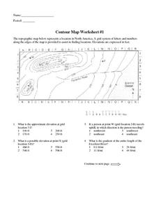
Contour Map Worksheet #1
Being able to read a topographic map is a standard in middle school earth science units and imperative for outdoor enthusiasts. As you introduce learners to this skill, you can assign this as an assessment or reinforcement. Pupils view a...
Curated OER
Topographic Maps
Sometimes it is difficult to grasp topographic maps. Here is a clever presentation designed to help your middle school earth scientists understand. Beginning with a side view of a pair of mountains, a graphic guy walks up one slope. As...
Curated OER
Boiling Point Elevation Problems
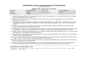
A table of the ebullioscopic constants for several compounds is found at the top of the worksheet. Using these constants, boiling point elevation can be calculated for the combinations of compounds. This worksheet has the answers along...
University of Wisconsin
Measuring Slope for Rain Gardens
The slope of the land is an important feature when considering the erosion that will occur. In this resource, which is part of a rain garden unit, learners calculate the slope of the proposed garden site. Even if you are not planning a...
Curated OER
Contour Map Worksheet #4
There are only four questions here. There is a contour map of Cottonwood, Colorado and the creek that crosses it. Earth scientists tell in what direction the creek flows, identify the highest elevation on the map, draw a topographic...
Curated OER
Elevation, Plants and Animals
Students determine whether elevation is one of the things that affect where and how plants and animals live. They read plant and animal physical descriptions and determine the environment where the animal might live.
Curated OER
Controlling Flight: Rudders, Ailerons, and Elevators
Fifth graders create paper gliders and check for flight distance and time. In this flight lesson plan, 5th graders create a paper glider from the attached worksheet and adjust the rudder, aileron, and elevator. They see how these...
Curated OER
Outdoor Education; Maps, Elevation
Ninth graders use online topographical maps to fill in a chart regarding elevation and contour lines.
Curated OER
Hurricane Impact: Storm Surges and Elevation Transitions
For this hurricane worksheet, student answer 6 multiple choice questions and 8 short answer questions about hurricanes. They color the map to show flooded areas.
Curated OER
Exploring Biomes Lesson 5: You Need a Vacation
In cooperative groups, emerging ecologists research assigned biomes found in Arizona. Combining photos and facts, they use PowerPoint to produce a fully automated commercial that lasts 45 seconds. In addition to the lesson plan outline,...
Curated OER
Exploring Biomes Lesson 2: Biome Research
Learners view a PowerPoint presentation on biomes and their classifications. Divide them into groups and assign them each an individual biome to research. There are pictures of the PowerPoint slides and notes about what to teach for...
National Wildlife Federation
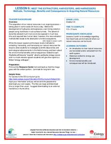
Meet the Extractors, Harvesters, and Harnessers: Methods, Technology, Benefits and Consequences in Acquiring Natural Resources
There are advantages and disadvantages to all sources of energy; the trick is determining which one has the least impact! Part six in the series of 12 has learners further explore energy resources. After reading information about one of...
Mr. E. Science
Forces in Fluids
Buoyancy is the fine line between a ship and a submarine. The presentation covers fluid pressure, air pressure, Pascal's Principle, elevation, Archimedes Principle, buoyancy, and Bernoulli's Principle.
Curated OER
Topographic Maps
Your choice of hands-on topographic mapping tasks is provided in this resource. From actual map-making to viewing and interpreting stereographic photos, the activities are sure to succeed. To make the most of this lesson, you will need...
Curated OER
Google Earth
In this Google Earth worksheet, students access the Google Earth website and find the latitude, longitude, and elevation for their house and school. Then they do the same for a variety of world locations. This worksheet has 10 fill in...
Curated OER
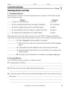
Viewing Earth and Sky
In this earth and sky worksheet, students review terms associated with map reading. Students also review topographic maps and how contour lines represent elevation. This worksheet has 5 matching, 5 true or false, 5 fill in the blank, and...
Curated OER
Introduction to Topographic Maps
Tenth graders create a topographic map and see how it represents different elevations. In this topographic maps lesson students read and interpret topographic maps.
Curated OER
Gilligan's Island
Students investigate topographical maps and match actual landforms to them. In this topographical maps lesson students create "Gilligan's Island" to scale then answer questions about it such as what the highest elevations is and what...
Curated OER
Clouds
In this recognizing cloud shapes and their elevations worksheet, students cut out labeled cloud shapes and paste them on an elevation map. Students identify the location of five cloud shapes.
Curated OER
Tracing Highs and Lows in San Francisco
On a topographic map, students identify the scale bar, north arrow, and contour interval. They then locate a hill on the map and make note of the contour lines. Students then locate other places with similar contour line patterns....
Curated OER
Exploring Hawaiian Mountain Zones
Fourth graders watch a video that describes the climate and vegetation zones of Hawaii. They describe the different physical conditions that create vegetation zones from the sea to the mountains. In groups, they create an illustrated...
Other popular searches
- Angle of Depression/elevation
- Angle of Elevation
- Elevation Plans
- Boiling Point Elevation
- Elevation Maps
- Land Elevation
- Contour Maps and Elevation
- Elevation Relief Map
- Angles of Elevation
- Elevation Changes
- Map Elevation
- Plans and Elevations


