Curated OER
Fossil Fuels (Part III), The Geology of Coal
Do not overlook this set of lessons just because your school does not have a data analysis system. There is plenty of material here to administer a complete mini unit on the formation, distribution, and properties of coal. Since it...
Curated OER
Itaipu Dam and Power Plant (Brazil and Paraguay)
Learners study South America's Itaipu Dam and Power Plant in order to gain an understanding that hydroelectric power is a major means of generating electricity throughout the world. They also look into the environmental impacts that...
Teach Engineering
The Great Pacific Garbage Patch
The Great Pacific Garbage Patch is one of several garbage patches around the world where garbage accumulates naturally. As part of a GIS unit that combines oceanography, environmental science, and life science, class members investigate...
Cornell University
Constructing and Visualizing Topographic Profiles
Militaries throughout history have used topography information to plan strategies, yet many pupils today don't understand it. Scholars use Legos and a contour gauge to understand how to construct and visualize topographic profiles. This...
Global Oneness Project
Then and Now
The devastating changes happening to the Native American inhabitants of an island off the coast of Louisiana are the topic of an informational lesson. After scholars break into groups to explore particular topics, they come back together...
Theodore Roosevelt Association
Roosevelt's Legacy: Conservation
The legacy of Theodore Roosevelt carries through modern American politics, economics, foreign policy, and society. But his proudest and most profound efforts were in the world of conservation, and in preserving the natural beauty of...
National Gardening Association
Migration Mishaps
Elementary ecologists pretend to be migratory hummingbirds. They fly between wintering and nesting grounds, trying to reach a habitat haven. In a musical-chair fashion, some birds will miss out, and are removed from the game. To further...
Curated OER
Studying Snow and Ice Changes
Students compare the change in snow and ice over a 10 year period. In this environmental science activity, students use the live data on the NASA site to study and compare the monthly snow and ice amounts on a map of the entire Earth. ...
Curated OER
Water Quality and Watersheds: A GIS Investigation
Requiring more than one class period, this resource takes earth science learners on a journey through a watershed. Using ArcGIS Explorer, an online geographic information system, they view maps of watersheds and surrounding landscapes....
Curated OER
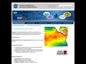
Comparing the Effects of El Nino and La Nina
Students examine the differences between an El Nino and La Nina year. For this investigative lesson students create maps and graphs of the data they obtained.
National Museum of the American Indian
The A:Shiwi (Zuni) People: A Study in Environment, Adaptation, and Agricultural Practices
Discover the connection of native peoples to their natural world, including cultural and agricultural practices, by studying the Zuni people of the American Southwest. This lesson includes examining a poster's photographs, reading...
Curated OER
How Does Climate Change Affect Animal Populations?
Students investigate the effect of climate change on animal population in Nova Scotia. In this environmental science lesson, students complete a Nova Scotia map activity and research the causes of global warming in small groups. Students...
Curated OER
Kids Need Natural Resources
Third graders define renewable and non-renewable resources and give multiple examples of each type of resource. In this environmental science lesson, 3rd graders sort picture cards into two categories, renewable and non-renewable...
Curated OER
Mapping the Effects of War
Students examine how war can lead to environmental health crises. They read an article, conduct research on a region from the article, and create a poster to depict the geographic region and the environmental health effects of the conflict.
Curated OER
Color Enhanced Maps
Learners download or create maps with numerical weather data. They add isolines and color to create regions on their maps. They explore the visual properties of color palettes and create a visualization applying their knowledge.
Curated OER
Soils
Students apply knowledge of soil, environmental impacts, economics, multiple human demands, and use given data for a proposed scenario in making land use decisions. They debate land use issues and/or scenarios and discuss a case study.
Curated OER
The East Fork Project
Students identify possible sources of health risks, types of exposures, routes of exposure, and populations that could be affected after discussing water pollution and environmental health hazards. After discussion, students conduct a...
Curated OER
Global Warming
A series of independent learning activities teaches learners about global warming as it relates to economics and industrialization. The culminating project requires them to create a multimedia presentation identifying the problems,...
Curated OER
Will There Be a White Christmas This Year?
Learners examine historical weather data, and create map and color key that illustrates the likelihood of a white Christmas in different locations across the United States.
Curated OER
Tracking the Salt Front
Using the Hudson River as the focus, learners discuss the difference between salt water and fresh water environments, analyze maps and graphs, and complete addition and subtraction problems. This lesson comes with a wealth of...
Curated OER
Student Tracking
Here is an interesting lesson on satellite tracking. Learners use various tracking techniques to find out where they go on a daily basis, what the environmental conditions are, and what they are doing during their "migrations." A...
Indian Land Tenure Foundation
Respect for Land
Youngsters examine how people show respect and care for the land. Specifically, learners see how the Native Americans truly did care for and respect the land, and still do so to this day! They also explore how they themselves can care...
California Academy of Science
Discovering Rainforest Locations
How many rainforests are there, where are they, and do global factors effect their locations? These are great questions that have great answers. Children in grades four through eight use several different maps to determine why...
Curated OER
Bering Sea Buffet - A Foodweb Activity
Life in the Bering Sea, food webs, and the ocean ecosystem are introduced with a map activity. The lesson starts as kids explore maps and images of the Bering Sea, then it kicks into high gear as they start to discuss the types of...


