Curated OER
Geography
In this geography activity, students answer multiple choice questions about maps, rivers, land, and more. Students complete 20 multiple choice questions.
Curated OER
Design an Island
Students make a map of an imaginary island using the topographic symbols provided from a worksheet. Students place lakes, dwellins, reefs, etc. in areas where they would logically be located from understanding how the topography of an...
Curated OER
Lesson Ten: Direction
Students explore the concept of relative location. In this map lesson, students read I Hate English by Ellen Levine and consider how maps and globes help people to familiarize themselves with an area.
Curated OER
Put Me in My Place: Using Alphanumeric Grids to Locate Places
Students practice locating points on a large wall grid and create and label a neighborhood map. In this geography lesson, students spell and discuss places as the teacher places them on the map. They discuss the concept of an...
Curated OER
Flat Stanley
Students read Flat Stanley, and make a poster board Flat Stanley which they sent out to family members in different states. They create an adventure for their Flat Stanley based on his "travels" and map out his trip.
Curated OER
Summarizing is Fun with Flat Stanley!
Students read the book "Flat Stanley" by Jeff Brown. Through modeling and guided practice, as a class, they complete a story map and 1-paragraph summary of the first chapter in the book. Then, in groups, they follow the same procedure...
Curated OER
Mapping Potato Island
Students create their own topographical map using a potato. In this hands on lesson students construct a topographical map and explain what contour lines are using a potato.
Curated OER
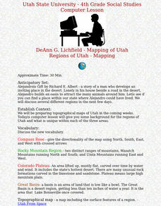
Regions of Utah - Mapping
Fourth graders draw a rudimentary map of the state of Utah, dividing it into the three regions: the Great Basin, the Colorado Plateau, and the Rocky Mountain Region.
Cornell University
Constructing and Visualizing Topographic Profiles
Militaries throughout history have used topography information to plan strategies, yet many pupils today don't understand it. Scholars use Legos and a contour gauge to understand how to construct and visualize topographic profiles. This...
Curated OER
Putting the World in Perspective
Students work in small groups to: make a mental map of the world by tearing paper shapes of the seven continents and locating them on a flat surface in their relative positions, compare their finished mental map to a reference world map,...
Curated OER
Design an Island
Students explore islands. They create a two- or three-dimensional map of an island. They explain how the topography of an area influences the location of water sources, ecosystems, and human settlements. Lesson includes adaptations for...
Curated OER
Place Value
Third graders review place value by arranging four numbers to make the highest number possible. They are shown a hundred flat. Students are asked to show another way of making 100 using base-ten blcoks. They are then shown a thousands...
Curated OER
Where in the World Am I?
Students participate in mapping activities to explore an area from different spatial perspectives. In this mapping lesson, students define the terms needed to understand a map. Students use representations such as a balloon and a...
Curated OER
Places in My World
Second graders explore where they are located on the globe. For this maps and globes lesson, 2nd graders use a map to show where they live and show the cardinal directions. Students identify characteristics of mountains, flat land,...
Curated OER
Moon Features Activity
In this moon worksheet, learners answer questions about the lunar surface and identify the features of the moon on a moon map. They include craters, bays, mountains, seas, oceans and craters.
Curated OER
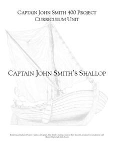
Captain John Smith's Shallop
Young explorers, all aboard the shallop to discover how early European explorers would navigate the American coastline to find resources, map terrain, and trade with Native American tribes.
Curated OER
I Can Find that Where? - A Study of Landforms
First graders make landform maps of the United States. In this landform lessons, 1st graders participate in a discussion of local landforms and make a landform map of the United States. They follow the teacher's directions to add plains,...
Curated OER
Where in the world is...
Young scholars identify locations around the world. In this mapping lesson, students place tag board pieces with names of locations on a wall map of the world. Initially, young scholars identify states, then cities, then continents,...
Curated OER
Cross Section and Slope
Students draw cross sections of given contour maps. In this math lesson, students interpret the different symbols used in the map. They determine slope and steepness through direct measurement.
Book Units Teacher
Story Elements
This 97-slide PowerPoint uses Charles Dickens's A Christmas Carol, Wilson Rawls, Where the Red Fern Grows, and Jeanne DuPrau's The City of Ember, to illustrate the elements of a story. Setting, plot, characterization (both flat and...
Curated OER
Nature and Place Names in Arkansas
Middle schoolers examine the way that many place names in Arkansas came to be. By looking at Arkansas highway maps, they find names that come from the characteristics of each of the state's six geographical divisions. This interesting...
Curated OER
Arkansas: A Changing Climate, a Changing Land
Here is a lesson on the climate zones and geography of Arkansas. In it, learners look at maps (embedded) of different climate zones found throughout Arkansas. They engage in discussions regarding how global warming and climate change is...
Jefferson Lab
Optics: Mirrors and Lenses
Did you see that or did I imagine it? Optical illusions are often created with mirrors and lenses, and here is a presentation that covers many different types of mirrors and lenses and how they work. Flat, concave, and convex mirrors, as...
Curated OER
The Age of Early European Explorations & Conquests
Your students' world will literally take shape in this presentation, which chronicles the growing edges of the (flat) earth during European Exploration of New Worlds. Dias, da Gama, Magellean, and Columbus are key players in this game of...


