Association of Fish and Wildlife Agencies
Schoolyard Biodiversity Investigation Educator Guide
In 1980, in the tropical rainforests of Panama, scientists discovered 1,200 species of beetles living in and around just 19 trees, with most of the species new to science—that's biodiversity! In the activity, learners work in teams to...
Curated OER
The Great Topo Race
Students create a three dimensional island out of cardboard to examine how to read and use a topographical map. They make sure that their island can sustain life and that it has one volcanic mountain peak. They trace the parts of their...
Curated OER
Cardinal Directions
Young scholars draw items on a map in specific places to show their knowledge of cardinal directions. In this simple map skills lesson plan, students draw a cloud, a tree, a house, and a lake to show North, South, East, and West.
Curated OER
Watershed Island
Students make a clay model and a geographic map of a watershed. They talk about the differences between the two representations and the potential human threats to watersheds.
Curated OER
Building a Topographic Model
High schoolers explore the features of a topographic map. They make paper models that portray, in three-dimensions, features represented by contour lines on a topographic map. Students demonstrate different elevations shown on a...
Curated OER
Topography: Know the topography of your neighborhood
Middle schoolers read and identify features on a topography map. For this topography lesson plan, students learn how to read a topography map, and then go out and take pictures of their own and discuss the topography pictures they took.
Curated OER
A View from Overhead
Students explore the concept of mapping. Using given illustrations, students observe views of a park from above the ground. They compare and contrast the different views. Students discuss uses for maps. Using a resource from the...
Curated OER
Watershed
Students study watersheds and use topo maps to help explore where they are located. In this watershed lesson students delineate their watershed on their own.
Curated OER
The Flat-Out Truth
In this Earth's shape activity, students read an article about a gentleman who believes the Earth is flat. Then students complete 5 short answer questions.
Curated OER
Mapping the Unknown
High schoolers explain how early maps of the ocean bottom were made. They describe and execute a method for producing a low-resolution map of a surface that cannot be seen or touched. Students analyze the data from a mapping activity and...
Curated OER
Landscape Picture Map: Natural Features
Students discover six landscapes. In this natural features lesson, students review the meaning and examples of natural features. Students use a landscape picture map to identify six natural features.
Curated OER
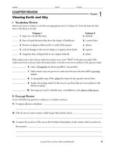
Viewing Earth and Sky
In this earth and sky worksheet, learners review terms associated with map reading. Students also review topographic maps and how contour lines represent elevation. This worksheet has 5 matching, 5 true or false, 5 fill in the blank, and...
Curated OER
Making Sense of a Round World on a Flat Surface
Students explain the world in spatial terms
Curated OER
Volcanoes!: Forecasting the Path of Mudflows
Learners construct a mockup of a volcano by crumbling up newspapers and piling them into the shape of a volcano. They place a tarp over the newspapers making sure the tarp is large enough to simulate a flat area at the volcano's base....
Curated OER
Forcasting the Path of Mudflows
Students visualize consistency of mudflows and how they move down stream valleys away from a volcano's summit. They use topographic maps of Mount St. Helens before the 1980 eruptions to forecast the path mudflows might take during an...
Curated OER
Science Review for Grade 5 (5.2)
In this science review for grade 5 (5.2) worksheet, 5th graders answer 25 earth science questions in a standardized test format, including reading maps and diagrams.
Curated OER
Getting from Place to Place
Learners examine modes of transportation. In this transportation lesson, students listen to their instructor present a lecture on modes of transportation over the past 300 years. Learners respond to questions about the lecture.
Curated OER
Making a Globe
Young scholars examine the mercator projection or nautical chart and observe how global maps do not have the same distance as flat maps. They design handmade globes using the meridians and equator as guides to draw in the land. They...
Curated OER
Flight Paths of Orbiting Satellites
Students examine the path a satellite follows as it orbits the earth. In this space science instructional activity, students use a globe as they illustrate a satellite in its orbital plane, then plot points on the satellite's path on the...
Curated OER
Traveling with Flat Stanley
young scholars use the internet to gather geographical data about a state of their choice. Using new vocabulary, they describe the features present in the state, its climate and attractions. They develop a PowerPoint presentation to...
Curated OER
Landforms By Hand: Geography, Map Skills
Students experiment with landform vocabulary by using their own hands and a bar of soap as media.
Curated OER
Building a Topographic Model
Learners explore Mount Shasta and various locations on Mars to examine ways geographical data can be represented. They study topographic maps and translating data from 2-Dimensions to 3-Dimensions.
Curated OER
Volcano Hazards
Learners research volcano hazards in VolcanoWorld, make a paper volcano, produce and watch the effects of ashfall, produce and watch the effects of a mudflow and create a hazard map by plotting historical ashfall/mudflow data from Mount...
Curated OER
Would You Like A Desert With That?
Young scholars explore the four different deserts in the United States and their characteristics. They discuss the four different types of deserts in United States and their characteristics, and locate them on a map.


