Owl Teacher
Introduction to World Geography
Give your learners a thorough overview of what they will learn when studying geography, from the five themes of geography (location, place, environment, movement, and regions) to the tools of a geographer and parts of a map.
Curated OER
The Ancient Civilization of Mali
Students explore the ancient civilization of Mali and examine various historical and cultural aspects of the civilization. In this ancient civilization of Mali lesson, students examine trade with respect to geographic locations, discover...
Curated OER
Food on the Map
Students work together to examine the tastiest towns in the United States. After discovering the names of the equipment, they identify the seven continents. They take a survey and locate the cities and states of the foods mentioned.
Indian Land Tenure Foundation
Maps and Homelands
You are never too young to learn about maps. To better understand the concept of a homeland, students work together to construct a map of their local area out of paper puzzle pieces. They'll put the maps together and then add details by...
Curated OER
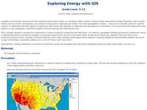
Exploring Energy with GIS
Students examine GIS technology as it is used to locate energy sources. In this GIS lesson, student access an assigned website to locate a series of lessons using the GIS software. They use the maps that are located on the primary lesson...
Curated OER
Mapmaker, Mapmaker, Make Me a Map!
Students evaluate the different types of historical and geographical information that one can gather through close study of historical maps from the 16th through the 19th centuries. They create their own maps.
Curated OER
Assessing and Making Maps
Students evaluate maps using the TODALSIGs basic map analysis system, explained on the worksheet. They create a map of Alaska using TODALSIGs. Students brainstorm the elements of maps.
Curated OER
Relief Maps
Learners study geographical maps and their functions. In this geography lesson students work in groups to build a map to scale.
Curated OER
Introducing Topographic Maps: Guiding Students from Concrete Models to Graphic Representations
Young scholars interpret topographic maps and infer human activity as it is influenced by the landscape.
Curated OER
Texas Commemorative Maps: Honoring Our Past
To celebrate Texas, groups plan and create a commemorative map for a topic or theme in Texas history. The richly detailed plan and the approach could easily be adapted to any state. Samples are included.
Curated OER
Regents High School Examination: Physical Setting Earth Science 2009
Junior geologists address 50 multiple choice questions and 35 short answer questions about the earth system. Plenty of visuals are included for interpretation: diagrams, graphs, maps, photographs, laboratory setups, weather symbols, and...
Curated OER
Underwater Mountains & Trenches
Students determine Earth's deepest trench, outline continents, major ocean mountains, and trenches on color-key map using Crayola Erasable Colored Pencils, identify oceans' geographic features, locate significant oceanic features around...
Curated OER
Arc GIS Project: Visualizing the Holocaust
A cross-curricular lesson for middle schoolers that covers language arts, social studies, geography, and math, this is a great extension activity if your class is reading The Diary of Anne Frank or learning about the Holocaust. Using...
Curated OER
Working With Electronic Topography Maps
Junior geologists examine topographic maps online and learn how to read them. they answer seven associated follow-up questions. This lesson plan is only a general outline and does not provide the details or the websites that you would...
Curated OER
Map Reading in the 21st Century
Students interact with MapPoint tools to view maps of the past and the present in multiple ways. They participate in mini-lessons aimed at locating certain points of interest or famous routes taken in history.
Curated OER
Map Memory
Fifth graders, working in a whole class setting, label a United States map with the names of all the states that they know. They transfer the names of the states to an individual map and color it. Next, they receive directions on how to...
Curated OER
The Roman Empire-Map Activity
In this Roman Empire worksheet, students complete a map activity in which they label and color civilizations, countries and physical features as instructed. There are no maps included.
Curated OER
Map Your Area
Students map the geographic boundaries of a recycling program's service areas and include the location of buyers important to the program. They use this map as an aid in managing a school recycling program or project.
Curated OER
Blank US Map
In this blank outline map worksheet, students study the physical boundaries of the 50 states that make the United States. This outline map may be used for a variety of geographic activities.
Curated OER
Kazakhstan Outline Map
In this blank Kazakhstan outline map worksheet, students study the political boundaries of the country. This outline map may be used for a variety of geographic activities.
Curated OER
Thematic Maps of Your School
Learners are able to list the essential elements of a thematic map, understand and use scale effectively to represent a geographic area, use research skills to develop a body of information, plan and draw an accurate thematic map based...
Curated OER
Mapping Exercise
In this mapping worksheet, students are given data of children exposed to health risks and their geographical location. Students plot each child's home and the risk factors using an (x, y) grid. They answer 2 questions about the...
Curated OER
Mapping School Grounds
Students map and analyze the natural and cultural environment of the school grounds. In small groups, they sketch the natural and cultural features of each side of the school building, create a map, participate in a class discussion,...
Curated OER
Westward Expansion : Mapping
Fifth graders travel along exploring the expeditions of John F. Fremont. In this Westward expansion lesson, 5th graders gain understanding of the events that shaped the west through the use of maps. Students use mapping skills to...


