New York State Education Department
Global History and Geography Examination: June 2016
Assess scholars' knowledge of the changing borders in Germany during World War II with a test that includes both multiple choice and essay questions.
Curated OER
A Long Way from Home: A Hands-on Geography Lesson about World War II
Pupils build World War II directional signs. In this World War II lesson, students explore the geographic locations of the war as they analyze primary sources and conduct research regarding places of significance in the war. Pupils...
Curated OER
Locations Of Countries In Europe
In this European geography worksheet, students describe where 12 countries in Europe are located by using directional phrases. Students also practice describing the nationalities of people from each country and how to pronounce each...
Curated OER
Geography - Mapping the Holocaust
Eighth graders map the important locations of the Holocaust. In this Holocaust lesson, 8th graders research the location of countries involved in the Holocaust as well as the location of concentration camps. Students mark the locations...
Curated OER
East Asia--The Asian Holocaust
Ninth graders study the effects of the Asian Holocaust by comparing it to the Nazi Holocaust. They view a Power Point and discuss the comparisons between both Holocausts. As they compare and contrast both, they discuss their reactions...
Boston University
Scramble for Africa
In this fantastic simulation, your young historians take on the roles of imperialistic European countries in the nineteenth century and then "scramble" to carve up the continent of Africa! This is a very hands-on activity that will help...
Curated OER
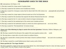
GEOGRAPHY GOES TO THE DOGS
Students use countries and dogs from around the world to answer the questions.
Curated OER
Where is the Water?
Students explore freshwater ecosystems. For this geography lesson, students brainstorm all the lakes and rivers they know then mark them on a map. Students will then mark all the major freshwater resources on each of the seven...
Curated OER
Europe Crossword
In this geography worksheet, students fill in twenty-two blanks about European countries. They identify the names of countries, capitals, and mountains.
Curated OER
Locating The Cold War
Learners identify major players in the Cold War and place them on a world map. They identify the two superpowers location on the map as well as their allies. Students analyze how the world divided itself.
Curated OER
An American Spy with Money To Spend
Sixth graders use their imagination, math, reading, computer, geography, and social studies skills in this unique, innovative, and fun lesson where students pretend to be international spies!
Curated OER
What Do I Know About Islands
In this island research worksheet, students fill in a graphic organizer about the island of their choice. Students fill in two tables with advantages and disadvantages of living on the Rathlin Island and Hallig Oland. They write a...
Curated OER
Identifying, Mapping, and Personifying Countries Involved in WWII
Get artsy with this WWII group activity, starting with a whole-class assignment. Create a map of Europe, Northern Africa, and the Pacific using geometric shapes cut from construction paper and placed on the floor. Consider splitting the...
Curated OER
Countries Involved in World War II
Students create their own floor map of Europe, Northern Africa, and the Pacific. They locate, identify, and speak for one of the countries involved. In addition, they classify the country they represent as an Axis Power or as an Allied...
Curated OER
Map Skills
Students examine the nations, battlefields, troop movement of the Germans through Belgium and the location of both fronts during World War I by creating a map. They visualize the strength of the Germans early in the war.
Curated OER
People Power
Students view a television program that explores many Eastern European residents' discontentment with communism. They work in groups to research living conditions in an Eastern European country before communism, under communism and...
Curated OER
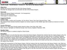
The Roman Empire
Fourth graders identify the reasons behind the fall of the Roman Empire and describe the changes that occurred after the fall of the Roman Empire.
Curated OER
Tourism in Spain
In this tourism in Spain worksheet, students use their research skills to respond to 10 short answer questions regarding the topic.


