Curated OER
Spherical Geometry: A Global Perspective
Students investigate spherical geometry using a globe and an apple. In this spherical geometry lesson plan, students translate Euclidean geometry terms to spherical geometry terms using a globe. They answer 3 questions about spherical...
Curated OER
Earth Science
In this earth science worksheet students complete a series of multiple choice and short answer questions on the different moon phases, gravitational pull and the earths layers.
Curated OER
Put the Title of the Lesson Here
Eighth graders write a Compare and Contrast essay comparing the lives of similarly aged students at different Latitudes. They share their essays with epals, via e-mail. They may include digital photographs in their correspondence as well.
Mr. E. Science
Climate and Climate Change
What factors make up climate? How does longitude and latitude affect climate? What is causing Earth's climate to change? These questions are the topic of a presentation that explains characteristics of climate and climate change.
Curated OER
Carbon Monoxide and Population Density
Tenth graders investigate the carbon monoxide level at a fixed latitude. They determine if there is a relationship to population density. They download data sets and generate a graph. They determine a link between human activity and...
Curated OER
Applications of the Pythagorean Theorem - Magnetism
Middle and high schoolers use the Pythagorean Theorem to complete a table showing with the magnetic field strengths in given cities. They find the average value of the Earth's magnetic field and plot one of the three-dimensional values...
Curated OER
Ocean Circulation
In this physical oceanography PowerPoint, viewers learn about ocean circulation, sea surface temperatures, and salinity. Relationships among these aspects are explained, as well as their impact on the atmosphere and climate. Each slide...
National Geographic
Mapping the Americas
Celebrate the geography of the Americas and develop map skills through a series of activities focused on the Western Hemisphere. Learners study everything from earthquakes and volcanoes of the Americas and the relationship between...
PBS
Rain Shadows
Satellite images from NASA help scholars focus on the similarities on the planet rather than the differences. The photos from the installment of a larger PBS series exploring weather and climate compare geological formations in the...
Curated OER
Navigation
Young scholars study the basic methods for finding one's position on Earth. Latitude can be deduced from the height above the horizon of the pole star or of the noontime Sun, while longitude requires an accurate clock giving universal time.
Curated OER
Eagle Creek Park (A Hike)
Students plot a hiking course using aerial photos and a topographic overlay and find the latitude and longitude of absolute locations. They measure the total distance of a hiked area and figure the area of the ground walked using Heron's...
Curated OER
How High Is That?
Students explore the National Spatial Reference System. In this vertical position lesson, students will discuss the use of vertical position data and solve practical problems involving geographic positioning.
Curated OER
Analysis of Atmospheric Conditions for a High Mountain Retreat
Students examine the relationship between altitude, atmospheric pressure, temperature and humidity at a particular location. They practice science and math in real world applications. They write reports detailing their scientific...
Curated OER
Follow Your Dreams: Career Goals
It is so important for impending high school graduates to start thinking about their potential careers. Here, they discuss the persistence of Blondie Hasler and his impressive transatlantic trip. They follow various routes on a map and...
Curated OER
Understanding Topographic Maps
Underclassmen create a cone-shaped landform and then draw a contour map for it. Then they examine a quadrangle (which was easily located with an online search), and relate it to what they experienced. The accompanying worksheet is...
Curated OER
U.S. History: What Happened Here?
Students apply the global positioning system to create maps of local historical sites. By collaborating with local historical groups, they research events and relate them to broader, national history. In addition to writing essays...
Curated OER
Taming the Mighty Dragon
Young scholars incorporate the five themes of geography to study the Yangtze river region. They analyze the possible effects of the three rivers gorge damn project on this area and role play a float the entire length of this dangerous...
Montana State University
Meet Mount Everest
Learning about one landform might seem boring to some, but using the resource provided practically guarantees scholar interest. The second in a sequential series of eight covering the topic of Mount Everest includes activities such as a...
Curated OER
Carbon Monoxide and Population Density
Tenth graders investigate the carbon monoxide level at a fixed latitude to determine if there is a relationship to population density. They download data sets and generate a graph, and find locations using the Earth's coordinate system....
Curated OER
The Geophysics And Cultural Aspects of the Greater Antilles
Learners determine location by using longitude and latitude. They measure to the minute longitude and latitude of a place and select a body of land and determine its location. They approximate time zones by using every 15 degrees of...
Curated OER
The Sounds of Samba
Students research the origins of Samba in Brazil using the internet. After defining new vocabulary, they locate the cities in Brazil using latitude and longitude which practice the Samba. In groups, they compare and contrast the...
NASA
Geographical Influences
"If global warming is real, why is it so cold?" Distinguishing the difference between weather and climate is important when it comes to understanding our planet. In these activities, young scientists look at the climate patterns in a...
Curated OER
The Mass of the Van Allen Radiation Belts
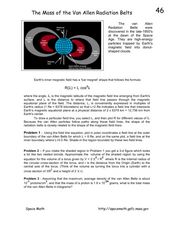
In this van Allen Radiation Belts learning exercise, students are given the formula for the field line of the Earth's inner magnetic field. Students use this equation to find the polar coordinates of a field line in the van Allen Belts....
Curated OER
The Science of Weather: Hurricanes
Learners use this USA today activity to learn about hurricane season. In this hurricane lesson, students study the map of the earth and hurricane science. Learners complete discuss questions. Students draw a map of the United States and...


