Curated OER
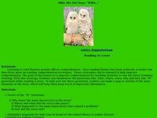
Ollie the Own Says: WHO
Scholars examine the strategy of making a story map or outline to identify the main elements of a story. They discuss the who, what, where, when, why, and how of a story, in an outline form. As a class they read a short story, answer the...
Curated OER
The Case of the "Lost Gorge:
Students examine the case of a map making expedition. In groups, they read a case study on "The Lost Gorge" in the Finger Lakes region of New York state. They examine maps and determine where the error in the map-making occured to end...
Curated OER
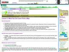
What You Can Learn From a Map
Students investigate the use of road maps, shadeded relief maps, and topographic maps.
Curated OER
Isoseismal Maps
Students examine the difference between magnitude and intensity in earthquakes. They complete map work and write a first hand account of a person living in each level of intensity on the Modified Mercalli Scale.
Wind Wise Education
Where is it Windy?
How is the wind up there? The class builds a topography model using materials available in the classroom, then place wind flags in different locations on the landscape. Using a fan as a wind source, pupils collect data about how wind...
Angel Island Immigration Station Foundation
Where Is Angel Island? An Introductory Geography Lesson
Prepare young historians for a study of Angel Island Immigration Station with a lesson examining primary and secondary source materials, maps, and websites. Using what they have learned, individuals create a map of Angel Island, labeling...
Smithsonian Institution
Borders and Community: Early 20th Century Chicago Neighborhoods and Ethnic Enclaves
Chicago is one city, four neighborhoods, and countless nationalities. The lesson explores the ethnic division of Chicago in the early twentieth century. Academics read primary sources, analyze maps, and tour an online exhibit to...
Curated OER
Map Activity - Roanoke Valley
Students write directions from a starting point to a destination using a map and ads from the Yellow Pages. They define the following terms using total body response or through the use of random objects: "right-hand," "left-hand,"...
Curated OER
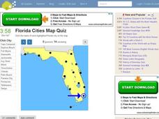
Florida Cities Map Quiz
In this online interactive geography activity, students examine a map of Florida and identify the 12 noted cities on the map using a pull down menu within 3 minutes.
Curated OER
Texas Cities Map Quiz
In this online interactive geography worksheet, students examine a map of Texas and identify the 15 noted cities on the map using a pull down menu within 3 minutes.
Curated OER
Michigan Cities Map Quiz
In this online interactive geography worksheet, students examine a map of Michigan and identify the 14 noted cities on the map using a pull down menu within 3 minutes.
Curated OER
South America Map Quiz
For this online interactive geography quiz worksheet, students examine the map that includes all of South America's countries. Students identify the 13 countries in 2 minutes.
Curated OER
Central America Map Quiz
In this online interactive geography quiz worksheet, learners examine the map that includes 22 Central American countries. Students identify the names of the countries in 3 minutes.
Curated OER
UK Cities Map Quiz
In this online interactive geography worksheet, students examine a map of the United Kingdom and identify the 25 noted cities on the map using a pull down menu within 3 minutes.
Curated OER
Canada Map Quiz
In this online interactive geography quiz worksheet, students examine the map that includes 13 Canadian provinces and territories. Students identify the names of the provinces and territories in 2 minutes, 30 seconds.
Curated OER
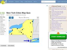
New York Cities Map Quiz
In this online interactive geography worksheet, learners examine a map of New York and identify the 11 noted cities on the map using a pull down menu within 3 minutes.
Curated OER
Washington Cities Map Quiz
In this online interactive geography instructional activity, students examine a map of the state of Washington and identify the 13 noted cities on the map using a pull down menu within 3 minutes.
Curated OER
Rock Around the Map
Students research the geographical histories of various musical genres and make maps that note important places in music history. They Write geographical biographies about one of their favorite musical artists.
Curated OER
California Cities Map Quiz
In this online interactive geography quiz instructional activity, students examine the map that includes 12 California cities. Students identify the names of the cities in 3 minutes.
Curated OER
German Cities Map Quiz
In this online interactive geography quiz worksheet, students examine the map that includes 12 German cities. Students identify the names of the cities in 3 minutes.
Curated OER
New York City Map
In this New York city map worksheet, students examine the city. The map highlights some of the points of interest in the city.
Curated OER
Canada Map
In this Canada political map activity, students examine province boundaries. The map also highlights each of the province's capitals with a star. The provinces and cities are labeled.
Curated OER
Summer Shorts
Want to use sequence maps in your narrative writing unit? Young writers work to create personal narratives about their summer vacation. They write a narrative of their vacation and create a display using summer clothing shapes made from...
Curated OER
Relief Maps
Learners study geographical maps and their functions. In this geography lesson students work in groups to build a map to scale.


