Association of American Geographers
Project GeoSTART
Investigate the fascinating, yet terrifying phenomenon of hurricanes from the safety of your classroom using this earth science unit. Focusing on developing young scientists' spacial thinking skills, these lessons engage learners in...
Curated OER
Hurricane Shapes: Spatial Patterns on Satellite Images
In this earth science worksheet, students match 21 hurricane satellite images to their appropriate shape. They also answer 4 short answer questions about hurricane shape classification.
American Museum of Natural History
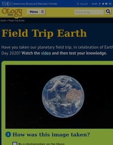
Field Trip Earth
Take a field trip around Earth by way of satellite images. Learners watch a video lesson that describes different images taken from orbiting satellites. They then test their visual skills in a 14-question online quiz.
Scholastic
Study Jams! Severe Storms
Tornadoes and hurricanes and blizzards, oh my! Severe storms are always occurring somewhere on the planet. By reading through these slides, learners discover the characteristics of each type. Have them do this as homework and then take...
Curated OER
Hurricane Research
Young scholars examine the factors that influence hurricanes to develop. In this hurricane lesson students research atmospheric trends that affect hurricanes and create a summary.
Curated OER
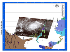
Hurricane Winds: A Spatial Hierarchy of Processes at Different Scales
In this earth science lesson, students study a satellite image of hurricane Isabel and write answers to 5 questions that follow. They match predictions to the map locations.
Curated OER
Hurricanes
Students perform various experiments to explore hurricanes. In this earth science activity, students explain how they form. They identify the structure of a hurricane.
Curated OER
Hurricane Strength: Spatial Association of Wind Speed and Water Temperature
In this hurricane activity, students read and analyze satellite images of hurricane Rita. They complete 4 short answer questions about it.
Curated OER
Tracking a Hurricane
Students use knowledge of what satellite imagery tells to create a descriptive hypothesis of the ground phenomenon during a hurricane.
Curated OER
Causes and Effects of ENSO
Students analyze monthly sea surface temperature data from the Pacific Ocean to determine if the period is an El Nino or a normal year. They recognize signs to see if there are any patterns that signal either occurrence. Satellite images...
NOAA
Earth Origami
After reading a brief history of Carl Skalak's journey on the open waters, scholars make a three-dimensional model of the Earth out of an Origami balloon using a printable decorated as the Earth.
Curated OER
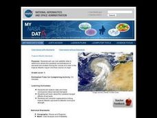
Troical Atlantic Aerosols
Students explore the effect aerosols have upon he weather and climate. They observe NASA satellite images to explore and draw conclusions about aerosol transport. From studying the images, students track the path of aerosols. They...
Curated OER
In the Eye of the Storm
Learners share opinions about what information the public needs about an impending hurricane. They research and report on a major U.S. hurricane and compare different reports about Hurricane Katrina.
Curated OER
Colons
Clarify colon misconceptions with this explanatory handout. Get into the nitty-gritty of grammar with multiple examples of the proper use of the colon. While this isn't an interactive handout, it could be used as a grammar guide for your...
International Technology Education Association
Become a Weather Wizard
Accurate weather forecasting is something we take for granted today, making it easy to forget how complex it can be to predict the weather. Learn more about the terms and symbols used to forecast the weather with an earth science lesson...
Curated OER
Science: Reading a Compass
Students demonstrate how to take bearings using a compass. In pairs, they select objects in the classroom then write down its first initial and bearing. They exchange papers and try to disciver their partner's object.


