Curated OER
Size It Up: Map Skills
Compare information from a US population cartogram and a standard US map. Learners draw conclusions about population density by analyzing census data a population distribution. They discover that census data is used to apportion seats in...
Curated OER
United States Map - Lesson 9
Learners explore the concept of cardinal directions. In this geography lesson plan, students identify the compass rose on a large U. S. map and then discuss the cardinal directions.
Curated OER
United States Map- Land Elevation
Learners explore a physical map. In this map skills instructional activity, students discuss examples of elevation and investigate the symbols used to identify elevation on a map. Learners use the map to identify various land elevations.
Curated OER
Directions on a United States Map
Students generate directions for an imaginary trip. In this map lesson plan, students review the four main directions and how to use a map legend. Students locate destinations based on directions given by classmates.
Curated OER
United States Map- Continent, Country, State
Students identify their continent, country, and state on a globe. In this geography lesson, students use a globe to identify the seven continents, the United States, and the state which they live in. Students define key terms.
Curated OER
United States Map
Learners compare the United States on a globe and on a map. In this map activity, students relate the sizes of the continents and locate the United States. Learners identify the location of the continental US as well as Alaska and Hawaii.
Curated OER
Using Four Main Directions in the Classroom
Students identify the four cardinal directions. In this map skills geography lesson, students use a magnetic compass to label the four directions in the classroom. Students use the four directions to locate objects in the classroom.
Curated OER
Grades 6-8 Lesson Plan - Cities as Transportation Centers
Students examine maps of the 1800's and 1900's. In this geography skills lesson, students collaborate to read core maps and identify transportation centers and travel networks.
Curated OER
World Map and Globe-Equator, North Pole, and South Pole
Learners identify the Equator, North Pole, and South Pole on a map. In this geography instructional activity, students use a world map and circle the North and South Pole. Learners locate the Equator on a globe and use a map marker to...
Curated OER
Ecozones Project
Students examine, detail and produce a display about a particular ecozone in Canada. They produce a detailed wall map, written report and a summary sheet.
Curated OER
Mush! Tracking Travelers on the Trail
Students get to know Alaska and the Iditarod route that is run by dogs as they track the mushers' progress on a map that they create specifically for the race. They learn about latitude, longitude, plotting on a map, checkpoints, and...
Curated OER
Come One, Come All
High schoolers analyze information from core map and other sources and construct routes from New York and Boston to Cincinnati as they might have existed in 1835.
Curated OER
Equator, North Pole, and South Pole
Students identify the Equator, North Pole, and South Pole on the globe. In this map skills lesson, students use a globe marker to locate specific locations on the globe. Students find where they live in relation to the Equator.
Curated OER
World Map and Globe - Four Main Directions
Young scholars study the four main directions on a map. In this map lesson, students locate the North and South pole, and learn the four cardinal directions. They use the compass rose on a map to help with the directions. (Map is not...
Curated OER
Four Main Directions
Students describe directions using a globe for north, east, south and west. In this mapping lesson students identify the north and south pole. Students understand the importance of the equator and the Prime Meridian. Students explain how...
Curated OER
Virginia In the World: The Geography of Commerce
Middle schoolers examine how Virginia connects with the world through export trade. Using a map, they use symbols to depict the value of trade and the direction of the flow of goods. They complete a scavenger hunt using electronic...
Curated OER
Using the Four Main Directions in the Classroom
Students use the four main directions to locate features in the classroom. In this direction lesson, students review the 4 main directions using a world map. Students use a magnetic compass to locate the north wall in their classroom and...
Curated OER
Using 4 main directions in a classroom
Pupils use the four directions of a compass rose to locate classroom features. In this directions lesson plan, students locate the features by identifying directions.
Curated OER
Using the Four Main Directions in the Classroom
Students utilize a compass to determine where North is in the classroom. In this direction lesson, students label the four main directions. Students locate features in the classroom and describe the directions to get to them. Students...
Curated OER
Conflicting Views
Young scholars complete a Venn diagram comparing the United States and Afghanistan. They research the history of the Taliban and how they relate to the United States and its foreign policy. They write a paper on possible solutions.
Curated OER
Child Labour in developing countries
High schoolers explore the idea of global citizenship. Students examine the UN Convention on the Rights of the Child worldwide. High schoolers analyze facts about UNICEF's National Non-Uniform Day.
Curated OER
Identifying Border States of the U.S.
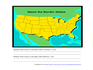
In this identifying border states of the U.S. worksheet, 3rd graders visually identify then write the names of the states that border Canada and Mexico; page 1 is a lesson, page 2 is the worksheet.
Curated OER
BIGGER AND BIGGER: (We Live in a family, a neighborhood, a city, and the United States)
Young scholars discover that they are part of bigger and bigger groups. They begin with families and work up to belonging to North America as they initiate a study of the whole country.
Curated OER
The Apollo-11 Landing Area at High-Resolution
In this moon crater worksheet, students use images of craters taken from the Lunar Reconnaissance Orbiter to determine the size of the craters. This worksheet has 6 problems to solve.


