Curated OER
Americas: Physical Map
In this Americas physical map learning exercise, students make note of the major landforms and bodies of water located on the North American and South American continents.
Curated OER
Geography Challenge
In this geographical features worksheet, learners read the 10 statements about geographical features. Students select the correct to complete 10 statements.
Curated OER
Run-off Race
Pupils create wetland models in pans and use them to experiment to see how plants help slow the flow of runoff water and keep our waterways clean.
Curated OER
War of 1812
Eighth graders locate the major land forms and bodies of water on a map of Louisiana. In groups, they discuss the role of the Mississippi River in the Battle of New Orleans and how land and water affect the outcome of battles. To end...
Curated OER
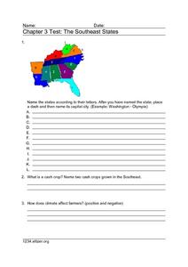
Chapter 3 Test: The Southeast States
In this geography worksheet, students complete a test about the southeastern United States. They name the states, tell about the climate and crops, complete a matching activity about the landforms. and another about the industry.
Curated OER
Africa: Political Map
Students create a political map for Africa. For this country identification lesson, students locate Africa on a globe and discuss some of its major countries and bodies of water. Students complete a political map of Africa and test...
Curated OER
Where in the World...?
Students use longitude and latitude to locate various cities, regions, landforms, and bodies of water around the globe. They use The New York Times Learning Network's crossword puzzle 'Longitude and Latitude' to sharpen their atlas skills.
Curated OER
U.S. Geography for Children: The Northeast
For this map skills of the northeastern United States worksheet, students observe an outline map, locate and label the states, and designated landforms and bodies of water; and create symbols and a map key for sources of economy and...
Curated OER
U.S. Geography for Children
In this U.S. map activity worksheet, students observe maps of the continental United States, Hawaii, and Alaska, locate and label landforms and bodies of water, and create symbols for natural resources and places of interest. Students...
Curated OER
The Country of Venezuela
In this map skills of Venezuela worksheet, students use an outline map to find an label important cities landforms, and bodies of water. Students label and color code 10 answers.
Curated OER
Virginia Geographic Regions
Third graders observe the five geographic regions of Virginia which have distinctive characteristics based on their landforms and bodies of water. They then describe the types of landforms and bodies of water in the region where they live.
Curated OER
Deep Ocean Currents
Students observe the interactions of different temperatures of water using colored ice and a thermometer and then compare the results with global ocean current solar heating. They identify where floating ice would be found in the ocean,...
Curated OER
Paper Mache Globes
Third graders create a paper mache model of the earth. At the conclusion of a discussion about the earth, they are given paper mache materials, they create their globe and appropriately draw and label landforms, bodies of water and the...
Curated OER
Eurasia Physical Map
In this Eurasia physical map instructional activity, students make note of the major landforms and bodies of water located in this world region.
Curated OER
Australia and Oceania: Physical Map
In this Australia and Oceania physical map worksheet, students make note of the major landforms and bodies of water located within this region.
Curated OER
South America: Physical Map
In this South American physical map activity, students make note of the major landforms and bodies of water located on the continent.
Curated OER
Europe Physical Map
In this Europe physical map activity, students make note of the major landforms and bodies of water located on the continent.
Curated OER
USA: Physical Map
In this United States physical map worksheet, students investigate the major landforms and bodies of water located throughout the country.
Curated OER
Africa & Asia: Physical Map
In this African and Asian physical map worksheet, students investigate the major landforms and bodies of water located on the African and Asian continents.
Curated OER
Geographic Context for War
Students explore the geography of Korea. In this Korean War lesson, students examine maps of the country and label landforms, bodies of water, climate, population centers, and neighboring countries to determine the significance of...
Curated OER
Map of Italy
In this map of Italy activity, students find, color and label cities, surrounding countries, bodies of water and landforms in the country of Italy.
Curated OER
Australia Outline Map
In this Australia and Oceania outline map worksheet, students make note of the major landforms and bodies of water located within this region.
Curated OER
Geography of Vietnam
Ninth graders examine the geography of Vietnam. In this Geography lesson, 9th graders create a physical and political map of Vietnam.
Curated OER
Big Blue Sky- Based on the Montana Quarter Reverse
Young scholars use a Montana quarter to help describe geographical features such as landforms and bodies of water. Students read an article about Montana as a group and discuss examples of landforms and bodies of water. After reading,...


