Curated OER
Spherical Geometry: A Global Perspective
Students investigate spherical geometry using a globe and an apple. In this spherical geometry lesson plan, students translate Euclidean geometry terms to spherical geometry terms using a globe. They answer 3 questions about spherical...
Curated OER
Maps Reinforcement
In this map worksheet, students complete 6 multiple choice questions and 5 short answer questions about 3 different map figures.
Curated OER
Lesson on GPS
Students investigate global positioning systems. In this technology and mapping lesson plan, students view a PowerPoint presentation in which they identify the features of a GPS, state its uses, and follow steps to find a waypoint.
Curated OER
Plot Your Course
Learners determine distance and direction on a nautical chart. In this nautical lesson, students identify obstacles and characteristics of common aid to navigation on a nautical chart.
Curated OER
Parallels and Meridians
In this parallels and meridians worksheet, students read about parallels and meridians and answer questions about lines of latitude and longitude. Students complete 8 problems.
Curated OER
Common Themes
Tenth graders test usefulness of a model Earth by comparing its predictions to observations in the real world. In this landforms lesson students construct an island from a contour map using model clay then analyze the landscape features...
Institute for Geophysics
Understanding Maps of Earth
Here is your go-to student resource on primary geography concepts, including facts about the surface of the earth and its hemispheres, latitude and longitude, globes, types of maps, and identifying continents and oceans.
Curated OER
Is Portland, Oregon Experiencing Global Warming?
Students use data to determine if the climate in Portland has changed over the years. In this weather activity students complete line graphs and study long wave radiation.
California Academy of Science
Earthquakes and Tectonic Plates
Here is a comprehensive package in which middle schoolers learn about types of seismic waves, triangulation, and tectonic plate boundaries. Complete vocabulary, colorful maps, and a worksheet are included via links on the webpage. You...
Curated OER
Globe Foldable
Maybe the world wasn't built in a day but kids can certainly assemble a globe in one class period using the images provided by these templates. Cut, fold, piece, glue, and voila!
Curated OER
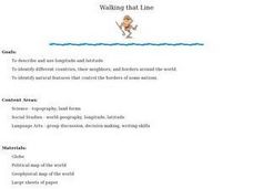
Walking that Line
Students attempt to describe and use longitude and latitude. They will identify different countries, their neighbors, and borders around the world. Included in the lesson the students identify natural features that control the borders of...
Curated OER
Tell Time With Your Feet
Students discover what the latitude and longitude of their location is. They start walking and measure their shadow. They fill in a chart to discover the approximate time.
Curated OER
Latitude on World Maps
Sixth graders examine the purposes of maps. In this Geography lesson plan, 6th graders practice using latitude and longitude on a map.
Curated OER
Sunrise and Sunset
Students utilize a Mesonet daily solar radiation to determine the times of sunrise and sunset and the length of the day. They describe how sunrise and sunset change with latitude and longitude and how the length of the day changes with...
Curated OER
Eagle Creek Park (A Hike)
Students plot a hiking course using aerial photos and a topographic overlay and find the latitude and longitude of absolute locations. They measure the total distance of a hiked area and figure the area of the ground walked using Heron's...
Curated OER
Degree Confluence Project: At the Intersection of Geography and Technology
Students participate in a Longitude-meets-latitude project comes together on the Web!
Curated OER
Latitude and Longitude
Pupils identify latitude, longitude, prime meridian, international date line, and equator. They compute the latitude and longitude of different objects.
Curated OER
Mapping and Topgraphy- 8th Grade
Eighth graders practice interpreting a contour map as well as reading latitude and longitude in a team activity. Following a discussion on mapping terms, teams are given maps and estimate the distance between two points. Students...
Curated OER
Globe Lesson 7 - Parallels and Meridians - Grade 6+
In this parallels and meridians worksheet, students read a 2-paragraph review of parallels and meridians and respond to 7 short answer questions.
Owl Teacher
Introduction to World of Geography Test
Assess your learners on the five themes of geography and the most important key terms and concepts from an introductory geography unit. Here you'll find an assessment with 15 fill-in-the-blank and 14 multiple-choice questions, sections...
Curated OER
The Global Grid System-World Map Activity
Students demonstrate how to use the global grid system. In this map skills activity, students use a world map to locate various locations. Students identify locations based on the global grid system. Students complete a worksheet as an...
Curated OER
Snow Cover By Latitude
Students create graphs comparing the amount of snow cover along selected latitudes using data sets from a NASA website. They create a spreadsheet and a bar graph on the computer, and analyze the data.
Curated OER
Globe Lesson 17 - Alaska and Hawaii - Grade 4-5
Students develop their globe skills. In this geography skills lesson, students explore the area added to the United States when the Alaskan territory was purchased from Russia.
Curated OER
Globe Lesson 13 - When the Day Changes
Students explore the patterns of day and night. In this geography skills lesson, students read brief selections and examine diagrams that note the transition of day and night around the world. Students respond to the questions included...


