Curated OER
Google Earth on the Range
Eighth graders use Google Earth to study the landscape of Utah. In this Utah landscape lesson, 8th graders view landscape photos and work in partners to analyze the pictures. Students write a paragraph that describes the landscape and...
Curated OER
Europe Lakes Map Quiz
In this online interactive geography quiz activity, students respond to 10 identification questions about major lakes located in Europe.
Curated OER
Ski in Slovakia in Style
Learners read a short article about the mountains and skiing in Slovakia. In this ESL lesson plan, students explore the reasons that skiing is a popular activity in Slovakia, then complete several short activities to reinforce the reading.
Curated OER
Maps that Teach
Students study maps to locate the states and capital on the US map. Students locate continents, major world physical features and historical monuments. Students locate the provinces and territories of Canada.
Curated OER
Leapin' Landmarks: Locating 10 man-made landmarks around the world
Third graders engage in a lesson which addresses their curiosity about some of the outstanding people-made landmarks of the world. They explore the geographical themes of location and place through literature.
Curated OER
Natural Disasters and the Five Themes of Geography
Have your class do research on natural disasters and create a presentation using this resource. In completing this activity, learners apply the five geography themes to their research. They write a paper describing their results. It's a...
Channel Islands Film
Island Rotation: Lesson Plan 1
How do scientists provide evidence to support the theories they put forth? What clues do they put together to create these theories? After watching West of the West's documentary Island Rotation class members engage in a series of...
Curated OER
Animal Farm Chapter 2 Discussion Notes and Mini-Project
Imagine having the opportunity to create your own country. After responding to questions about chapter two, readers of George Orwell's dystopian classic are given a chance to design a utopia for one-million people, complete with...
Curated OER
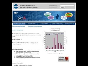
Creating Climographs
Young scholars use satellite data to compare precipitation and surface temperatures on different islands. In this satellite instructional activity students create graphs and explain the differences between weather and climate.
Science Matters
Slip Sliding Along
The San Andreas Fault is the largest earthquake-producing fault in California. In the seventh lesson in the 20 part series, pupils create maps of California, focusing on the San Andreas Fault system. The comparison of where California is...
University of Southern California
What Is The Ocean?
Go on a tour of the ocean through the lens of a scientist. Learners read maps of the ocean floor, study tide behavior, examine wave motion, and analyze components of soil. Each lesson incorporates a hands-on component.
Curated OER
The Silk Road, An Ancient Internet
Students examine how goods and ideas moved along an ancient trade route between China and Europe. They make charts of items, ideas, etc. that were transported along the Silk Route.
Curated OER
Field Trip to Mammoth Cave
Students, when given a microscope or a camera, write two observations they have seen using technology that they did not see with just their eyes with 100% accuracy. When given a blank map, they mark the location of Mammoth Cave along...
National Park Service
Caves, Canyons, Cactus, and Critters
Mother Nature's Gravel Company is open for business! The unit includes four lessons covering weathering and erosion. Experiments are simple to complete and young geologists compare notes to see who makes the biggest ice wedge, moves...
Curated OER
The Industrial Revolution
Eighth graders examine the time period of the Industrial revolution in American history. In this American History lesson, 8th graders read the chapter on this time period. Students create a presentation on this time period to teach...
Curated OER
Map Memory
Fifth graders, working in a whole class setting, label a United States map with the names of all the states that they know. They transfer the names of the states to an individual map and color it. Next, they receive directions on how to...
Curated OER
Map Keys
Third graders examine maps and map keys. In this locating map features instructional activity, 3rd graders use crayons, markers and colored pencils to label maps. Students work in partners to read map keys and locate given places and...
Curated OER
Colorado: Crossword Puzzle
In this United States history worksheet, students use the 14 clues in order to fill in the crossword puzzle with the appropriate answers pertaining to Colorado.
Curated OER
Mount St. Helens Shakes and Burps
Students uncover the nature of volcanoes and locate some of the world's active, dormant, and extinct volcanoes. They also discover how scientists detect, measure, and predict volcanic activity.
Curated OER
Globe Skills Lesson 4 The Colonial Period
Students practice their map skills. In this Colonial geography lesson, students complete an activity that requires them to locate English colonial locations using latitude and longitude coordinates.
Curated OER
Bathymetry
Students study the topography of the ocean floor and the geological processes of how it is formed. They summarize what bathymetry, describe how islands are formed and illustrate a bathymetric model of the sea floor.
Curated OER
Climate Patterns across the United States
Students articulate differences between climate and weather using examples in a written statement. Using climate data from across the country, they describe climate patterns for various parts of the United States on a map. Students...
Curated OER
The 50 States
Fifth graders use maps and music to learn the 50 states. In this US Geography lesson plan, 5th graders map out a region of the United States and practice singing the song, The 50 States that Rhyme.
Curated OER
Naming the States of the U.S
Fifth graders study the 50 states on a map. In this social studies lesson, 5th graders identify the names of the states and location. Additionally, students work in small groups to name and locate as many states as they can on a blank map.


