Curated OER
All Aboard the Freedom Train!
Young historians identify Harriet Tubman, her character traits, and role as a conductor on the Underground Railroad. They create an escape map using map legends and the Cardinal directions. This plan utilizes one of my favorite video...
Curated OER
Be Specific, Go West To The Pacific
Fifth and sixth graders follow Lewis and Clark from St. Louis to the Pacific and back again. They read online journal entries made by Lewis and Clark to gather information. The official Lewis and Clark website is used by learners to...
Curated OER
With Liberty and Justice for All
High schoolers examine the role of Supreme Court justices. In this judicial branch instructional activity, students consider the civil rights and civil liberties as they investigate Minersville School District v. Gobitis (1940) and West...
Curated OER
Bordering States & VA Regions
In this Virginia geography worksheet, students respond to 2 fill in the blank questions and 16 multiple choice questions regarding the bordering states and regions of Virginia.
Curated OER
Third Grade Social Studies Quiz
In this social studies worksheet, 3rd graders complete multiple choice questions about communities, maps, distances, and more. Students complete 11 questions.
Curated OER
Going, Going, Ghost
Third graders research ghost towns. In this geography lesson, 3rd graders locate ghost towns on a map and choose one location to research. Students construct a research paper and present it to the class.
Curated OER
The United States in 1790
In this geography skills instructional activity, students study the provided map of the United States in 1790 and then complete the provided quiz over the 17 states and territories.
Curated OER
Do You Know Your 50 States?
Learners use the names and abbreviations of the 50 states to label a blank map of the United States.
Curated OER
Wyoming Map
In this map of Wyoming worksheet, students view and label on a map of Wyoming its major cities, important landmarks, entertainment parks, compass rose and a legend.
Curated OER
Creating a Thematic Map Using S'COOL Data
Learners observe weather patterns, collect data, and make a weather predictions for various locations on a map.
American Battlefield Trust
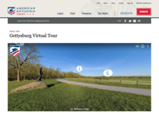
Gettysburg Virtual Tour
Step into one of the most iconic battlefields of the American Civil War with an educational interactive resource. Young historians learn about key moments, locations, soldiers, and turning points in the battle with a clickable map and...
Curated OER
Scaling the Map
Middle schoolers practice determining map distances using the map scales. They discover how much an area represents on the map in relation to the actual area. They decide on the best place to build their cavern.
Curated OER
The Colony of Virginia as Far as the Mississippi
Learners study George Washington's map and journal of his 1754 expedition to the French. They draw conclusions about the importance of western lands and the problems involved in tapping the resources of the West during that era.
ReadWriteThink
Dear Librarian: Writing a Persuasive Letter
Everyone deserves to read a great book! Here, pupils write a persuasive letter to the school's librarian detailing their favorite story and why it should be found on the shelves. Class members' persuasive reading passages are shared with...
US Apple Association
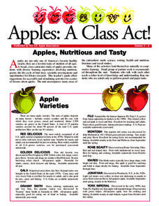
Apples: A Class Act! (Grades 4–6)
Middle schoolers have a bushel of fun as they engage in activities and research core facts about apples. Packed with suggestions for in-class activities and out-of-class research, the colorful 6-page packet is sure to satisfy hungry...
Curated OER
Over, Under, In, and Out
Students investigate the concept of coin design. They look at the inscriptions found on coins by handling them in class. The design is found in the state of West Virginia. The objects pictured on the coin are described by students and...
Curated OER
The Formation and Value of Temperate Grasslands
Students study the Temperate Grasslands biome of North America. They explain that it is an endangered ecosystem because the rich soils have been converted to farming in most areas. They view videos imbedded in this plan, then complete...
Curated OER
Four Immigrant Groups: Their Lives and Music
Fourth graders examine the experiences of four immigrant groups. Class members brainstorm a list of misconceptions of those groups and discuss if these perceptions are still present today. Using maps, groups locate the countries of...
Curated OER
National Marine Sanctuaries Shipwrecks
Junior oceanographers access the Channel Islands National Marine Sanctuary Shipwreck Database and plot the locations of several shipwrecks. Shipwrecks are always an enthralling subject and this activity allows your learners to act as...
Curated OER
A Differentiated Way through Think Dots
Students examine reasons that led people to explore, identify "West" as defined following Revolutionary War, explain importance of finding natural resources, develop time line of dates and events leading up to Lewis and Clark Expedition,...
Curated OER
Influence of Geography on the Migration of Virginians
Sixth graders study how geography influenced the westward migration of Virginians. They review the settlement patterns of early Virginians before discussing reasons why people move away from an area. Looking at maps, they determine how...
Carnegie Mellon University
Marcellus Shale: Who Pays?
After viewing short clips of unfortunate events, your class will consider two sides of a homeowner's court case, and then learn about the Marcellus shale deposit beneath the state of Pennsylvania and the hydraulic fracturing process. In...
Jamestown-Yorktown Foundation
How Did Relations between Britain and the Colonies Change after the French and Indian War?
What does the French and Indian War have to do with the American Revolution? Following the war, Britain issued the Proclamation of 1763 in an attempt to limit the colonists' western expansion. To understand how the proclamation, the...
Curated OER
Geographic Features of the East Coast
Fourth graders view a map of the thirteen colonies and discuss why the people who came from England built towns along the Atlantic coast. They read the directions on the worksheet and underline words in the question that ask them to do...


