Curated OER
Mapping Community Values
Learners discuss the origin of various maps focusing on the values behind them. Students also explore how human needs and geography influence community settlement patterns. Learners extend learning by creating and mapping their own ideal...
Curated OER
Lesson Design Archaeology- World Map
Students practice locating positions on the world map. In this map skills lesson, students explore the world map and items such as the compass rose, Equator, mountains, cities, etc. The students practice locating positions on the world...
Curated OER
The Ottoman Empire
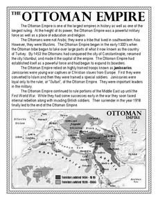
In this Ottoman Empire instructional activity, students read a 1-page selection about the empire and examine a map. Students then respond to 5 short answer questions about the reading selection and the map.
Curated OER
At the Edge of the Continent
High schoolers study how to interpret a bathymetric map. They study the main features of the continental margin. They plot and graph bathymetric data. They think about and discuss the bathymetry of the edge of the cont
Curated OER
From Claws to Jaws: Atlantic Regions of the United States
Students explore New England, Mid-Atlantic, and southeastern regions of the United States. In this social studies thematic unit, students research a state and make a regional quilt. Students wrte a book report and read two novels whose...
Curated OER
Learning European Geography
Sixth graders discover locations and countries in Europe by identifying them on a map. In this European geography lesson, 6th graders read the book The Lost Little Elephant, with their class and discuss the geography referenced in the...
Curated OER
North American Biomes
In this Science activity, students color a biome map of North America. Students color the map by solving the clues listed on a separate sheet of paper.
Curated OER
Introduction to Africa
Students are introduced to Africa. The purpose of this lesson is to find out what students all ready know about the continent of Africa, and what students are interested in learning more about. They focus on the physical features of Africa.
Curated OER
Learning About the Equator, The Seven Continents and the Four Oceans
Students use a globe or map to locate the equator, oceans and continents. Using the internet, they spend time surfing through predetermined websites on continents and oceans. They write facts on different parts of the globe on index...
Curated OER
Welcome to My World!
Second graders increase their usage of maps and understand how maps are important in their lives. Students define what an atlas is, and to enforce the students' definition of what an atlas is, they also make their own atlas.
Curated OER
Geography Worksheet
For this geography skills worksheet, students respond to 14 short answer questions by using maps and atlases. The maps and atlases are not included.
Curated OER
Walking on Maps
Students are introduced to the various types of maps and their functions. As a class, they play a game similar to twister to review map concepts. They answer questions about the map and use the internet to view larger maps of the world.
Curated OER
World Map and Globe-Equator, North Pole, and South Pole
Young scholars identify the Equator, North Pole, and South Pole on a map. In this geography lesson, students use a world map and circle the North and South Pole. Young scholars locate the Equator on a globe and use a map marker to...
Curated OER
Latitude and Longitude- Online Interactive
In this maps worksheet, students learn about longitude and latitude by reading a two paragraph text and studying two maps. Students answer 9 fill in the blank questions. This is an online interactive worksheet.
Curated OER
Globe Lesson 17 - Alaska and Hawaii - Grade 4-5
Students develop their globe skills. In this geography skills lesson, students explore the area added to the United States when the Alaskan territory was purchased from Russia.
Curated OER
South American Outline Map
For this blank outline map worksheet, students study the political boundaries of the continent of North America and those of the countries located there.
Curated OER
Outline Map of Japan
In this geography worksheet, students examine a black line outline map of Japan. There is a compass rose on the page. There are no labeled cities.
Curated OER
Locate and Name the bodies of water and the continents
Second graders locate the equator, bodies of water, and different continents on a globe. In this globe lesson plan, 2nd graders recall geographical information on a globe.
Curated OER
Me on the Map Lesson 1
Young scholars use maps, globes, geographic information systems and other
sources of information to analyze the nature of places at a variety of scales. They identify on a map and determine the population
of the city, county, state,...
Curated OER
Hemispheres & Continents
Students learn in cooperative learning groups to determine how the equator and the Prime Meridian divide the earth into hemispheres and use Venn diagrams. Students will locate and label the hemispheres, continents, and oceans.
Curated OER
The Moving Continents from Pangaea to the Future
Eighth graders examine how the movements of the Earth contribute to fossil distribution. In this fossils lesson students make maps of the placement of the continents.
Curated OER
4th Grade Spelling: Continents and Nationalities
In this 4th grade home connection spelling practice activity, 4th graders examine 20 spelling words that feature continents and nationalities. Students write the words 1 time each.
Curated OER
The Interconnectedness of Ancient Peoples Map Study
Seventh graders begin this lesson by viewing various maps of the Ancient World. As a class, they take notes on the changes of different areas in Europe and Asia as their teacher lectures to them. They answer questions about the...
Curated OER
Continents and Islands Map Quiz
In this online interactive geography quiz worksheet, students respond to 17 identification questions about the continents and islands of the world.


