PBS
Earthquakes and Volcanoes
Earth's surface constantly changes thanks to a variety of geological forces; in fact, Australia currently moves faster than GPS technology. Scholars connect the idea of continental drift to earthquakes and volcanoes with the help of an...
NASA
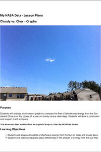
Cloudy vs. Clear - Graphs
Explore the link between solar energy and cloud cover using real data from NASA from China! Future climatologists analyze and interpret graphs of solar energy on clear and cloudy days using a literacy cube. Investigators draw conclusions...
Curated OER
Seasons Worksheet #2
A tilted Earth is shown in relation to the rays of light from the sun. Earth science superstars determine latitude, month, and time of day. They compare number of daylight hours for different points on Earth. The five multiple choice...
Curated OER
Earth Science: The Structure of the Earth
Students identify and complete activities about the structure of the Earth. In this Earth structure lesson, students view a Powerpoint about the Earth's layers and complete a diagram. students compare temperatures in the Earth's layers...
Curated OER
Map Reading in the 21st Century
Students interact with MapPoint tools to view maps of the past and the present in multiple ways. They participate in mini-lessons aimed at locating certain points of interest or famous routes taken in history.
Curated OER
Seasons on Earth
Students examine how seasons occur and explore how the different angles effect surface heating. In this climate lesson students interpret satellite maps of the world that show seasonal differences in plant life.
Curated OER
Exploring Earth Through Maps and Technology
In this maps worksheet, students read 3 pages of detailed information about maps, latitude, longitude, topography, satellites and global positioning. Students then answer 10 questions. There is also a research project assignment available.
Curated OER
FUN WITH MAPS
Second graders receive a general overview about how maps are made and used, how specific information can be derived from them, and how a student can gain personal information about their surroundings from examining them.
Curated OER
Map Grids
Students study map grids and explore how they can be used to locate positions of objects or features on a map. They read a story and then participate in a grid activity using a large map of the setting of the story.
Curated OER
Exploring Hawaiian Mountain Zones
Fourth graders watch a video that describes the climate and vegetation zones of Hawaii. They describe the different physical conditions that create vegetation zones from the sea to the mountains. In groups, they create an illustrated...
Curated OER
Geography of South America
Student's identify geographic features of a South American map. They use the scale of the map to calculate distances between points. They identify examples of the five geographic themes on the map of South America.
Columbus City Schools
Constructive and Destructive Geologic Processes
Show the class the world as they've never seen it before—from way above! Learners try to unravel the mysteries presented by rich satellite imagery, learn to interpret topographic maps, and study erosion by constructing their very own...
It's About Time
Taking a Ride on a Lithospheric Plate
Assist your pupils and broaden their horizons with several activities that determine the exact positioning of various communities over the globe. Pupils use data from the Global Positioning System to determine the position and rate of...
Curated OER
Earthquakes: Second Grade Lesson Plans and Activities
What causes earthquakes? Second graders learn about stresses from plate movement with a set of hands-on activities. After tracing fault lines on a map with yarn, class members create a paper plate model of Earth to show its layers and...
Curated OER
Plate Tectonics: Fifth Grade Lesson Plans and Activities
Fifth graders continue their investigation of the plate tectonics cycle with an exploration of the movement of Earth's crust. During the lab, young geologists conduct an experiment to discover the result of different types of stress...
Environment Agency - Abu Dhabi
Plate Tectonics
Young scholars observe a presentation on plate tectonics, layers of the earth, and plate boundaries. They then use the Internet to research major plates and label them on a world map.
Laboratory for Atmospheric and Space Physics
Planetary Distances on the Playground
There's no need to stay inside; get out of the classroom and create a scaled map of the solar system on your playground field! In collaborative groups, scholars identify the distance between the sun and other planets, place planet...
Curated OER
Working With Electronic Topography Maps
Junior geologists examine topographic maps online and learn how to read them. they answer seven associated follow-up questions. This lesson plan is only a general outline and does not provide the details or the websites that you would...
Curated OER
The Global Grapefruit - Maps vs Globes
Students tell how maps differ from globes, state some characteristics of 3 different types of map projections, and realize that distortions are inherent in various systems of map projections.
Curated OER
Maps as Models of Earth
Eighth graders use different types of maps to find locations and surface features. In this map-reading lesson students use a compass to find direction.
Curated OER
Reading Weather Maps
Fourth graders the symbols that are used on weather maps. They develop five day forecasts based on information they gather from weather maps in the newspaper and on the Internet.
Curated OER
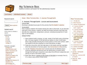
Journey Through Earth
Students study plate tectonics. In this plate tectonics lesson students build a cutaway scale model of the Earth.
Curated OER
Cartographer on Assignment: Creating a Physical Map of Africa
Students use geographic information to make an outline map of Africa, then demonstrate their understanding of the physical landscape of Africa by using a variety of materials to create a physical map of Africa
Curated OER
Explosive Ideas: Oregon quarter reverse
Explore Earth and her amazing layers with this lesson on planetary change. Students will research the ways in which Earth's layers cause change. They will complete a "Tectonic Puzzle" and use a worksheet to answer questions about Earth's...


