Curated OER
South east Asia and the South Pacific: Political: Labeled Map
In this Asia and the South Pacific map worksheet, students examine the boundaries of the nations in this region of the world. Students also note the location of capital cities as they are denoted by stars. This map is labeled.
Curated OER
Canada: Outline Map
In this Canadian political map worksheet, students examine Canada's province boundaries. The map also highlights each of the province's capitals with a star.
Curated OER
Canada Outline Map
In this Canada outline map learning exercise, students make note of the political divisions of the provinces and territories of the nation.
Curated OER
Canada Outline Map
In this blank outline map learning exercise, students study the political boundaries of the North American country Canada as well as those of the provinces located there. The capital cities of the provinces are listed.
Curated OER
Canada Outline Map
In this blank outline map instructional activity, students study the political boundaries of the North American country of Canada as well as those of the provinces located there.
Curated OER
United States Outline Map
In this United States outline map worksheet, students note the political boundaries of the states that are labeled with state capitals.
Curated OER
Central America Outline Map
In this Central American political map worksheet, students make note of national boundaries and capitals in this region of the world. National capital city locations are noted with stars.
Curated OER
Mexico and Central America Map
In this blank outline map worksheet, students study the political boundaries of Mexico and Central America. Each of the counties is labeled and the capital cities are starred.
Curated OER
US: Northeast Region Map
In this United States political map worksheet, students examine the state boundaries of the Northeast Region. The map also highlights each of the state capitals denoted by stars.
Curated OER
Asia and the South Pacific : Political Map
In this Asia and the South Pacific map worksheet, students examine the boundaries of the nations in this region of the world. Students also note the location of capital cities as they are denoted by stars. Major bodies of water are labeled.
Curated OER
Central America Outline Map
In this Central American political map activity, students make note of national boundaries and capitals in this region of the world. National capital city locations are noted with stars.
Curated OER
Central America Outline Map - Labelled
In this Central American political map worksheet, students make note of national boundaries and capitals in this region of the world. National capital city locations are noted with stars.
Curated OER
South US Region Map
In this United States regional outline map, learners examine the state boundaries of the states in the Southern Region. Capital cities are denoted with stars.
Curated OER
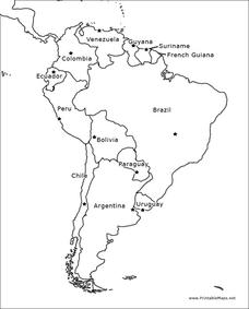
South America Outline Map
In this outline map worksheet, students discover and investigate the physical boundaries of the countries in South America. The names of countries and a star to mark the capital city are included.
Curated OER
Constellation Mapping
Students plot constellations on a grid map. They discuss the various ways early explorers planned their travels. Students identify and recognize major constellations. They color their maps and take them home to try to find various...
Curated OER
Language Arts: Creating Character Maps
Third graders select characters from books they have read to create character maps. After drawing the maps, they add the characteristics around a sketch of their chosen character. In groups, 3rd graders who have read the same book,...
Curated OER
Let the North Star Tell You Where You Are
Students create an astrolabe and locate the North Star in the night sky. They determine the latitude of the North Star, and calculate an average latitude based on class results.
Curated OER
Map Grids
Students study map grids and explore how they can be used to locate positions of objects or features on a map. They read a story and then participate in a grid activity using a large map of the setting of the story.
Curated OER
Using a Political Map
In this online interactive map activity worksheet, learners examine a political map of New Jersey and respond to 9 fill in the blank questions.
Curated OER
Map of Egypt
In this map of Egypt worksheet, students label the cities, bodies of water, surrounding countries and color the map according to the directions.
Curated OER
Character Mapping
Third graders choose one character from a book they have read recently. Using paper, they create a character map of the character along with a small drawing to show what they look like. To end the lesson, they share their character map...
Curated OER
Map of Italy
In this map of Italy activity, students find, color and label cities, surrounding countries, bodies of water and landforms in the country of Italy.
Curated OER
Exploring the Map of Morocco
In this exploring the map of Morocco worksheet, students find and label cities, islands, bodies of water, mountains, deserts and other countries around Morocco.
Curated OER
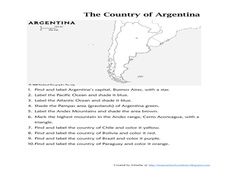
Map of Argentina
In this map of Argentina worksheet, students label key areas, cities, bodies of water and surrounding countries, then color the map according to directions.


