Curated OER
State to State Scavenger Hunt
In this states worksheet, students utilize the Internet to access one specific website to locate the answers to five fill in the blank statements about the states found on a United States map.
Curated OER
The United States in 1790
In this geography skills instructional activity, students study the provided map of the United States in 1790 and then complete the provided quiz over the 17 states and territories.
Curated OER
1862 MARYLAND CAMPAIGN, AMERICAN CIVIL WAR
Students explain why General Robert E. Lee decided to invade Maryland in September 1862; review the major events of the Maryland Campaign of 1862; describe the major events of the three phases of the Battle of Antietam; and assess the...
Curated OER
Mesopotamia
Middle schoolers map Mesopotamia. For this Geography lesson, students are introduced to Ancient Mesopotamia. Middle schoolers use an atlas to label the defining features and areas of Mesopotamia on a map.
Curated OER
Do You Know Your 50 States?
Learners use the names and abbreviations of the 50 states to label a blank map of the United States.
Curated OER
The Brief American Pageant: The Planting of the English America
A series of maps illustrate the early growth of English America, which includes the Maryland, Virginia, Carolina, and Georgia colonies. Settlements such as Jamestown, Roanoke, and Charleston are labeled on the map, allowing a teacher or...
Curated OER
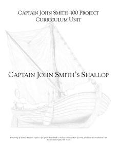
Captain John Smith's Shallop
Young explorers, all aboard the shallop to discover how early European explorers would navigate the American coastline to find resources, map terrain, and trade with Native American tribes.
Curated OER
Latitude and Longitude
In this latitude and longitude worksheet, students complete 4 activities to demonstrate understanding. Students use a protractor to measure angles on a map of the earth. Students fill out a latitude and longitude chart after studying a...
American Battlefield Trust
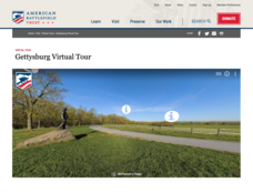
Gettysburg Virtual Tour
Step into one of the most iconic battlefields of the American Civil War with an educational interactive resource. Young historians learn about key moments, locations, soldiers, and turning points in the battle with a clickable map and...
Curated OER
Water and Land 207
Students examine maps of different projections, mathematically calculate distortions, and note the advantages and disadvantages of each map. They study the different maps and transfer the map to graph paper.
Curated OER
A Place Called Fairfax
Students use maps to locate Virginia, its surrounding states and Fairfax County. Individually, they describe the absolute and relative location of the county and why it is important to know both. As a class, they brainstorm the...
Curated OER
A Place Called Fairfax
Students are introduced to the various types of maps of Fairfax County, Virginia. Using the maps, they explain the relative and absolute locations of the county and discuss the importance of both. They also discover how the county is...
Curated OER
Scaling the Map
Learners practice determining map distances using the map scales. They discover how much an area represents on the map in relation to the actual area. They decide on the best place to build their cavern.
Curated OER
Town Along the Chesapeake Bay
Fourth graders make a drawing of a town along a river off of the Chesapeake Bay in Maryland. Upon completion, they give an oral description of their town, including its houses, stores, businesses, farm area, government, etc., and will...
Curated OER
Taxi: A Book Of City Words
First graders engage in a literature study that helps them to focus on the concepts of goods and services. They describe the various skills people may need at home, school, and work. Students create a map of businesses found in the city.
Curated OER
The Acadian Odyssey
The dispersion of the Acadians is outlined in this informative PowerPoint. Colorful maps help show where different Acadians settled throughout the United States. Tip: After viewing this slideshow, have students create a timeline of the...
Curated OER
Geography Review
Third graders name the continent, country, state, and community in which they live. They locate Maryland and Baltimore on a map of the United States.
Curated OER
The Three Gorges Dam- Should it be Completed?
Learners research and analyze the geographic problem of whether or not the Three Gorges Dam should be completed. Students take a position on the issue, gather information related to their position, present their conclusions, and write a...
Curated OER
Ancient Greece: Athens as a City State
Sixth graders find Greece on the map and recognize how the geography of Greece was important in its development. In this ancient Greece instructional activity, 6th graders research Greece and compare to the civilization of ancient Egypt....
Curated OER
Making a Connection
Students research why government community workers are important to us. They work in teams to identify and illustrate the jobs and services provided by these community workers. Assessment comes from their Student Concept Maps.
Curated OER
Native American Dolls
Young scholars examine Native American dolls. They discover the connections between the dolls and the Native American culture and customs. They also use maps to locate the position of different tribes.
Curated OER
The Formation and Value of Temperate Grasslands
Young scholars study the Temperate Grasslands biome of North America. They explain that it is an endangered ecosystem because the rich soils have been converted to farming in most areas. They view videos imbedded in this plan, then...
Jamestown-Yorktown Foundation
How Did Relations between Britain and the Colonies Change after the French and Indian War?
What does the French and Indian War have to do with the American Revolution? Following the war, Britain issued the Proclamation of 1763 in an attempt to limit the colonists' western expansion. To understand how the proclamation, the...
Curated OER
Fenwick Island, Maryland And Beyond: Who Owns the Sand?
Students examine beach processes and complex beach systems. They study the human efforts to stabilize an unstable environment can lead to complex problems.


